Tag Archives: beacon

Wendover – Watford Walk

With trees so bare, so bare!
But O so beautiful, so beautiful!
The grey and blue sky
Β© 1972, Fleetwood Mac, Album – Bare Trees

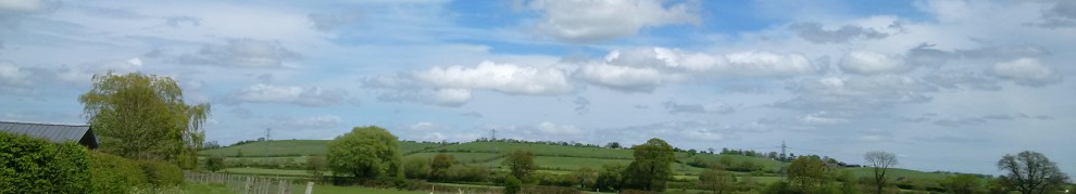
These words were to ring true for all of my walk, grey skies and very cold weather all day, but very beautiful scenery to be enjoyed throughout… A wander around Wendover small market with a few stalls to look round for a few moments in time before setting out on my walk for the day. Starting off with South Street, which was rather quaint as tudor style buildings were mainly scattered along the road. Turning into “Chapel Lane”, I fully expected to find a church en-route. However as the lane became a footpath, it seemed to follw a number of houses rather than leading me to a chapel. Passing by Wendover Community Orchard, the path was soon to cross over ridgeway national trail. Nevertheless this was a trail for another time, so I continued onwards.

From 2016 – 17.04.2016 – Wendover – Watford Walk

The footpath joined with a small roadway, which I now found myself walking alongside. On reaching the next junction, I started to head down a lane, was beautifully surrounded by fields. Some sections were quite narrow, proving difficult to walk along, particularly when a car tried to pass by! Along the way, I spotted a sign for “Hale Valley Vineyard”. A very odd place grow a vineyard, I would have normally expected one in warmer climes! The vineyard has about 500 vines and produces dry white wines, although there has been some production of sparkling white wines in days gone past. Apparently you are able to book a tour around and view the vines, I wonder if you can manage to have some tasters too?! Marching onwards along the lane, I was soon to pass by “Wendover Woods”. With grey skies and the dark shadows cast by the trees above, it really did look a bit dark and foreboding. I think it will be worth investigating further.

From 2016 – 17.04.2016 – Wendover – Watford Walk

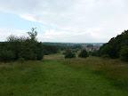
Beyond the woods, the landscaped opened up either side of the road with rolling hills and lovely views across the vale. Eventually the lane started taking past a very small number of houses, I was very surprised to find a large mansion just around the corner. The notable Henry Colet twice Mayor of London in C15th and formally knighted, was born here although it was in an earlier version of the building that stands now. I merrily continued on my way, going past the Ridgeway once more, the grey clouds seemed huddle together and then the rain started to tumble from the skies. For quite sometime I was a quite bemused by the rain as it seem to turn white, at first I confused this with spring blossom falling from surrounding trees. However, the further I walked the trees lining the road disappeared and the white specs coming down from the sky got larger and came down faster! It was then I realised that it was snowing and I was not the only one to battle the weather as I saw a number of cyclists fighting it too as they were on the Chiltern Cycleway which my route now partially followed! Therefore I did not hesitate along this stretch as the snow was extremely cold and the faster I walked the warmer I was! With speed in mind, I found a small chapel belonging to the village of St Leonards.

From 2016 – 17.04.2016 – Wendover – Watford Walk

A church has stood in this very area since C11th when the local Manor was granted to Henry de Crokesley and lands were set aside for a Chapel at ease. During the C17th the Church fell into disrepair, particularly noted after the English Civil War when only the timber construction remained. Restoration and rebuilding of the Church was undertaken at the end of the C17th and is the one that stands today. Heading away from St Leonards, I found myself walking along some very narrow lanes. With overhanging trees, high hedges lining the roadside and a number of turns, quiet but difficult to negotiate in place. The lanes soon brought me out into the small hamlet of “Braziers End”, although it was not much to look at except houses, it really was a great name for the area! The term “Braziers End” is said to be derived from when groups of travellers used to gather together in the area and light Braziers whilst celebrating weddings.

From 2016 – 17.04.2016 – Wendover – Watford Walk

Leaving Braziers End behind, I continued onwards and through the village of Bellingdon. “Bellingdenu” is the Anglo Saxon that the current village name is derived from, meaning “Bellas Valley”. I now have visions of an Anglo Saxon lady ruling and owning the entire valley I had been walking. Walking through the village I spotted a small Corrugated Iron Church, I had seen one previously, in comparison it was well used to the other one, which was unused and unloved. Eventually I started my descent downhill and found I was now approaching “Chesham” Unintentionally I found myself walking further into this town than I originally planned as I misread my route map! However, I did not explore as much as wanted to, so I will be back to find out more about this town! Picking up my route again, I spotted a little plaque showing how a small piece of land had been given to the town of Chesham in the Festival of Britain in 1951! Walking up all I continued onwards through the small areas of Lye Green and Orchard Leigh.

From 2016 – 17.04.2016 – Wendover – Watford Walk

It was not too difficult to navigate on this occasion as there was a footpath alongside the road. I eventually turned into “Jasons Hill”, interesting not only did Bella own a valley, but a chap named Jason had his own hill! Reaching the bottom of the hill, I found I was on the outskirts of the village of Botley. Just outside the village was Ley Hill common, to my nice surprise, I found yet another beacon and this one was being made ready to be lit. The beacon was to be lit by the Scouts in honour the Queen Elizabeth II 90th Birthday πŸ™‚ . The common itself is over 32ha in size and is a “country wildlife site” and very well used. Ley Hulle was first recorded in the C15th but not a grassland to be enjoyed by all, since the name meant “unploughed field”. It was used by settlers to extract chalk and clay to create Pottery, tile and for making bricks. I continued on uphill, walking past Ley hill Golf Club, and onto Shantock lane. Unsurpisingly, like the other lanes I had encountered in my walk, it was narrow and high hedges line the roadside. Nevertheless, I was still able to find my way through onwards through, and eventually reached “Hogpits Bottom”, I am not sure where this name came from, but sounded like something from Harry Potter!

From 2016 – 17.04.2016 – Wendover – Watford Walk

On my way through I found the C18th “Bricklayers Arms” public house. Looking very inviting, I did not quite manage to partake in a tipple, but I could see it was very busy and very much enjoyed. Although the series of Midsomer Murders was not actually filmed here, it is worth knowing that the original cast stopped for a pint a while back! The next stretch of my walk was to take me past the village of Belsize and take me down a number of lanes, both Plough Lane and eventually becoming Bottom Lane. I am still not quite sure what it was bottom of though! I eventually found myself in Chandlers Cross, which looked familiar to me as I had walked in this area before. As this was familiar territory, I found that rather hurried this section of my walk. However, on this occasion I decided walk past Whippendell Woods and onwards.

From 2016 – 17.04.2016 – Wendover – Watford Walk

As I did I found myself negotiating yet more traffic along a very narrow lane, Grove Mill lane to be precise. On the other side of each fence was a Golf course which belonged to “The Grove” Spa & Hotel, still looking as lovely as I had previously seen it. I was pleasantly surprised as a I turned a sharp corner to find Grove Mill, although it looked like residential property now, it still had all the original features of a mill. Going across the humpbacked bridge, I soon found that I had to cross the Grand Union Canal. I had finally reached Watford my destination, so it was here that I finished my walk for the day.

All My photos for the day

2016 – 17.04.2016 – Wendover – Watford Walk

My Route

<

Weymouth Walk – 13.10.2012

Think but of the surprise of His Majesty when, the first time of his bathing, he had no sooner popped his royal head under water than a band of music, concealed in a neighbouring machine, struck up β€˜God save great George our King’.

Diary and Letters of Madame d’Arblay, vol 5, pp. 35-6

What a to do when George III went bathing in Weymouth in 1789! George III indeed made this English Seaside Resort of Weymouth extremely popular to visit during the C18th, and visitors have flocked here ever since. We were about to walk experience some of the South West Coast Path that surrounds Weymouth and enjoy the sea air, so we took our walk with a nice leisurely pace for a change.

It was not our first experience of walking over train tracks, but here along Weymouth Harbourside there are traintracks deeply imbedded into the road. The road and pavements are extremely narrow on this stretch and it was even more tricky to walk when there were cars parked on the pavement. I began to struggle to imagine a full size train trying to negotiate its way along this road with cars parked along it and not only that C18th buildings which have windows jutting out on to the roadside! I presume that trains still use this stretch of track during the summertime as we found a full size platform by the ferry terminal for boats to the Channel Islands…

As we left the terminal behind and started to walk across the car park to the other side of the “pier”, which gave us some unprecedented views across Weymouth bay. If we had a little more time here, the Weymouth Sealife tower has been built here and stands 53m (174ft) tall, which could have given us a even better view across Weymouth, Portland and the Jurassic coast. Instead we decided to turn away from the tower and walk towards Weymouth beach. Unfortunately we were unable to access some of the beach, which we did not realise, as it was being prepared for a Motocross competition that was taking place the next day.

From 2012 – 13.10.2012 – Weymouth Walk

To make up for the disappointment of not being able to walk on the beach, we reached a curious seashell shaped building, where someone had been creating sand sculptures. Not quite as large and grand as the sand sculptures we had spotted in Weston Super Mare, but nevertheless very clever. The symbol that had been left was the “Paralmypics GB” sign. Obviously as Weymouth had held the 2012 Sailing events for both the Olympics and Paralympics, I presume that this was left over from this! What a great tribute πŸ™‚

It was nice to see that King George III has been immortalised in the town with a lovely statue. Not only that a replica of his original bathing machine was right in the middle of roundabout! This is so different from the baths we encountered in Weston Super Mare and Lord Churston Bathing House in Devon. It really seems that King George III did set a trend for bathing at the Seaside πŸ™‚ .

At least we were not stuck to find out the time on our walk, as we came across “Jubilee Clock” on the Esplanade as we walked on a little further. The clock was built in 1887 in the 50th year of the reign of Queen Victoria to mark her Golden Jubilee year. What a great tribute to the Queen and how great to know it is still standing over 100 years later. I did ponder if there was a tribute to Queen Elizabeth II and her jubilee too, particularly as the statue to George III was also built in the 50th year of his reign.

From 2012 – 13.10.2012 – Weymouth Walk

The esplanade of Weymouth seemed to be missing something to me, a pleasure pier. Unlike the other seaside resorts we had visited such as Ventor, Hastings, Paignton and Weston. I wondered if this was due to the harbour and stone pier that had been built in it’s place? However, we were soon to find a building known as the “Pier Bandstand”. This lovely Art Deco Building, has been beautifully restored, however as I went onto the beach could see it did not really go anywhere and is really just the entrance building and no longer a pier 😦 .

The pier was built in 1939 after a competition was held by the Royal Institute of Architects with a total of 26 entries. V.J.Venning’s design was chosen and the pier was finally opened on 25th May 1939. The pier was 200 feet in length, but accommodate up to 2,400 seats in the bandstand. In the later years the pier included amusements and a restaurant, but by the mid 1980s the actual bandstand was too expensive to maintain and was finally demolished. Despite a project for the pier to be restored completely for the 2012 Olympic year it arrived pass, what a great shame.

I should not have doubted whether there was a tribute to Queen Elizabeth II jubilee in Weymouth, because, as we reached Greenhill Gardens, their was a wonderful display in the flowerbed reading –

“The Queen’s Jubilee
1952 – 2012”

The gardens even had a floral clock, which is working order. So different from the floral clock which is no longer in operation in Weston Super Mare at least I can now imagine what that could have looked like πŸ™‚ . Just before we left the gardens, we encountered a line of beachhuts, they looked freshly painted to me and they were still in use.

From 2012 – 13.10.2012 – Weymouth Walk

I wandered onto the beach for a while, but I did not venture to dabble my toes into the sea while I was there, unlike the gentleman who was brave enough to take a dip! As I turned to go back up the esplanade I noticed a small plaque which had been put up, to celebrate the twinning of Weymouth & Portland and Holzwickede. I am not quite sure as to why this little plaque is so hidden?

I clambered back up onto the promenade to continue on. It was not long before we came across another set of Beach huts. Unlike the other huts, these were not of the traditional design, they seemed have a design more reminiscent of the 1950’s, and even had their own area with a dedicated paddling pool and sandpit. They certainly were a lot larger almost a small chalet if you ask me πŸ™‚

We felt it was time to head away from the seafront just for a while. Our main reason, was to stop and find somewhere to have lunch. Just behind the beachhuts was Lodmoor Country Park, well there is a lot more in this area, the Sealife Adventure park amongst other things! However, we only felt we had time to briefly look at the Country park after lunch. I do admit to rather enjoyed watching the “Rio Grande” miniature railway, which goes around some of the park. Hopefully this little railway not suffer the same fate as the Weston Super Mare Miniature Railway.

From 2012 – 13.10.2012 – Weymouth Walk

We retraced our walk back into town to explore the other part of Weymouth. As we walked through the town I spotted a little sign which stated that one of the buildings was a former inn built in the Tudor times. I think I was more fascinated by the fact it was built near the former Medieval Friary. As we walked away from the inn and crossed the bridge to the other side of the harbour, we spotted the “Kings Arms” which was so called after the visits of George III to Weymouth and is still going today unlike the Milton Arms 😦 . Following the harbourside, it took us past the RNLI station and it was here we had a choice of direction to take. Either to walk on to the “stone pier” or to Nothe Fort. We felt we wanted to look at the Fort.

We climbed the steps to Nothe Gardens and it was definitely worth it, we were rewarded with some lovely views across the other side of the bay! As we walked to Nothe Fort we discovered it was closed, so sadly we will need to go back to discover more. However, from my brief visit I can see why this Victorian fort was built in this very domineering position over the bay, especially as some of the remnants of the defences from WWII can still be seen! I do wonder why no fort had been built previously since Weymouth has such a history of shipping? I think of the Napoleonic forts I have seen in the past like the Berryhead fort.

Because the fort was closed, we decided to leave the gardens and walk along the stone pier. As we started to make our way out onto the pier, we found a commemorative stone dedicated to the “Earl of Abergavenny”.

“Ill-fated Vessel! – ghastly shock!
At length delivered from the rock,
The deep she hath regained;
And through the stormy night they steer;
Labouring for life, in hope and fear,
To reach a safer shore – how near,
Yet not to be attained!”
William Wordsworth

The “Earl of Abergavenny”, was a ship that was captained by William Wordsworth’s younger brother John Wordsworth. After two successful trips to China, sadly on 5th February 1805 the ship sunk with over 250 passengers including her Captain John Wordsworth. The wreck in Weymouth bay was visible for many years afterwards.

As we turned back towards Weymouth to complete our walk, I looked up towards Nothe Fort and had a complete surprise a Beacon! I am quite pleased, as this means only another 3,399 to find on my walks, I better keep a keen eye out πŸ™‚ . We eventually reached town and just before we completed our walk, I spotted a blue plaque – “William Thompson – Naturalist and pioneer of underwater photography”. I am impressed with Mr Thompson’s idea of underwater photography, particularly as this was in C19th long before the modern technology of today!

For all the days walk –

2012 – 13.10.2012 – Weymouth Walk

Borehamwood – Edgwarebury Walk – 08.07.2012

Finishing our starry eyed trail from the previous week, we decided to return to Borehamwood just to finish our tour. To see the Stars beneath our feet at Borehamwood station and to read the rest of the plaques, in the High Street, which we missed the previous week. Our walk for the day began in Stratfield road, amidst a group of unassuming flats. Why would a block of flats be so interesting? For any movie buffs, one of these flats was used for filming locations for Stanley Kubrik’s “Clockwork Orange”.

This Sunday stroll was to take us away from the glorious Borehamwood and out into the Countryside. Firstly, the trail was to take us down the Furzehill Road. Pondering as to why this road was rather long, I have discovered that along with Shenley Road (where the Studios reside), Allum Lane (which we walked last week), Barnet Lane (which we were about to encounter) and Theobald street were all created as a result of the “1776 Enclosure Act”. This act divided up Borehamwood Common, which was approximately 684 acres in size, between the various landowners of the era, including the Church and included these new roads to be laid out! I was glad, however, to discover a small public footpath which was to take us away from the walking the road, to our chosen destination – Barnet Lane.

The footpath was shaded by trees and made the walk very dark and not particularly inviting :-(. Although it is a nice short woodland walk, I think I would have much preferred to have walked in the meadow which ran alongside the path, sadly it was behind a fence. The trail took us through the wood and out into the open, but even then the path was not really looked after. It was really difficult to walk through the tall weeds and brambles that had grown up either side of the path, such a shame really! Despite the fact that I do not like walking along the pavements, suddenly the road that we were walking parallel too looked very appealing to walk along! Luckily this part of the path was not too long and it brought us out in the road and the next path which was in “Woodcock Hill Village Green”. As we started to cross the green, I was so glad that I had my walking boots on as the path was really muddy and the ground was sodden. Although it is hidden under all that green grass! –

From 2012 – 08.07.2012 – Borehamwood – Edgwarebury Walk

As we turned the corner from the field, much to my surprise we had discovered yet another beacon! It was good to see that this beacon had been lit for the Queen’s Diamond Jubilee :-). So now I have found my 9th Beacon during my walks and only 3,491 to find across the Globe! So far I have only found Beacons in this Country, I will need to walk further afield to find more. Most of the beacons that I have found have been along the coastline, whereas this particular Beacon has been located on a hillside and once it is lit, I can imagine it could be seen for miles around.

Woodcock Hill’s visibility had not gone unnoticed in years gone by. During the Napoleonic Wars, a temporary hut was stationed here which housed a “Shutter (Optical) Telegraph system”. The Optical Telegraph was developed by Lord George Murray, who was actually a Anglican Cleric when he created it in 1797! The tower stood 30 foot (~9 metres) high above the hut, with 6 shutters and could transmit 64 coded messages. At the time the shelter was built there was a clear line of sight to St Alban’s Church which had another tower to transmit messages along the “Semaphore Line”. It seems the British Admiralty at the time of the Napoleonic Wars, had a number of these Semaphore Lines across the country, the one we had stumbled upon would have eventually stretched all the way to Great Yarmouth in Norfolk.

From 2012 – 08.07.2012 – Borehamwood – Edgwarebury Walk

We were a little unsure where the path went from here as the path seemed to run out at the information point! We decided to take a short cut we found before the information board into Barnet Lane. It seemed like the correct path to take, despite there being no footpath signs, as plenty of people had been using it! Now that we were in Barnet Lane, we found that we had joined up with the London Loop. Somehow, I thought that we may came across it at some point in our walk! Whilst we were walking along, we noticed some very odd looking brick structures in the farmers field. In fact these strange structures are nothing more exotic that are just air tunnels for the train tunnel that we were now walking above! These brick buildings is the only evidence the Trains were under our feet!

Our walk continued along the Lane, whereas the Loop took a turn down “Deacons Hill Road”. Barnet Lane seems a lovely place to live and in fact, we found out that the Director Stanley Kubrick, who I mentioned earlier, actually owned a couple of the hourses in this very road! However, our walk was now to take us away from “Barnet Lane” and was to take us through “Edgwarebury Lane”. As we started along the Lane, we immediately took a short diversion to look at the beautiful “Edgwarebury Hotel”. This lovely Tudor house was built during the 16th Century and the first known resident of “Edgwarebury House” was Commander Sir Tim Dawson BT, of the Royal Navy in 1540. It remained a private residence for many generations of the Dawson family. However, during the 1930’s the house was turned into a private club and in the 1960’s it was then changed into a hotel. It has been used in many Elstree TV and Film productions, one Classic film would have been the 1968 Hammer Horror, “The Devil Rides Out”. The Hotel has had guests which has included Peter Sellers, Tom Cruise, John Cleese and Stanley Kubrick.

From 2012 – 08.07.2012 – Borehamwood – Edgwarebury Walk

The lane took us alongside the hotel grounds for a while, and it really did us a lovely view. The lane suddenly felt like came to a end, however, this was for cars and not for pedestrians. The next part of the walk was restricted to car traffic as we were to cross over the M1 on a bridge! I am unsure as to why the bridge is no longer used by cars, perhaps it is not deemed strong enough? Once we were on the other side, it really felt we were in the countryside. As we followed the lane around, I realised that the lane had brought us to “Bury Farm”. I had only just blogged about the Farm last week! It is nice to see that the farm which was established in 17th Century, is still going to this day πŸ™‚

We hurried our walk slightly as it started to rain, it was here that the lane suddenly came out in to suburbia. As the rain began to subside, we turned off the road into “Edgwarebury Park”. This park was created in 1932 by two councils after purchasing it in two parts in 1929 and 1932. The earliest reference to this land is in 1216 when it was formerly within the “Manor of Earlsbury” domain, somehow the area was transferred to the ownership of “All Saints College Oxford” at one point! Walking through this lovely park, we discovered a beautiful rose garden which had been planted for Queen Elizabeth II Golden Jubilee πŸ™‚ Her Majesty even had her own collection of roses here, but sadly I could not capture any in bloom 😦 I did see the official of roses of our Commonwealth Team – how nice to see they have survived all our rain!

We left the wonderful flowers behind and walked out of the park and on towards Edgware where we were to finish our walk. Just before we did, I made one last discovery, a original gas lamp? Well I think it is, please let me know what you think?

For all the photographs that I took during the walk, I apologise for some of the photos as some of them have raindrops on them! :-

2012 – 08.07.2012 – Borehamwood – Edgwarebury Walk

<><