Category Archives: Offa’s Dyke

Sponsored Walk for Children’s Adventure Farm Trust

Offa’s Dyke Path – Llangdegla and Prestatyn – 23.06.2011

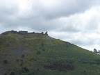
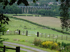
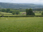
After packing up the tent we walked up to the beautiful village of Llandegla. This is where we rejoined the Offa’s Dyke Path, as it passes straight through the village “high street”. It took us past the small Memorial Hall and Post Office (which was the main shop as far as I could tell?) Until we reached the Church. It was really good to see a Sign post to Prestatyn saying that it was only 29 miles away and we had covered 68 miles in the past few days! I do remember the first sign saying it was 97 miles to Prestatyn, so it did feel like we had achieved something!

From 2011 – 23.06.2011 – Offa’s Dyke Path – Llangdegla and Prestatyn

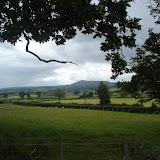
It is here that I have to inform that you we had decided to stop our walk. Unfortunately my knee had severely swollen up and the previous evening even the campsite owner had seen me hobbling about the campsite 😦 . I think we were both Disappointed that we were not going to be able to walk the last 29 miles – and tackle the beautiful Clwydian Range – but to be honest in the end I realised, that Offa’s Dyke will be there for us to to return to (and we will!). When I was rested we could carry on walking in Prestatyn – since this was all for Charity!

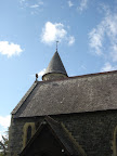
Whilst waiting for the bus, I took a look around the Saint Tecla Church. I was rather struck by the beautiful stained glass window. In fact this window is actually rare example of a smoked glass and not a stained glass window at all. The window was made about 1800 where it was originally installed in St Asaph Cathedral. During restoration work of the Cathedral it was moved to the Church during the early 19th Century.

From 2011 – 23.06.2011 – Offa’s Dyke Path – Llangdegla and Prestatyn

We had to leave this beautiful Church and village behind, by catching a bus to Denbigh. Where we stopped for a while, a lovely Welsh town – disappointingly I do not seem to have any photos to hand? We took the bus here to Rhyl where we a caught a train to Prestatyn, where the official finish of our walk was.

We found a somewhere to camp in Prestatyn for the night. The site is actually a converted Chapel still provided a beautiful place to camp 🙂 . Despite not being able walking to our last destination, we both felt it was fitting to at least complete the rest of the “Dyke” from the Campsite. “Plas Ifan” was situated directly along the path and it was quite interesting to note that they were advertising that 2011 is the path’s 40th anniversary. Prestatyn was ensuring that path was well and truly celebrated with a festival this year!

From 2011 – 23.06.2011 – Offa’s Dyke Path – Llangdegla and Prestatyn

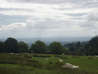
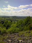
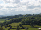
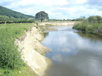
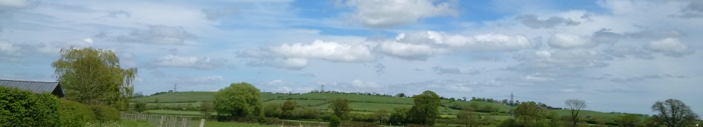
The “dyke” was seemingly not as picturesque we had previously encountered as we were now walking along the roads in Prestatyn. However, it seemed quite refreshing to be in a town environment after encountering cows, grumpy sheep, being isolated in the middle of seemingly nowhere and being amongst people for a change 🙂 . The path took us along the high street and across the road railway bridge (*Hopefully after June 2011 the path will have a better route across the railway this was still under construction) and then toward the sea.

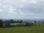
We past “Lido Beach”, which I presume is a caravan park, rather than an actual Lido. Particularly as there is not much evidence of the Lido any more, except the shop which looks like it could have been entrance? All I can find out about the Lido, are a very few memories about the outdoor baths that used to be here at Prestatyn. Does anyone has any other thoughts?

The path continues by the Bastion Gardens until we reached the seafront. It was here we finally reached our Journey’s end. It was the official end of our hike. Offa’s Dyke Path was marked by a large stainless steel statue. We were informed by the site owner that the shape of the statue was to capture the sun rising and setting. It was to be the new official end of the path. I had mixed emotions – glad we had made it – sad we had missed a lot – glad we had raised money for charity by doing the walk!

From 2011 – 23.06.2011 – Offa’s Dyke Path – Llangdegla and Prestatyn

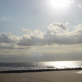
I was completely swept away by Prestatyn Beach. It is so beautiful. When I said that we had reached the official end of our walk, legend says the Dyke actually went out to sea, and we should have walked out onto the beach! Prestatyn Sands are really quite something to behold. I shall go into this more in another blog!

As we had a little more time we decided to stroll on from our wonderful adventure to look around. We were not disappointed with our next find. Prestatyn Pontins. Not very exciting you may think – but for any film fans out there, this is where “Holiday On the Buses” was filmed! It was odd to see the same looking gates as the film! I think other things may have changed though – all for the good 🙂 As we left Pontins behind we were treated to a fabulous sunset to end our day before drifting back to the tent….

I just want to say a big thank you for anyone who sponsored me on this walk and for everyone’s support!

For all the photos of the day please click here –

2011 – 23.06.2011 – Offa’s Dyke Path – Llangdegla and Prestatyn

<><

Offa’s Dyke Path – Wern Isaf – Llandegla Walk – 22.06.2011

After 5 days of walking, we had really stretched ourselves – my knee was now really painful and we both felt ready to stop.     After taking breakfast in Llangollen and a discussion, we returned to the path. So we both had a touch of deja-vu when we  walked passed the Campsite we had left in the morning to rejoin the path! From the information that we were given by the campsite owners,Offa’s Dyke was “a short way along the road, and just past the Cattle Grid”. Their information was correct, but I think I misinterpreted their word “short”, as it seemed quite a long way to me – probably as we were going uphill!

As we struggled along, little did we know that the hill that towered by the side of us held a story of Ancient History and Legend! This hill, has remains of a Medieval castle, “Castell Dinas Bran”, which in turn is built on top of an ancient Iron-Age hill-fort. This Castle has been home to the Prince’s of Powys. Despite the Castle being burnt to the ground in 1277 by, Edward De Lacy, the Castle had an impressive builder since the castle can still be seen in 2011. In fact the Castle was constructed by none other than someone who was reputed to be one of the protectors of the “Holy Grail”, his name was “Bran”.

The Legend surrounding the Castle goes on…. “Dinas Bran” is also known as “Castle Corbenic” in the legend of the Holy Grail. “Corben” is a French word for crow or raven and means Bran in Welsh the same meaning as Corbenic, the castle of the Grail of Arthurian legend. Bran became injured by a spear, and eventually he was put to death and his head was cut off. He gave instructions that his head was taken to a hill which was eventually to become the site of the Tower of London. It is said that while his head is buried there it would guard the land. Is it a coincidence that the present day ravens at the Tower are as important?

We were not blessed with seeing the Castle in full which a is a shame now I know the Legends surrounding the Castle! But I can share a photograph that I took –

From 2011 – 22.06.2011 – Offa's Dyke Path – Wern Isaf – Llandegla Walk

As we rejoined the path, well I say path, it was actually a lane that we were walking which was rather a change from fields, stiles, towpaths and hills! I was rather bemused when I heard the most horrendous noise as we were walking along. I thought we were either walking near a festival or someone had some very loud music on. As we continued on it became very deafening! In fact what we heard was not a festival but sheep!!! They were being rounded up ready for shearing. The farmer was using 3 sheepdogs, as well as his own mini tractor!

As we carried on our walk, we passed some the farm buildings, when we noticed that see one poor little sheepdog had been left all on his own 😦 – we just wanted to take him with us! In stark contrast to the farm on one side of us, rising up on the other were granite craggy outcrops. This reminded me of mountains of Glencoe – particularly when we saw the signs for climbing. We were walking in the Eglwyseg Valley.

Legends seems to be aplenty in this area. This valley is the setting for the legend of St. Collen, the Monk who gave his name to town of Llangollen. The Monk supposedly killed the giantess “Cares y Bwlch”, despite her desperate cry for help from another Giant named “Arthur”, who lived amongst the Eglwyseg Rocks. This particular tale had been told by Sabine Baring-Gould, and is recorded in the town Corwen, in Denbighshire. It is easy to see why such a legend of a giant living amongst these craggy outcrops came about…

From 2011 – 22.06.2011 – Offa's Dyke Path – Wern Isaf – Llandegla Walk

As the path carries on, we finally saw a sign for Worlds End where the route was heading. We thought that we were to continue along the road, but actually Offa’s Dyke path turns off the road at this point. The path took us through a small gate and past a small Farmhouse. It was here we got confused. There is a small Offa’s Dyke sign, but sadly, it had not been looked after and the the arrow was hanging loose *nb this was june 2011*. Assuming that this was the correct route we continued straight on. We did note that there were no more markers along the path and something did not feel quite right as the path thins out as it goes along the side of the mountain side. We therefore decided to turn back to the marker and tried two different routes but still failed to walk this section. *Warning if you do walk this part of the path the first route we took was probably correct despite being so thin in parts*. We walked back to the gate, as the Official guide suggested that by using the road to World’s End we would pick up the path again, if we used that route instead.

Walking the road is not so bad, in fact it gave some interesting insights! As we turned the corner we were rather surprised when a farmer asked us to move out of the way, so he could he could bring his cows along the road – all 3 of them! The farmer was very pleasant and explained he was taking the 3 heavily pregnant cows to the farm! I must admit this is the very first time I have ever been held up on a walk by cows!

Once we were able to continue on the road did seem never-ending to us. It just twists and turns – until we reached “Worlds End Farm” – Firstly I must point out that this is not like the “World End” in Pirate of the Carribbean… No Davy Jones Locker was here – just a small farm and trees – it was very remote indeed. I still can’t fathom why it was called World’s End quite yet but I am sure I will figure it out soon! If we had walked the way of Offa’s Dyke we would have been able to see World’s End Manor House known as “Plas Uchaf” which was built in the 16th Century. Pity we did not, as I am sure it would have been a lovely sight to see. 🙂 Proof that this was known as World’s End –

From 2011 – 22.06.2011 – Offa's Dyke Path – Wern Isaf – Llandegla Walk

We did stop along this section for a spot of late lunch. In fact we tucked into a Welsh Oggie – which we purchased from a bakers in Llangollen – very nice it was too! Refreshed we were able to continue on our journey. The road passes through a ford which is known as the “Horseshoe pass”, which has a stunning view across the valley. The path then takes a turn on to the desolate moors which are known as “Cyrn-y-Brain”. This was a very different kind of landscape that we were not used too. It was very flat and we were almost expecting some kind of mist rolling over the moors – If it did you would have expected the Hounds of the Baskervilles heading towards us!

It was here that we experienced yet more sheep. They were everywhere we looked. It was yet another tale of us encroaching on there territory. At one stage I will admit I had the “lovely fluffy sheep” image completely destroyed – because as we walked nearer a sheep it continuing staring at us and in fact stamped it’s feet at us! It was so angry… I will never look at a sheep in the same way again. They seemed to be watching us from everywhere…

From 2011 – 22.06.2011 – Offa's Dyke Path – Wern Isaf – Llandegla Walk

The path continues along this section for about 1/2 mile until the path turn us onto the moor itself to Llandegla Forest, which was near our destination. The path is well looked after and has many wooden boards to cross, it is quite impossible to get lost on this section or sink into the mud! Llandegla forest was a very intriguing to walk, it was full of mountain bikers. we felt like lone walkers! Nearly everyone was on a bike except us. The path did not remain flat here, as there is a one small hill which was quite tricky to negotiate as it is reasonably steep – we were lucky it was not raining as it was quite muddy. We eventually come out out of the forest and met with a lovely view over the fields, were we met a friendly biker who assured us it was not long before we would come across the pub for a nice drink!

In fact the path took us across a few more fields and it seemed a long time before we even reached Llandegla, where we came across the Crown Inn where we were able to refresh ourselves 🙂 It was here we ended our days walking and pitched our tent for the night in Llyn Rhys Campsite. The locals at the pub were also very friendly to talk too! I think the saddest part of the day, that by this point was my knee was in agony, it made us think again if we were going to continue the next day – particularly as the friendly locals told us of what was in store!

All the days walking photos can be seen below –

2011 – 22.06.2011 – Offa’s Dyke Path – Wern Isaf – Llandegla Walk

<><

Offa’s Dyke Path – Carreg-y-big – Wern Isaf – 21.06.2011

It rained all night. The sound of rain on the roof woke me a few times during the night, worrying me about the weather for our next day’s walk. Despite my initial fears, the rain did subside, so we were able to set out without the fear of being completely drenched. We followed the path from the farm which led up to what is known as “Selattyn Hill”.

I have discovered that Selattyn hill, has a monument built one side of it known as the “Belevdere tower”. Unfortunately as we were so busy walking we did not see the building. The tower, was constructed by Mr Crewe of Pentrepant to commemorate Prince Gwên, a 6th century British prince. According to legend, he was killed in a battle when he was fighting the Saxons near to the Morlas Brook, which was somewhere north of the hill. It is shame we did not see it 😦 . However, Selattyn Hill did provide some beautiful views 🙂 –

From 2011 – 21.06.2011 – Offa's Dyke Path- Carreg-y-Big – Wern Isaf Walk

Leaving the monument to the Prince behind, the path descended down the valley, into a road. The path led us back onto fields, and we found ourselves walking the actual Dyke again. We seemed to be quite high up as we could see for miles, but not as far as the previous day. We were even rewarded with a view of Chirk Castle in the distance.

It was not long before we were on the descent again and we faced with our first real challenge of the day. “Dirty Dingle” or what was officially known as “Nanteris ravine”. Not quite the ravine in “Indiana Jones and the Temple of Doom”, but it certainly seemed as bad! It was was about 80 or more steps down, which were very steep. I think our worst enemy was not how steep the actual steps were, but *MUD*. This was because steps are not constructed from concrete, they are only wooden steps enabling walkers to get down the slope.

The rain had seeped through the trees and it was very, very muddy – consequently we both slipped! Ouch! Only our rucksacks prevented us from falling to far, after that, we held on very tight! After climbing the steps out of the ravine, we had to face a muddy slope on to reach the top of the hill on the other side. I needed to use a rough branch to steady myself up the hill. Unfortunately, I had usefully lost my walking stick at some point 😦 so I had to improvise!

Once we had passed the dangers of the “Dirty Dingle”, we really had a great view of Chirk Castle. This was looking a lot larger and made me ponder who would have dared to have cross the owners of this castle in the past!?!. I must admit, it looked very well preserved, after having just visited Hopton Heath castle which needed a full restoration (and how wonderful it looks now 🙂 ), from what I could see it seemed very intact. I could even see that the flag was flying – but I don’t think it was about the Queen being residence!

From 2011 – 21.06.2011 – Offa's Dyke Path- Carreg-y-Big – Wern Isaf Walk

The route took us on down through the fields and eventually out onto a roadway. We continued our walk along Offa’s Dyke Path, which took us up what began to seem like a very steep climb… (Please note, however, if you do reach this point, and you should so wish to do so, there is a route available through Chirk Castle Grounds and you are able to walk this route e during the summer months.)

We were beginning to feel exhausted when a voice came out of the blue… “Would you like a cup of tea?” Shocked, we had not heard it wrong, we had been asked by an extremely kind lady for a cup of tea, which was a complete shock to the both of us!   They were very kind, and were able to watch the clouds roll across the valley just for a a while.  I think a bigger surprise to us was that these two lovely people turned out to be going to Greenbelt this year!   If you manage to read this blog, firstly a MASSIVE Thankyou for the lovely drink and see you at Greenbelt 2011!

Restored and refreshed, we continued up the lane, which seemed quite a hike, we were once again faced with a field full of sheep! I don’t think they minded us this time. At the top of the hill, we were rewarded once again with a stunning view of Chirk Castle. If you get chance, look out for “Offa the sheep” sneaking in the photo below(a sheep’s chance of fame LOL)

From 2011 – 21.06.2011 – Offa's Dyke Path- Carreg-y-Big – Wern Isaf Walk

As we did not stop at Chirk Castle as we had originally planned, I was little bereft to find out more of what treasures that it may have held in store. The castle belongs to the Myddleton family – not to be confused with the “Middleton” family that has recently been involved with the British Royal family! The castle was built during 13th Century for the Lord Justice of North Wales for Edward 1. Although I did not officially see the coat of arms for Chirk, I think the legend of the “Bloody Hand” is quite fascinating. The Red Hand has quite a versions of how the red hand came about… all of them over the family inheritance of the castle. I will re-tell one of tales here (please click here for the rest of the murky tales 😉 )

… in the dark and distant past of Chirk Castle, two younger members of the family fought bitterly over who should inherit the castle. In order to settle their quarrel, it was agreed that the two family members should battle out in a race. It was simple enough, all the winner had to do was to touch the Castle gates at the finishing line. However, legend has it, that as rightful winner reached out to touch the castle gate, he was robbed of his victory by a supporter of his foe. The support took out his sword and sliced off his outstretched hand – hence the “bloody hand of chirk”

We were soon to leave Chirk Castle behind, as the path was on the descent through the fields. We were about to encounter yet another Canal. It was so different from the Montgomery canal we had just walked. This was the Llangollen Canal. The biggest difference – barges! It was nice to see that the canal was in use, unlike the Montgomery Canal which seemed so silent… 🙂

The Llangollen Canal, originally known as the Ellesmere Canal, built between 1793 and completed in 1805. The history behind the construction of the canal seems quite complex. The intention behind the canal was to link the rivers Dee near Chester and the Severn at Shrewsbury, but as many canal companies were involved with their separate ideas, the canal evolved, hence the change in name. This canal was built for industrial purposes, but no longer as it is merely used for pleasure cruises. I can’t say I blame them really – even Indiana Jones himself (Harrison Ford) has taken to these waters to sail one of the Narrow Boats we saw 🙂

In total the Llangollen canal is 41 miles long – although we were only going to explore a very small part of it. As we continued we were treated to the amazing sight of the “Pontcysyllte Aqueduct” – The word “Pont y Cysyllte” meaning – “bridge that links”

From 2011 – 21.06.2011 – Offa's Dyke Path- Carreg-y-Big – Wern Isaf Walk

This amazing bridge has stood since 1805 when it opened to the sounds of brass bands, a parade and thousands of cheers from crowds of people who come from all over the country to witness boats “fly” across the valley. It was Thomas Telford who had engineered this bridge, and it is now a world heritage site.

The path took us to the junction, we could either follow the boats across the aqueduct or the path under the bridge. The bridge is 126ft ~38m tall, not very high for us to walk, considering we have tackled Ben Nevis and Snowdon, but with our heavy rucksacks we decided that we would walk the bridge another time! Sorry to disappoint you all… Once we had reached the other side of the Aqueduct we had arrived at the Trevor Basin. This was a major mooring place – mainly for refuelling. There was also a great pub called “Thomas Telford”, named after the engineer, where we also refuelled for our final leg of our journey.

Instead of walking Offa’s Dyke to reach our destination, we walked Llangollen Canal instead. It was the same amount of miles – 3 miles on the flat rather than through the fields. Unfortunately I am unable to tell you what this section of the path is like, apologies for that. I would also point out that my knee had started to hurt at this point so I was glad of being able to walk along the flat! On reaching Llangollen, we need to cross the canal to reach the Campsite. We would like to point out that the Wern Isaf Campsite was not on the official list of campsites although it is on the website. I would recommend to stay here if you are camping while you are walking as it is not too far from the path, the owners are lovely!

All the photos (all be it not as many as the day before!) are as follows –

2011 – 21.06.2011 – Offa’s Dyke Path- Carreg-y-Big – Wern Isaf Walk

<><

Offa’s Dyke Path – Llaymynech – Carreg – y – Big Walk – 20.06.2011

Rested, we set out on our walk, following the track down the Montgomery Canal.  For anyone who is thinking of walking Offa’s Dyke from Llanymynech onwards, please note that this is the wrong way! We were actually walking down “Wat’s Dyke Way” We had not checked our map and just carried on were left off on the previous day!

Oblivious of our initial mistake, we still enjoyed this part walk! As I said in my previous blog the “Montgomery Canal” was built for barges to carry industrial materials. It was it this point we saw our first real evidence of Llanymynech’s industrial past. We had spotted something that looked like a huge chimney that was in the middle of nowhere. I know understand from most of what I have read that most of the villages that were along the canal had “Lime Kilns”

From 2011 – 20.06.2011 – Offa’s Dyke Path – Llanymech – Carreg – y – Big Walk

As we carried on down the canal, we found the state of the Montgomery canal very sad. In some places the canal had completely disappeared, overgrown with trees and other such wildlife.   In one way this was is such a shame, but on the positive side, wildlife has flourished 🙂 .    Eventually realising that we had gone the wrong way (hence my photo of the “Wat Dyke’s Way”) we decided it we needed to turn back and quickly!  We did manage to learn one more thing about the canal before we did finally leave it.

Nearby to Pant Wharf, the end of Montgomery Canal walk, there used to be a tramway that brought limestone from the quarries which were on the nearby Llanymynech hill.     This was the hill we were about to tackle!  It was going to be interesting to find out how far these trams would have had to travel as they would have travelled under there own weight  and been winched back up by pulley!

We arrived back in Llanymynech to start our Offa’s Dyke Walk in ernest.       The path took us across the canal and towards the Hill.   It was really interesting to find out that we were walking in the footsteps of Mr Charles Darwin.   He had visited Llanymynech in 1831, when he was a novice Geologist.  He came to Pen-y-Feol cutting where he tested his “new” chometer – which is designed to measure angles of slopes.   Whilst we continued up the lane, I noticed the markers where Mr Darwin had taken those measurements –

From 2011 – 20.06.2011 – Offa’s Dyke Path – Llanymech – Carreg – y – Big Walk

When we reached the top of the lane, Offa’s Dyke path took a turn – to take us up onto Llanymynech hill.    We had seen this from afar – and always thought that this was a a great big fort/castle of some sort.    but in fact the reason the site  has taken shape the way it has – was it was an abandoned Limestone Quarry.     The buildings that we saw, were connected to the Old tramway which took limestone to the canal – which I had just learnt about! However, from here it was difficult to see the canal from the top of the hill, so it was difficult to imagine how it would have looked to have a tramway from the hill to the canal all those years ago.

It seems Llanymynech Rocks has quite a history other than just limestone quarrying.   Apparently,  silver once rumoured to be hidden amongst the rocks.   Sadly for those who mined for the precious metal, found nothing – this was during the 12th Century when money was needed to release King Richard I during the Crusades.     Even before the 12th Century,  the Rocks provided a different metal – copper – it was the Romans that notably mined for this – or rather their slaves.

The view from the top of the hill was really quite impressive.    On such a clear day, we could see for miles.   I do wonder while all that industry was taking place if anyone did actually stop to look? In some sad cases they probably couldn’t – such a shame –

From 2011 – 20.06.2011 – Offa’s Dyke Path – Llanymech – Carreg – y – Big Walk

The path then left these lovely views behind, and it runs parallel to the Llanymynech Golf Course. In fact we were a bit confused at one point with one of the paths as it weaved in and out of the trees and onto the Golf Course again. This is because the we are actually following the line of the “Dyke”.

We did not stray onto the Golf Course, we did not really want to upset the Golfers!  I remembered what it was like to walk across Moor Park Golf Course when I was walking some of the London Loop! The path leaves the Golf Course behind and descends through some woodland, onto road and eventually joined some fields.

We had to cross a stile, which we were very used to by now – so why I am blogging this? Well, it was what on the other side that fascinated me. A railway. A railway which had not been taken away. Just simply abandoned – the rails were rusting away. This was the Tanat Valley Line which served Oswestry to Llangynog from 1904 to 1960. It seems odd to me that this line was not really dismantled just “left”.

The route took us past Porth-y-waen – but there are no real signs of Offa’s Dyke in this area. Perhaps just all the quarrying in these parts has led to Offa’s Dyke disappearance in this particular section. Just as we thought we had left the railway behind, we came across an old level crossing! Not only was the level crossing just left, but an old truck was also on the track. It was an eerie sight.

From 2011 – 20.06.2011 – Offa's Dyke Path – Llanymech – Carreg – y – Big Walk

The path carries on past the small village of Nantmawr onto some fields. We had reached “Jones Rough” a small nature reserve which is now looked after by the Shropshire Wildlife Trust. It is said that the area gained the name “Jones Rough” from the Jones family who had built a small cottage called “Mount Zion” in the area in the 19th Century. Apparently they did not have any permission to build the cottage, but thought they could claim it for there own –

under the belief “that if there was smoke coming from the chimney by morning the builders could claim the dwelling as their home.”

However, the Landowners – Powys Estates claimed the cottage as their own and duly asked for rent! Hence why it is known as “Jones Rough”

Despite all of this, we did not see the cottage in question! The path took us up Moelydd Hill. Yet another climb, but I think out of all our climbs of this walk, this claimed to have the most interesting view! I think we were lucky to have such a clear day. According to the very handily placed stone compass – we could have seen Liverpool in one direction and Snowdon in another. We definitely could make out Snowdon – it was nice to see in the distance – (strange after seeing up close) I don’t think we saw Liverpool.

From 2011 – 20.06.2011 – Offa’s Dyke Path – Llanymech – Carreg – y – Big Walk

We made our way down again. The path took us through some more fields, and along a small road. We passed a beautifully sculpted tree which reminded me of the ones which had been done in Cassiobury Park. We had entered Trefonen Village, where we stopped for a drink and a breather. We left the village behind to rejoin the route. This stretch of the path actually follows the actual dyke.

We soon on the ascent again into Candy Woods. An odd name I thought. I almsot expected to see Willy Wonka to pop his head out! The trees were not made of chocolate though! The nice day we had been experiencing changed dramatically, it started to rain quite badly. You would think it is not so bad walking through woods in rain, but mud and rain come through leaves seems to feels worse somehow.

Once we left Candy woods the path led us out onto open field. In fact this was Oswestry Old Racecourse. What an amazing place to have a racecourse – on top of a hill – commanding views across the valley. Remains of the original grandstand were still still standing – which was built in 1804. The racecourse, seemed to have a lively history, from the end of the 18th Century with well attended meetings with Lords and Earls amongst them. The last meeting as in 1848 it seems that the racecourse lost out to larger racecourses such as Chester with the coming of the Railway. I would agree, the racecourse was not huge – I couldn’t imagine a racetrack on the size of land that was there and the horses thundering past.

We left the ghosts of the horses behind, to find our rest place for the night. Carreg-y-big. We couldn’t wait. The weather was really catching up with us as the rain was really coming down! We nearly walked past the farm! We were soaked 😦 … The owner of Carreg-y-big was so lovely when he greeted us he even fed us! SO a massive thank you to him for his kindness from these two walkers for use of the equestrian centre sofa’s for the night – saved putting up the tent 🙂 !

For all the day’s Walking photos please click here –

2011 – 20.06.2011 – Offa’s Dyke Path – Llanymech – Carreg – y – Big Walk

<><

Offa’s Dyke Path – Buttington Bridge – Llanymynech Walk – 19.06.2011

Unlike our Scotland experience of camping taking the tent down was a lot nicer! No midges to fight off – it actually very leisurely. There was a down side to it though, no tea or coffee. Buttington has one pub, a church and no other amenities 😦 . We had to walk a reasonable way to get our morning drink!

We returned to the path. No sooner had we crossed a farmers field,  we were faced with crossing a train line – which I always find pretty precarious to cross.   There was no particular warning system  when the next train was due,  I only had my eyes to rely on!       We were able to catch glimpse of  “Buttington Bridge” which for a bridge, was particularly striking. I can’t find much information about the actual architect – but I do know that this is a Grade II Listed building!

Our route left train line and the road behind, as the path turned into a large expanse flat fields. Whilst we were walking this part of the path, we came saw this small little river. The way that the river had cut into the land, exposing the raw material beneath – reminded me of the Chalk cliffs of Dover. This tiny unsuspecting little river in fact is the River Severn!

From 2011 – 19.06.2011 – Offa’s Dyke Path – Buttington Bridge – Llanymech Walk

Just a small word of warning if you walk these fields, there is one thing you need worry about and that is the sheep! We were unable to stick to walking the dyke, most of the way we had to circumnavigate our way around sheep who simply refused to move – they just *stared* at us – as if to say “this is our field you move not us!”

Sadly the path leaves the fields behind, and we had to do some road walking. We felt it was a shame the path was on the opposite side to the river, not only did it have a road between us and the river, it was also hidden by trees 😦 we were hoping that we were going to join up with it again! All was not lost though, as the path took us to meet up with the Montgomery Canal.

The Montgomery Canal is 35 miles in length stretching from Frankton Junction near Ellesmere to Newtown. Unlike the fully navigable Grand Union Canal where I had walked recently, this canal was full of wildlife and there was a ack of barges! This is a far cry from the Canal’s original intention. Two separate canal companies, Ellesmere Canal Company and the Montgomeryshire Canal Company, built this canal with a similar purpose to carry industrial material – coal or limestone. I shall elaborate on this in my next post.

As we walked along the towpath on this quiet stretch, we came across a lifting bridge. Not a sight I have seen on the Grand Union Canal before. I am not quite sure what they were used for? I presume it is for ensure that farmers could get across the canal – a lot less expensive than building a large stone bridge? Any answers on a postcard (or email please!)

From 2011 – 19.06.2011 – Offa’s Dyke Path – Buttington Bridge – Llanymech Walk

We followed the Tow Path for another mile or so before turning us into Pool Quay. Where we rested in the “Powis Arms” for our overdue morning hot drink!

Feet rested up, we decided it was time to set off once again to make our way to Four Crosses. As we started off, I did notice a large looking Church – it was a rather impressive building. I can’t find much out about it’s history – only that it is the St John the Evangelist Parish Church and was built in 1862. Again, if anyone has any historic knowledge of this church, I would be keen to know

From 2011 – 19.06.2011 – Offa’s Dyke Path – Buttington Bridge – Llanymech Walk

Our walk met up with the Dyke once again. I always felt a bit odd to be walking a 8th Century earthwork, but always found the animals that had grazed the fields all around me would never had cared about what it was…

At this point path passes over the old Cambrian Mainline Railway which used to run from Oswestry to Newtown – sadly the evidence of this line was difficult to see (although I am sure we found some of it on a later walk?) This line was to replace the Montgomery Canal – but also fell redundant just as the Canal did.

The Dyke passes over some flood defences – very strange looking metal structures that were stuck in the middle of a field. Presumably built to deal with any possibilities of the River Severn bursting its banks on this low lying land.

We took this part of the path in our stride. We did encounter lots of cows (not sheep this time!) which decided to hog the path. These were a lot more difficult to walk around – we ended up walking in the boggy field and not the lovely path (perhaps that is why all the cows were on the dyke!). We also had to deal with quite a few stiles too – It was here that hit my knee on one of these stiles and injured it 😦

Eventually we had reached Four Crosses. We stopped at the Four Crosses Inn for some overdue lunch and a rest before carrying on. Before we rejoined the path, we did take a little diversion. Well ok – it was more of a confused diversion since the path was being rebuilt! We past this really lovely church which has a “round tower”

From 2011 – 19.06.2011 – Offa’s Dyke Path – Buttington Bridge – Llanymech Walk

These “Round Towers” Churches are mostly found in East Anglia and not in Mid Wales. When I have started looking up the history of how these churches came about they seem to have “myths” – perhaps the towers were originally wells or were harking back to prehistory? Other historic evidence points to 10th Century King Athelstan issuing a law with a specific requirement as to what was needed to claim local leadership over his piece of Land. This was to have bell tower on it. It is possible that the round towers owe their existence to this decree.

We left the Church behind to find our way back to the path. We had been led back to the Montgomery Canal. We found this very pleasant to walk. The sun was really shining and it is very warm. The Canal trees provided the very shade we needed. The Canal still looked uncared for, which is shame but the wildlife had taken full advantage of it. We found that out when we crossed over an Aqueduct. Originally to take industrial Narrow Boats, on hot summers evening it was hard to imagine any boats on it now particularly as we stopped to watch 2 mute Swans building a nest with their 5 sygnets!

From 2011 – 19.06.2011 – Offa’s Dyke Path – Buttington Bridge – Llanymech Walk

It was hard to tear ourselves away from this wonderful sight. But we did! This was a straight walk on to the village of Llanymynech. Just before we turned off we caught sight of a wonderfully restored lock – a sign to me that perhaps there was hope for the Canal yet!

It was here that we were going to camp for the night. Did I say camp? Well actually there are no campsites here we had walked right past it! We had to find somewhere to stay and very quickly or we would have to back on ourselves 😦 The Manse saved the Day – thank you!

Photos from Day 3 of our walk please feel free to click here –

2011 – 19.06.2011 – Offa’s Dyke Path – Buttington Bridge – Llanymech Walk

<><

Offa’s Dyke Path – Montgomery – Buttington Bridge Walk – 18.06.2011

If you are wondering how I managed to have any photos on my any of blogs after my bold declaration in my last post of “I have lost all my photos forever” Someone had kindly lent me there camera so I had a spare one with me 🙂 how wonderful!

We started out from the Bed & Breakfast which was in fact not very far from the path at all – which was lovely.  It was nice to know that today’s walk was not going to tackle as many hills as the day before.   Although I let out a sigh of relief at this piece of knowledge we did have to tackle a hill straight way!  We took it slowly and although at one point the path did seem a little steep to climb it was worth it for the view.

From 2011 – 18.06.2011 – Offas Dyke Path – Montgomery – Buttington Bridge Walk

As we descended the hill,  we were able to rejoin the dyke that we had left behind. As there was no path along the part of the actual dyke that we were unable to walk I have since found out there is a nice example of a “Castle Mound” to be found!

As we continued on, we eventually ended up walking at the end of peoples gardens. It must be really odd, or nice depending how you look at it, to have an 8th Century Monument at the bottom of your garden! Leaving the gardens behind, we were essentially on the ascent again.

Intriguingly, Offa’s Dyke also follows the course of an old Roman Road. This was part of the Roman Road which ran from Wroxeter (Viroconium) to Forden Gear. This was a very important road connecting Central Wales, leading out to the Estuary and the Coastal Fort’s. The part of the road we were walking today was the “Westbury to Forden Gaer” section, which lies along the ridgeway of the Long Mountain, descending into Forden (the village which we had just passed) the road which was then later taken over by Offa’s Dyke.

We were then entering a strange piece of woodland. Why strange? Well we found these very strange stone walls that didn’t seem to be there for no particular reason. At first glance to me I wondered if they something to do with an old railway? I did try to convince myself that the path was the correct size for a trackbed! I was wrong of course as it has nothing to do with railways! In fact this is actually known as “Offa’s Pool”.

From 2011 – 18.06.2011 – Offas Dyke Path – Montgomery – Buttington Bridge Walk

“Offa’s Pool” was built as part of the Leighton Estate. John Naylor – an eminent Liverpool banker in the Mid-nineteenth century took over the whole estate and as a result along with the architect W.H.Gee was responsible for building the “pool”. This “pool” was quite an water engineering feat – it collected water to form part of a water power system which could irrigate land, power agricultural machinery, produce fertiliser and even power a funicular railway which went to the top of Moel y Mab to Beacon Ring (where we were about to walk)!

Passing by a beautiful pond, which contained some beautiful Koi Carp had now left the woodland behind. We had to were starting to climb again, but I don’t think we really minded on this occasion, since we had not really experienced much bad weather as we had on the previous day. When we reached the top, we came across “Beacon Ring”

“Caer Digoll” is the Welsh name for the Ring is derived from Long Mountain (Cefn Digoll – “unbroken ridge”). Although little is known about this Hillfort, I can imagine just by it’s sheer domination over the skyline how important it must have been during those early centuries, when the English – Welsh border was fiercely fought over.

From 2011 – 18.06.2011 – Offas Dyke Path – Montgomery – Buttington Bridge Walk

The Hillfort was referred to in a 9th/10th saga known as Canu Llywarch Hen (‘The song of Llywarch the Old’), when conflicts took place between the British prince Cadwallon and Edwin, the Anglo-Saxon, king of Northumbria during 7th Century. Beacon Ring is described, if not in poetic terms as

“…the lluest or camp of Cadwallon where he stayed for seven months, carrying out seven skirmishes daily.”

Before leaving this curious Hillfort behind, we came across two walkers, in fact the first two we had encountered all day! Assuring us the rest of our walk was downhill all the way! I think it was nice to know they were right!

In fact the rest of the way was through fields – mostly occupied by sheep. Although at one point, it was nice to find a bench kindly provided which had the funny little poem –

“There was a crooked man
Who walked a crooked mile
He found a crooked sixpence
Upon a crooked stile”

I must admit I did feel very crooked after all this walking! Interestingly enough this poem is from the English Stuart history of King Charles 1 and being the border between England and Scotland! (and not the border of England and Wales!)

From 2011 – 18.06.2011 – Offas Dyke Path – Montgomery – Buttington Bridge Walk

Still passing this little bench we were able to continue our walk on further on down the fields. We did take a look back at where we had come from – took a little gasp at how high the actual fort was – in fact it was 1,000 feet up (~300 metres).

We had started to reach very flat area and the roadway. As we turned into the Road were the path took us we had finally reached our Journey’s end – Buttington! It was here we were too camp for the night. We pitched tent at behind “The Green Dragon Inn”. Just as an aside we had a nice pub meal in there and if you interested in pop memorabilia they have some excellent signed posters – The Bachelors and The Osmonds – if you are into that sort of thing! Sadly I was unable to get photos of all of them as it was too busy!

All the day’s photographs are on the following link –

2011 – 18.06.2011 – Offas Dyke Path – Montgomery – Buttington Bridge Walk

<><

Offa’s Dyke Path – Knighton – Churchtown Walk – 17.06.2011

We took the “Heart of Wales” line from Hopton Heath to Knighton. Knighton in Welsh is “Tref-y-Clawdd” meaning “Town on the Dyke” – a very good place to start our Offa’s Dyke adventure if you ask me!

Knighton is a pretty little town – so much so it has even starred in two films – “Gone to Earth” (1950) and the film “Second Best” (1994) Starring William Hurt. The area is extra special as the Oscar-winning actress Julie Christie lived nearby at one time! I can’t really say I blame her for living her or for Knighton being a film location either it really is lovely!

We passed a rather striking (forgive the pun) Clock Tower – which had been standing there since 1872 – and hopefully been keeping the correct time too! Unfortunately I cannot provide you any photos of the clock 😦 – explanation later… We quickly stocked up on supplies, before we found our way to the path. Helpfully in Knighton there is a Offa’s Dyke Centre!

It was 97 miles to Prestatyn from the Offa’s Dyke Centre and we were about to walk all the way there *phew* I must admit it suddenly felt very daunting to see the sign in front of me (rather than just be planning it all on paper!)

From 2011 – 17.06.2011 – Offa’s Dyke Path – Knighton – Churchtown Walk

Setting out from the centre the path is very clearly marked (ok I admit it! – we did have to ask the locals when we saw a sign for “Welcome to Shropshire” and I thought we were going the wrong way!) Apparently we were going to cross the border between England quite a few times over the next few days!

This first section we were tackling is generally known as the “switchback” section. This is because the “Dyke” weaves a curved ‘switchback’ course over the Clun rolling countryside. Did I explain what Offa’s Dyke actually is? I mentioned it in my Hopton Heath about the King of Mercia building a Dyke (or a large earthwork!) From one of the quotes that I have found from one Historical record by a Welsh Scholar known as Asser in 9th/10th Century it confirms that –

“there was in Mercia in fairly recent time a certain vigorous king called Offa, who terrified all the neighbouring kings and provinces around him, and who had a great dyke built between Wales and Mercia from sea to sea”

Sounds scary to me! I don’t think I would have crossed the mighty dyke, let alone think about walking it! However, I am so glad that I am now have the chance too!

From what I read before we even started out, this section was meant to be the toughest part of the path! Well I think I found that out on the first hill! Having tackled Ben Nevis, Snowdon and the West Highland way – all without a hint of my asthma – I was bowled over half way up! I felt unfit – as if I had not trained at all! From this moment onwards our walking pace slowed right down!

We were walking the Shropshire Hills – an area of outstanding beauty – when I was able to get to see the views – it is simply stunning. Worth every moment of the walk and wheeze!

From 2011 – 17.06.2011 – Offa’s Dyke Path – Knighton – Churchtown Walk

The weather was very changeable, we had rain (you can probably gather from the picture above that the clouds were gathering!), sunshine – it got very hot and then it was very windy!  The problem with the rain it got very muddy, and with that I slipped … and it also meant the loss of my camera 😦  .  We had reached a beautiful view and I reached for my camera and it had gone.  I was devastated.  All my photos I had taken had disappeared forever 😦   Unfortunately we could not go back to look as we did not even know where to go and hunt for it 😦

As we carried on along the hillside, we found ourselves walking alongside the “Dyke” itself.    In fact I am quite impressed to see an earthwork that was built in the 8th Century is still clearly preserved.  The path follows the Dyke for quite a few miles – so it was nice to be able to enjoy this lovely piece of  “ancient architecture”.      As we walked on, it was welcoming to come across the 1/2 way marker for Offa’s Dyke (not our half way though!) saying we only had another 88 1/2 miles to go!

From 2011 – 17.06.2011 – Offa’s Dyke Path – Knighton – Churchtown Walk

After our adventures with the West Highland Way and the problems with signs – we were hoping that the Offa’s Dyke National Trail did not suffer a similar problem – i.e. a lack  of signs!  Sadly it does in certain sections! We did have trouble when we came across a field full of cows – which was very off putting indeed!  The markers and the dyke seemed to part company – We went around the hill, which was a natural path – when we should have gone over the hill!

It was much later in the day and we finally came across walkers – in fact we think they were Duke of Edinburgh walkers – one group were counting stiles (they were coming the other way and that didn’t give me much cheer!) and the next group promptly asked us  “we think we are lost… can you tell us are we on the right path to Newcastle? as we want to get to our campsite!” In fact they were looking for Newcastle-on-Clun – we assured the group they were in the right direction! I am not surprised they felt lost though we had all been crossing the English / Welsh border so many times that day they probably felt like they were were on the other side of the country LOL

It seemed we had left the Shropshire hills behind for a while, to walk some very wooded areas (with lots of stiles in!) in fact it started to rain on and off at this point. In fact we only managed a few more miles, before giving our Bed & Breakfast ring for help! (don’t panic readers – after one more night we camped the rest of the way!) but before help arrived, we had to negotiate a nasty, very muddy hill – in fact it would have been better slide down it – but we would have lost all our weeks supply if we had!

So thanks to Caemwgal Farmhouse who picked up two bedraggled charity walkers! We managed to eat and warm up ready for a good nights sleep – all ready for day 2!

All the photos (well the few I did manage to take!) please feel free to take a look here –

2011 – 17.06.2011 – Offa’s Dyke Path – Knighton – Churchtown Walk

<><