Category Archives: Essex

Colchester Walk – 22.03.2014

“Humpty Dumpty sat on a wall, Humpty Dumpty had a great fall. All the king’s horses and all the king’s men Couldn’t put Humpty together again” (Modern Text)

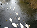
What a lovely Nursery Rhyme! What has that got to do with where we walking… well we had arrived in the historic town of Colchester, where this “song” had its origins. We were to find out about more of that later as we were wander the streets of the city. Starting out from the Station, we headed our way in to town to find out what it would hold in store for us. The station is a little way out from the main part of the Colchester, so it was not too pleasant at first walking beside some very noisy heavy traffic-laden roads. When reached the bottom of “North Hill” the atmosphere altered as the roadway eased up slightly and the pathway was to take us across a river, which made the area look nice and green. There was a lovely riverside walk to some open parkland and the “Middle Mill”, however we decided to onwards and maybe investigate this later in the day. It was not long before walking amongst some beautiful buildings from a bygone era.

Most of the buildings were Tudor, whether that was in Style or whether they were actually Tudor I am not sure. We passed by a lovely inn named the “The Marquis”, however, it was a little early in our walk to stop for a drink! Just past the pub was St Peters Church, always a good place to find a church next to a pub LOL. A church has been recorded on this site since the Domesday book in 1086 and the building itself has played its part in historical controversy. “Caroline of Brunswick” body rested here for a single night in 1821 when her funeral procession was passing through Colchester. Caroline of Brunswick was married to the then “Prince Regent” of England, their marriage was for political reasons but unfortunately it was a disaster. As a result they lived separate lives, the Prince even banished her from his own Coronation when the time came. When Caroline tried to make her way to the coronation, ill health prevented her and she sadly passed away. Those opposed to the Regent supported Caroline and even when her funeral procession was banned from London they caused havoc and riots by making sure it made it through!

From 2014 – 22.03.2014 – Colchester

As we made our finally made our way uphill, we turned to see if we would have been given a view from the top. Unfortunately this was not the case as it was too built up. We meandered down “Crouch Street” for some way, when we spotted an derelict looking Spanish Style Cinema for sale. The cinema was constructed in the early 1930’s by Cecil Masey and was grand in style, with a Wurlitzer Organ and even a stage! Despite remaining open into the early C21st, the cinema did not survive and it closed in 2002. A cinema by the same architect has been saved and is now listed as a Grade 1 building, that is good news as it would be shame if this building was demolished. We turned around, headed back down crouch street and found ourselves in “St Johns Street”, where I spotted the most unusual pub.

Many years ago, people would have been walking not into a pub but a theatre, hence why “The Playhouse” had a very opulent entrance! Opened in 1929 as a theatre it soon was converted to a cinema, but by the early 1980’s it had been converted to a Bingo Hall. It took a popular pub chain to restore the building. Although we did not visit it, I have viewed some photos of the inside and it does look quite stunning :-). We turned away from the street and the pub, making our way into a cool and shady passageway. The overhanging windows, from Tudor style buildings, gave the alley a feel like something from Diagons Alley from Harry Potter! All of a sudden we came out into small square which had a Medieval church, looking very out of place in a modern shopping centre!

From 2014 – 22.03.2014 – Colchester

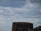
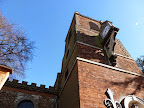
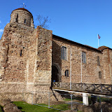
The Church is the only Anglo-Saxon building which still survives in Colchester today. Some of the tower was constructed from Roman bricks, which had been taken from the ruins of the Roman City of Colchester! The church has one important resident, William Gilbert, who discovered electro-magneticism and was Physician to Queen Elizabeth I. I did briefly visit the church, as a vintage craft fair was taking place, it was very tempting to buy lots of items. We headed away from the church and headed up towards the high street. We crossed the high road and found “Museum Place”, eventually taking us into “Castle Park”. The Park was officially opened in 1892 at the Museum Street Gate, but in years gone by this would have been the gateway to “Colchester Castle”! We could see Colchester Castle just beyond the gate and it certainly looked imposing!

As we got nearer we could see it was under going renovation, so it will look really great when it is finished. In 1076 the Normans started work on the Norman keep under instruction from William the Conqueror, it was not completed until C12th. The castle was designed by Gandalf from Lord of the Rings, not really! it was Gundulf, Bishop of Rochester, the man responsible for the White Tower at the Tower of London. The Castle has a peppered history serving as a jail, a base for the ‘Witchfinder General’ witch hunt, surviving being demolished and then for it to become a wedding present! It was the MP Charles Grey in early C18th who restored the Castle to its former glory and created the beautiful gardens surrounding it, upon his death it was sold to the corporation of Colchester who eventually opened it to the public.

From 2014 – 22.03.2014 – Colchester

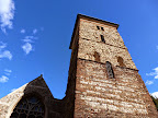
The Nursery Rhyme? I thought that it was associated with the castle,but it was not the castle but St Marys Church which we did not find en-route. The story goes, that during the siege of Colchestergoes, when the gunner known as “One-Eyed Jack Thompson” and his gun known as a “Humpty Dumpty” came tumbling down from the church tower. It could not be place back on and after much struggles in August 1648 the Royalists surrendered and opened the gates of Colchester to the Parliamentarians – Hence “Humpty Dumpty, had a great fall and all the kings men could not put him back together again!”

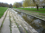
A little past the castle was the “Hollytrees” Museum, a lovely C18th looking building. It took its’ name from the two holly trees which had been planted in the grounds by Charles Gray in 1729. We started to walk through the Park Gardens, which were quite extensive. We walked behind the castle, where we came across the Park Bandstand. As it was a lovely warm day, it was easy to imagine sitting lazing in the summer sun listening to a band playing some soothing music! As we left the bandstand behind we spotted a Millennium/Jubilee Beacon! I have not seen one in quite some time. This beacon was not just a Millennium beacon, as it seemed older than the others as it was first lit in 1988 to commemorate the 400th anniversary of the sighting of the Spanish Armada in 1588. The sloping grounds we were now walking were once known as “Sheepshead Meadow”, it was here during the C17th when local cloth makers used to stretch out dry out cloth on “tenter frames” to see if it was of good quality. It was here that the term “being kept on tenter hooks” was coined!

From 2014 – 22.03.2014 – Colchester

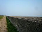
The path eventually led us out of the park, when we came across the “Middle Mill”, which we had seen a sign for earlier in the day. Apparently a Mill has stood in the area since the Norman era, sadly, the actual building was demolished in the 1950’s. The Weir was restored in 2000. From here we took a very long walk from here around Colchester, taking back into St Johns Road. We had both noticed a cycle trail to “Maypole Green” and both felt that it might have been worth investigating. It began to feel like we were walking away from the hurly burly of Colchester Town as the path became much quieter. We were not only walking past parkland, but a large number of derelict buildings. On our way, I spotted a blue plaque for Colour-Sargeant Edmund Fowler VC, who lived here from 1913 – 1925. Edmund Fowler was awarded the Victoria Cross for his Bravery during the Zulu War.

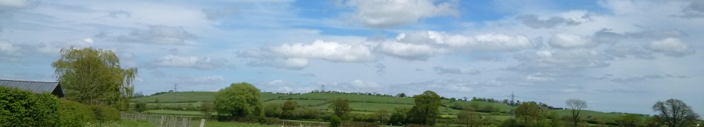
As we followed the cycle trail around, we discovered that a lot of the abandoned buildings had belonged to the MOD (Ministry of Defence). Obviously the MOD have moved out and were elsewhere! The trail gave way to a much more open land, it was very reminiscent of an ex-trainline. As we continued to walk, we saw number of modern, stark looking buildings surrounded by barbed wire. We noted that these were the new MOD buildings which had moved from the delapated area we had seen previously. We followed the trail around to “Maypole Green”, so called as a maypole once stood there in years gone by. With visions of dancers merrily making there way around the Maypole, we thought we would end our walk here for the day as it was getting rather late. From here we made our way back to Colchester Town Station to take the train home.

All the photos can be seen here –

2014 – 22.03.2014 – Colchester

<><

Clacton On Sea – Walton On the Naze Walk – 03.08.2013

“Oh! I do like to be beside the seaside
Oh I do like to be beside the sea!
I do like to stroll along the Prom, Prom, Prom!” © 1907 by John A. Glover-Kind

As we were about to embark on our stroll along the coast, I was reminded of this quirky song about the seaside. The sun was shining, the sea was sparkling blue, children were making sandcastles and the whole place just generally buzzing! How nice to see the English Seaside so busy! Our journey had brought us to the seaside town of Clacton On Sea, where smugglers have walked along the beaches, fortifications have been built to defend the coastline and Billy Butlin built his wonderland for holidays! Our walk in Clacton started out from the end of Clacton Sea Front and we were heading towards Clacton Pier

Had we carried out this walk quite some time back, the area would have been very different. The whole place would have been home to Butlins Holiday camp, which provided many happy hours of holiday fun in years gone by. The camp was built in 1938 and despite being requisitioned by the MOD for use during World II, it soon reopened its gates for holidaymakers. The camp’s heyday was during the late 50’s / 60’s and during 1958 Cliff Richard and the drifters played here! Sadly the camp closed in 1983 as tourists choose cheap foreign holidays instead of the Butlins holiday. Unfortunately this led to a decline in people visiting Clacton, however, I could see today the town seems to have survived the closure of such a place despite it being sadly missed!

Just at the edge of the seafront I caught sight of an odd shaped building, this was a “Martello Tower”. The tower was not built as a seaside attraction, but to deter invading forces away from the shoreline. This fortification was built during the early C19th as part of a defence strategy against the Emperor Napoleon’s impending invasion. Quite a number of these turrets still exist throughout England although they are no longer fortresses of any kind. I am not sure about the name “Martello” really, I think it sounds like some sort of sweet LOL. We headed away from the tower and strolled along the seafront to enjoy the sights and sounds of the seaside.

From 2013 – 03.08.2013 – Clacton – Walton On the Naze Walk

It was not long before we had reminder that these beaches had not always been about sandcastles. Smugglers once roamed the local area and it was known that they used to load their cargo on the beach here at Clacton. Unlike the town of today, the beach was accessible between two marshes, making it more attractive to smugglers. Particularly, as the revenue men would have been unable to reach the beach quickly from their barracks in Colchester! Since the early C19th Clacton’s seashore now sees more tourists than Smugglers! During the first part of the C20th, the beach, saw another visitor, Sir Winston Churchill. He was forced to land at Clacton on sea in a naval plane.

As we walked further along the promenade, the beach and walkway became much more crowded. This was because we were approaching the centre of attraction for Clacton – “Clacton Pier”. The pier was full of amusements and rides, a far cry from it’s original use when it was built in 1871. Originally, the pier was used by steamboats to bring goods to the town, but it also brought many day trippers to the area. So it was not long before the pier was altered to include many light entertainments including it’s own pavilion. The pier suffered damage during Second World War and since then it has passed through several hands and despite improvements over the years, it suffered a decline. The current owners of pier have completely refurbished the bars and renewed the rides and hope that the pier will be around for a long time to come!

We headed away from the pier by walking up the hill under a Venetian style Bridge. It was constructed in the early C20th in order to provide a continuous walk through the seafront gardens, which had been landscaped on both sides of the cliffs. When we reached the top of the slope, we turned into a small amusement park which now resides in what would have once been part of these formal gardens. Taking a glance across to the other side of the bridge, the gardens were in full bloom, if we had time, it looked a nice place to sit and enjoy watching the world go by! We carried on walking through the maze of rides and past the crazy golf to find our way back to the seashore. We did stop, for a few moments, to take in the view, where we could see along the pier and both ways along Clacton beach.

From 2013 – 03.08.2013 – Clacton – Walton On the Naze Walk

We rejoined the promenade to continue our walk along the seafront, which seems to stretch on for quite some time. The whole walkway is part of the Clacton sea defences, which have been built and strengthened over the years. Some of the defences were built in 1889, a sure sign that the peoples of the area knew that the sea could cause a lot of problems along the coast. We have seen some of the coastal erosion when we walked to Hemsby, so it seems that Clacton is quite prepared. Strolling further along, we left the noise of Clacton behind and the beaches became much quieter. With the blue skies and shining sun it really was a lovely day for a walk, we were even treated to see a beautiful bird of prey just hovering by the side of the path, not taking any notice of us.

We followed the path up a slope and out on to a large expanse of open fields. The coast path seemed to blend into the landscaped as it was no longer defined by the cliffs which it shadowed. I could see a small notice board in the distance, so I took the opportunity to find out where we had walked. It was “Holland Haven Country Park”, the whole reserve is roughly 100 acres, which would be great to explore sometime! Not only does it contain fields, it has quite a lot of marshland and the park been designated an area of SSSI (Site of Special Scientific Interest). It has therefore been recognised that rare and varied flora grow here.

We decided to walk along the sea wall, rather than the dusty track next to the park. The sandy trail below us was actually a cycle route and was very popular, I was quite glad we were walking along the wall as avoiding the all the cyclists! Just beyond the cycle route the scenery seemed to changed from the wild unkempt fields, to immaculately looking green grass. We were walking past a Golf Course which was very well kept, apparently this particular course has been established here since 1895! The sea wall suddenly became more of a walkway once again, as we had reached quite a number of beachhuts, most of which were in use. It was quite difficult to negotiate this part of the footpath as it was so packed!

From 2013 – 03.08.2013 – Clacton – Walton On the Naze Walk

Just beyond the huts we were able to find a shelter to stop and have some lunch and rest for a while. As I gazed around, beachhuts seemed to line the entire shoreline. Apparently there are just over 1000 beach huts in this area, and have been a feature here since the Victorian era. Just behind the huts was a small town, this was Frinton-On-Sea. Frinton On Sea seems like a quiet seaside town as it does not have the amusements like Clacton On Sea, but nonetheless has the main attraction of a lovely beach 🙂 So much so that it has attracted visitors such as, Edward and Mrs Simpson! Rested, we continued on past the beachhuts and left Frinton-On-Sea behind.

The coast path had brought us to Walton Pier, which was very busy for late afternoon. This pier was originally built during the 1870’s but unfortunately it did not reach out into deep enough waters for boats to dock alongside. Therefore the pier was rebuilt in 1898 with a much longer length, so much so it had a small tramway on the pier! It has survived fire and storms and is still standing today. Our walk was to take us away from the seafront and to take us into Walton itself. Walton does hold its own charm and unlike some larger seaside places, shops are small and the entire place is not overcrowded by amusements. Walton’s peak as a seaside resort was prior to the second world war, it was a popular place to visit.

“The town lies between the sea-cliffs and Walton Creek, which is much frequented by sportsmen in quest of wild fowl, and on the head of the creek stand powerful tide and wind mills: the air is salubrious and bracing, and the beach, consisting of sand and fine shingle, is well adapted for bathing, and affords a pleasant promenade, the ebb tide leaving a hard smooth sand.”

Kelly’s Directory of Essex 1937

Sadly it was badly damaged by bombs during the war and with the pier being partially closed for a while meant the holiday trade ceased. Unfortunately post 1945 Walton’s Glory days have never really returned, which is a shame as it a quaint place to visit. At the end of the high street, was the parish church, “All Saints”. I was keen to note that this church was built in the late C19th and was to replace the original church in Walton, which fell into the sea in 1798! I can see why the church was built so far away from the cliff edge!

We ended our walk here for the day, it had been such a lovely day to walk along the prom 🙂 Please feel free to look through all the photos for this walk –

2013 – 03.08.2013 – Clacton – Walton On the Naze Walk

Our route was as follows –

<><

Mayesbrook Park Walk – 24.07.2011

After a lovely morning stroll in Cassiobury Park it was nice to be able to enjoy another walk on lovely Sunday Afternoon. It was quite nice to be able to be able to return to Mayesbrook Park where we had finished a walk quite a while ago… However this time we were starting out from a different part of the park.

This small park derives it’s name from the brook that runs alongside it.    “Mayes Brook” as it is known is more than likely taken from a family name from approximately 1300.   As soon as we entered the park, we were faced with Mechanical diggers and metal fencing. Not exactly the most enchanting sight in the world for a park, but Mayesbrook is part of a project to the UK’s first Climate change Park!

Taking a path away from the JCB’s it took us down to one of the park’s lakes. It seems to have a huge amount of Bird life, particularly Canada Geese, alongside swans and moorhens. The lake is surrounded by a trees, I particularly willow trees, which I am rather partial to and I felt it gave the lake a rather relaxed feel. As we walked, I was able to capture how the grasses that surround the lake make it feel really lush.

From 2011 – 24.07.2011 – Mayesbrook Park Walk

As we took a route which parted from the lake, we were faced with concrete steps to take us up into an area which looked very strange to me. There is a main path that goes through the park, but I found it odd that was a stairwell which didn’t seem to lead anywhere. It had beautiful wrought ironwork which sadly seemed to be neglected. I cannot see any details as to what it was all for? Can anyone enlighten me? The only view that from the stairwell that you have now is earthworks for the climate change project!

The major path cuts straight through the park and this was the route we decided to explore. It was strange to find in the middle of the pathway a statue of some sort. I am not sure if it was meant to be a fountain or for a flower bed. It seemed to be related to the stairwell, part of something that used to be along the path? The stone monument does not look like a large flower bed, possibly for a small flower arrangement…!?!

From 2011 – 24.07.2011 – Mayesbrook Park Walk

As it was sunny Sunday afternoon, the park was quite packed. It was good to see that the new play area was really be utilised! In fact there was a new play area. As we carried on the park takes on a whole new identity, specifically as the Barking Football Club has a stadium right in the middle of it! The reason I mention this is because a brand new grandstand is being built for a 2012 Olympics Training Ground. It seems a very exciting project. The park is serving a dual purpose one for the climate change and the other for athletics, both very different.

Leaving the building works behind, the park turns into what seems like a small field. Whilst it is nice to have a stadium in the middle of Mayesbrook, it does make the park feel like a park of “two halves”. The park seems to just end here, in fact someone has quite handily painted the word “finish” at the end of the path! If anyone has been following my blog they should remember that we finished a walk way back at this very spot where the word “start” is painted a bit further on! With the word “finish” in mind, so did we…

Mayesbrook Park For the afternoon photos please feel free to click here –

2011 – 24.07.2011 – Mayesbrook Park Walk

<

Canvey Island Walk – 27.03.2011

Summer, well it definetly felt like it! Clocks had changed the night before, the sun was shining, so what better way to spend a sunny afternoon than by going to the Seaside.   This time we were to visit Canvey Island.    As the island was not particularly large, we did not really particularly plan any route and decided to take it in our stride.

Our first discovery, was the history of Canvey Village itself, where we started our walk.   In the early 17th Century the Island became home to around 200 Dutch immigrants, who reportedly “sought refuge from the Duke of Alba, the butcher of Flanders”. The Dutch water engineer, Cornelius Vermuyden, in 1623 agreed to maintain the sea walls when a local landowner agreed to give him a third of his land.  Notably Cornelius Vermuyden, went to work for Charles 1.

Although this was the highest point in the island, it did not seem noticeable as we set out on our way to find the sea.   The walk took us to Thorney Bay – please note that there is a caravan park located here and it is not a public right of way!    We were able to cut around the side of the park which had steps up to the seawall.    As Canvey is such a low lying Island, it is necessary to have such high level sea defences the only thing it does provide is a lovely coastal path beside it.

From 2011 – 27.03.2011 – Canvey Island Walk

We turned inland, so we could explore a little more of this small Island.   The route took us through a small little (main?) town of Canvey.     We did not spend much time in the town, although when we did find one particular cafe open we did stop for a refreshment and to think about how to continue our journey.  It was then we felt it was time to return to the Sea front.

When we walk roads we often notice street names.    Often they are are named after famous people of the area, local builders, or historic references to the area.   In this instance we came across “Station Road” I  have been told before that normally “Station Road” leads to a “Station” but I know in this instance it would not as there is no station on the Island!   I cannot see any references to Canvey Island ever having a railway?  Or was this relating to a Bus Station?  Eventually, we found “Seaview” road – this time aptly named as it lead us straight to the seafront!     We were then able to take the small coastal path.

From 2011 – 27.03.2011 – Canvey Island Walk

As we strolled along the coastal path, it was lovely to take in the fresh sea air.   Passing by small little beaches, the path eventually took us to Canvey Island Yachting Marina.  In fact this is the Island Yacht Club, which has been in existence since the mid-1930’s. Originally a growing number of pleasure boats and barges had been congregating in Oyster Creek during the early 1930’s and during 1935/1936 the club was first formed. Thames barges delivering building materials to the Canvey Supply Co. and Leigh Bawleys off-loading fish still regularly used the creek.

Although the Marina had some “public footpath” signs to follow – we decided that we would not follow them.. (perhaps some other day!)  So we returned on the coastal path we had just taken to see what else we could find!  The path seemed to lead us to what is known as “Canvey Seafront” .  We took the ramp which was provided over the sea wall  so we could walk on the nice beach.   It almost felt like a summers day (despite being only March!) – as I mentioned before –

From 2011 – 27.03.2011 – Canvey Island Walk

We strolled along, just enjoying the sea air, which felt bracing and fresh.  However, I so regret not bringing my bucket and spade 😦 .  Leaving the lovely front behind, we went over the steps again – we discovered the Canvey Bandstand and the few seaside amusements and the small funpark of the Island.  The Bandstand seemed a new addition – unless anyone can tell me otherwise?

We rejoined the coastal path to continue our walk.  I was most intrigued to discover a tiny building known as the “The Bay Museum” ‘.The following extract from The War Illustrated – April 5th 1940 is a little indication to the museums significance “During the past few weeks many British ships have been fitted with a special secret device that renders them immune from damage from magnetic mines.’” To ensure that this ‘special device’ was operating properly monitoring stations were established around the coast line. The Bay Museum was one of the stations, known locally as the ‘Canvey Loop’. The Bay Museum is a unique building in its own right, as it is the only surviving fully intact example of this type of MOD Property on the North side of the Thames Estuary

The coast path continued on and led us back around to Thorney Bay Caravan Park. Bypassing the park,    we retraced our steps via roads to Canvey Village. Just as we were leaving we discovered Canvey Heritage Centre, which somehow we completely missed when we started out on our walk, we did not visit on this occasion. The centre building definitely looked like it had been a church at some point. Although I have discovered a good website full of history of Canvey Island.

Our route continued to take us via the main road. We had another discovery – the Canvey Island Dutch Cottage museum, a tiny little thatched cottage dated 1618. As we walked on we had our final discovery of the day – Millennium Beacon Number 5 – see the following walks for the other 4 –  Purfleet Walk, Wemyss Bay Walk, Hainualt Country Park Walk and  Doniford Bay Walk.

From 2011 – 27.03.2011 – Canvey Island Walk

I didn’t even realise that Canvey Island had one!

As the sun was beginning to set, we made our final way back to Benfleet via the road bridge. It had been a lovely day at the seaside with lots of discoveries along the way!

All my photos for the walk are as follows –

2011 – 27.03.2011 – Canvey Island Walk

<><

Chase Nature Reserve Walk – 13.03.2011

With the sunsetting, and a walk that we had seemingly done before this all looks a bit odd?  Well, for March it was rather beautiful to be able to start out quite late and walk in the light of the setting sun so early in th year :-).   Despite walked part of the Chase nature reserve before,  I had spotted another walk when I passed by it on my way to Harrow Lodge Park, and I couldn’t resist walking an area which we hadn’t tried before!

They always say “Red Sky at Night *Shepherd’s Delight” and this evening was proving no exception,  it was a truly stunning sight to behold and after a cloudy day, it was worth making this an evening walk

From 2011 – 13.03.2011 – Chase Nature Reserve Walk

(*some do know this as sailors)

The Chase was a originally known for it’s Gravel Pits right up until the 1970’s.  These were eventually filled in and left to let wildlife reclaim the land once again in the form of wetlands and grasslands.  It seems that Horses have played a very important role in keeping the reserve in a natural state.  The London Wildlife Trust now manage the area.

I have to admit that although we didn’t see the horses, the hoof marks were in abundance and had definitely churned up a lot of mud to walk through!   So, apart from the birds that were singing their twilight song, the only other wildlife we could spot were plenty of rabbits.  There were lots of them!      They did not seem so appreciative of us walking through their quiet reserve!    I was surprised to seem them in such a marshy area….

From 2011 – 13.03.2011 – Chase Nature Reserve Walk

Although we could have continued our way through the reserve, we felt that we didn’t in this instance want to continue on this route, since we had joined up with our other route from earlier this year.  So we decided at this point to turn off the reserve to Eastbrookend Country Park – as it is adjacent to the Chase.   It is quite nice that this Country Park is a lot larger than we had originally realised and had a few more “ponds”/”lakes” (mainly used for fishing)  as well. We did discover that these were not the ones we had walked around last time.    It was also nice to know we were not alone on this twilight walk either.    As we were finishing the walk in the park, I was able to grab a few more photos as the sun was truly setting over the fishing lake

From 2011 – 13.03.2011 – Chase Nature Reserve Walk

Although this was a relatively short walk for us, it was nice to be able to have our first twilight walk of the year, and to be comfortable with walking with sunset walks. For all the photos for the stroll –

2011 – 13.03.2011 – Chase Nature Reserve Walk

<><

Harrow Lodge Park – Elm Park Walk – 06.03.2011

This Sunday afternoon walk was half planned and I was hoping that the light would stay with me for most the walk 🙂

My walk was to take me to  “Harrow Lodge Park”.   This name is certainly fascinating, was there a lodge in the middle of this park and what would it have been?    Always the best way to found out is explore!  The first thing I discovered in this park, was a “lake”.

Unfortunately, there are no real marked paths surrounding the lake,  so you can only really walk partially around it 😦 .    As I started to wander around part of the shoreside,  I did feel challenged by a particular Moorhen who seemed to look me in the eye as if to say “why are you on our part of the park?” I quickly abandoned this route and rejoined the path on the other side!

I have to admit that no sooner had I started to walk along this side of the lake, I found a small bridge to which I endeavoured to cross, and I could not believe my eyes at the amount of birds (particularly Swans) that were seemed to be waiting in a queue for any crumbs which may be on offer!!
From 2011 – 06.03.2011 – Harrow Lodge Park – Elm Park Walk

I decided to retrace my steps aross the bridge to continue my original walk.  It was then  I had  found a building, but it wasn’t the Harrow Lodge that I was looking for but a Cafe…   So my original question as to whether “Harrow Lodge Park” actually had a Lodge???   Well the only information that I can find so far – (Is anyone able to assist?)   It seems that a priory was founded  Hornchurch, near Harrow Lodge  at the time of Henry II so perhaps this was a lodge that was part of the Priory? –  this information is available on history of hornchurch website

As I continued on I found that although the  lake ended, the river actually continued.  I have since found out that and was actually part of the River Ravensbourne – not to be confused with the River Ravensbourne that I walked in South London in Forest Hill! But the one at Beam Country Park, there are just too many Ravensbourne Rivers it is getting all too confusing!  It is still very odd, how the river has been “shaped” since it it is not very natural.  It does not look like a canal and not like a river.

From 2011 – 06.03.2011 – Harrow Lodge Park – Elm Park Walk

It was then I departed the Harrow Lodge park and the river. This meant road walking, which is always a shame, but in this case necessary, as I was heading towards another park.

My walk had taken me all the way to Hylands Park. This a beautifully small but perfectly formed park and not to be confused with the Hylands Park in Chelmsford which holds the V Festival! Particularly as I don’t think 80,000 people could fit in this lovely park!

The park has been in existence since 1927 when it was made a public park.  It most notable time in history was in 1940 when a Spitfire when the had just taken off from nearby RAF Hornchurch and developed engine trouble but landed between two houses instead of crashlanding in the crowded park….

From 2011 – 06.03.2011 – Harrow Lodge Park – Elm Park Walk

Leaving the little park behind, I was again faced was road walking. The route brought me back to a River – I presume the River Rom? As this was along the Rom Valley Way? It is not really cared for, and I can certainly say not really encouraged to walk along! Therefore I had to abandon any hope of a a river walk, to the next Park – Grenfell Park.

Unfortunately, I cannot find out much about this very small park, so if anyone know about it – any comments welcome!    Sadly, this small park did seem a little to me uncared for in certain places – or was that because it is March? But I think the wildlife would love it in others particularly the long grass and bushes! 🙂   However, as the river runs through here I did  manage another river walk  🙂

It was here, I left my walk behind. I decided not to chase the river any more. The rest of the walk took me back to the front of Harrow Lodge Park, and a a lovely sunset reminding me the walk and day was almost over…

2011 – 06.03.2011 – Harrow Lodge Park – Elm Park Walk

<><

Beam Valley Country Park Walk – 23.01.2011

Cloudy and a little gloomy. A typical January Sunday afternoon. However, we still decided to go for an afternoon stroll. On our way to Eastbrookend Country Park, I noticed some open space that looked worth investigating, so we this week we did!

We headed off to Beam Country Valley Park – or what is really known as “Beam Parklands”.

Unfortunately, when walked into the entrance, the board was missing any information (it was just a hole!!) … I would like just to point out that it had not been wrecked – it was brand new wood and was ready to be filled!! In fact the path was new… The park is currently being renovated so most of it was being dug over and very muddy. In fact in some places it was even growing a shopping trolley – which hadn’t yet been harvested LOL ! (Although I have managed to hide it in the photo!)

From 2011 – 23.01.2011 – Beam Country Valley Park Walk

It seemed that the park was a “work in progress” as there was only one new path and this did not seem to lead us very far, so we had to take a much older path, which took us over a lake – actually this was the River Beam.   This river was how the Park was given its name.       The River Beam, is originally known as the “River Rom” as the river rises from the north of Romford,  when it is joined by its tributary “The Ravensbourne” and continues on, it is known as the River Beam – it eventually joins the River Thames.  However, we didn’t see too much of the river at this point.

The walk seemed very short for some reason as we seemed to come out of the park very quickly!  We had to walk down a road, to return into the park at another entrance, just so we could explore another part of the park.  All a bit strange to me.    On immediately entering the park, we were met by a bridge,  which looked newly built.  This bridge took us over the River and it was only then we could really see the park may be a little larger than we first thought.

From 2011 – 23.01.2011 – Beam Country Valley Park Walk

Again we found some empty info boards, and a new path, indicating that the park was very much under renovation! At this point we decided to wander off the beaten track so to speak. We felt it was a good idea to investigate an older path and some entrances to a mound of earth that looked vaguely interesting!

So we climbed to the top of the hill but it was very muddy and very, very tricky – reminding me of an old nursery rhyme!!!! 🙂

“Oh, **Angelfish**
Had a friend;
Marched them up to the top of the hill,
And marched them down again.

And when they were up, they were up,
And when they were down, they were down,
And when they were only half-way up,
They were neither up nor down”

But worth the View

From 2011 – 23.01.2011 – Beam Country Valley Park Walk

But do we know what the mud hill was for? We have no idea!! But I think we were stunned by the amount of land that we saw, it was simply amazing. Once we had managed to get down, we decided to take a wander around the area. It did look like some industrial buildings had been removed/demolished at some time but what I would not know.

As we walked on, I was very intrigued to find metal poles sticking out from the ground. Apart from being dangerous, why would these be interesting!?! They looked like Mooring posts. Why would metal mooring posts be in the middle of the ground no where near water? Well this was evidence of the Old Romford Canal. This canal was built from 1875 onwards and parts of were still in use right up until WW2 for defence – but once the war was over it was filled in. Much work was done on the middle/lower Beam Valley section, including a bridge and one lock complete with gates. At the upper end of the valley nearer Romford, a tunnel and short section of canal was built under the London Tilbury and Southend railway line.

Unfortunately, our walk run out at this point, both with light and with any path!  We ran in to surburbia and into fenced off land – quite rightly so as it looked very marshy to me!  So it was time to end our walk.  We may return to this park at some point to see how the renovations are going!!

All the pictures for the afternoon walk are –

2011 – 23.01.2011 – Beam Country Valley Park Walk

<><

Eastbrookend Country Park – Chase Nature Reserve Walk – 16.01.2011

As promised in my last walk of 2010, we completed our walk at Eastbrookend Country Park (if you look at my previous blog you will see that I have written the history of the area) – and this time the light did not run out on us (although the day was a little cloudy).

We decided to restart our walk from were we left off on our last walk. This particular area of the park I have now discovered is actually known as “Fels Field” – although I cannot seem to find out any logical reason as to why this part of the park was deemed a field or why it was named “Fel” – perhaps it was named after someone?  Anyone with any ideas?  I would be intrigued to know.

The field is not actually that large to walk, but nevertheless very pleasant.  Although their had been no rain, the field was quite muddy to walk on 😦 .  In this instance I was glad that I had dug out my walking boots for the first trip of the year!

From 2011 – 16.01.2011 – Eastbrookend Country Park – Chase Nature Reserve

Sadly this particular Country Park is divided by up roads, which is such a shame as it loses it’s continuity whilst walking 😦 Making it difficult to plan a walk properly…

We navigated our way back down the road, we found our way to Eastbrook pond. Odd name that “pond”, not really that appropriate if you ask me, as it seemed larger than any pond I would normally come across – particularly as it would not fit in the average back garden!

It was good to see an abundance of Wildfowl on the pond and particularly in January. I always like to watch the Swans – they always seem to add a touch of magnificence to the waters! Other wild birds included greylag geese, canada geese and mallard ducks.

From 2011 – 16.01.2011 – Eastbrookend Country Park – Chase Nature Reserve

There was plenty of fisherman around which proved they were not fishing for small goldfish! The “pond” obviously had a population of carp or trout to attract the serious fisherman in early January! So when we took a wrong turning at one point we had to be particularly quiet!

We managed to find our way out again of the park, once again walking down a lane, which looked like we were heading for Eastbrookend Cemetery.   We could see that there was a small path by the cemetery entrance, however it was not very well signposted so we were unsure if this would take us back into the park but it seemed the next best route to take. Especially as the alternative route seemed to be through the cemetery, was not very advisable!

We had arrived at yet another part of the country park – a huge expanse of land.  More like the field I would have expected to see when we were at “Fels Field” which was undulating – this was extremely flat.

At this point we had lost all sense of route, but were enjoying our walk nevertheless and it was good to be out in January! It was then we arrived at “Chase Local Nature reserve”.  This area had a totally different feel about it.  The grass was most definitely greener on the other side!! Although a lot more boggy!

From 2011 – 16.01.2011 – Eastbrookend Country Park – Chase Nature Reserve

We decided to tackle the reserve, and see where this would take us. The terrain was extremely marshy and it was then I was wishing that I had brought my trekking pole, just so that I could test out the ground in front of us… I did not fancy falling into a huge pool in front us which was disguised as a small puddle!

After negotiating a small proportion of the reserve, we noticed that the local wildlife group had helpfully provided small wooden bridges in various places. Obviously the area was in a constant state of marshiness! We found the longest wooden “bridge” which would eventually lead to some steps – but we had no idea where to!

From 2011 – 16.01.2011 – Eastbrookend Country Park – Chase Nature Reserve

The path took us into a totally different environment, which was dark and inhospitable. The muddy path was parallel to the train line meaning it was not particularly nice to walk down, and most of the trees that hung over the path were still very barren – no signs of any life :-(. With the leaves on the ground and an extremely muddy path was a firm reminder that we were well and truly still in winter.

This path seemed to go on and on and on – almost never ending! It eventually came out into suburbia and past some factory buildings. The strangest thing happened, it emerged exactly where we started our walk in the first place, near the station! We had missed this footpath in the first place 😦 we had walked all the way round to Fels Field via the long route when we could have taken this shortcut in the first place!!

These are the photos of the afternoon walk –

2011 – 16.01.2011 – Eastbrookend Country Park – Chase Nature Reserve

<><

Eastbrookend Country Park – 07.11.2010

Firstly,  this was very short as light stopped walk!  I think we not really planned this very well at all, the hour changing in the previous week made so much difference – and by leaving just the little bit later – we really did notice the light fading very quickly!

Our aim was to go to Eastbrookend Country Park, where we had visited some of it previously.    This particular Country Park has been created from derelict / waste land.     On research, some of the area was used as landfill for rubble for what was from the blitz, whereas some of it was also a Gravel workings site near the River Rom.   The park  was open in the mid 90’s and I am sure the locals would have seen a very big difference!   It looked very rural to me 🙂

From 2010 – 07.11.2010 – Eastbrookend Country Park Walk

We started wander around the park, and the first thing we came across a large wooden sign with the letter”E” engraved on it.  Although I am still not too sure what it may be,  it suspiciously looked like a footpath/waymarker sign to me.  In fact it could be the Eastbrookend Timberland Trail but I am still looking this up!   This will be a nice a nice footpath to follow, if this is the case, on our return to this park!

Sadly, we had noticed the light was fading already as we had vastly misjudged the time to get to the park in the first instance!  As we left Eastbrookend Country Park behind, confusion reigned.    We were unsure as to where we were for  a while – particularly in the dark!    After regaining our bearings, we realised we were in Dagenham Central Park.   It was here I noticed a small stone plaque on my way thought the park which commemorated the 21st Anniversary of the Girls Life Brigade Dagenham District Battalion – Can anyone remember this event? As I am unable to I find any information I can link too?

From 2010 – 07.11.2010 – Eastbrookend Country Park Walk

So why did I blog such a short walk?    As an introduction to this park and of course to remind me to return! 🙂  All the photos of the short walk  please click on the photo below!  (You can see how dark it was and this is only 5pm!)-

2010 – 07.11.2010 – Eastbrookend Country Park Walk

<><

Tilbury Walk – 31.10.2010

Tilbury Docks – Completely improvised idea to walk here and very unsure what we would find…. I had imagined massive container ships, not being able to walk anywhere – dock cranes and containers stacked to the hilt blocking the view to the Thames…. but it was not quite like that at all.

Although Tilbury docks had been steeped in history – the actual town itself had only been around since 1912 – previous to this time Tilbury had been in the Parish of Chadwell of St Mary.     As we started to walk down “Dock Road”  it was very odd to find all the roads had strange names – Bermuda Road, Sydney Road, Auckland Road – but as to no clue as to why except that we were near docks?   (but I think I was about to find out!) It was not long before we came across “National Cycle Network Route 13” which we decided to use as our walking route for the afternoon.

It was nice to know as we walked across the bridge we discovered some great graffiti art – in fact I apologise to the artist if they would consider this art and not graffiti… but it certianly brightened up the afternoon 🙂

From 2010 – 31.10.2010 – Tilbury Walk

The cycle route took us past exactly what I was expecting to see – lorries, warehouses, containers and even brand new cars ready to be shipped – all neatly stored… but…. the cycle path itself was tarmacked, signposted and very well maintained! One of the first things that struck me was the “International Cruise Terminal” which threw me… I didn’t expect to see that! Maybe in Southampton or even Dover but not in Tilbury docks.. (we even spotted a very large cruise ship in dock just around the corner 🙂 )

I did note that the terminal building was Art Deco in style, which fits in with what I have now discovered that the International Cruise Terminal had been here since the 1930’s.   Ships went as far out as Australia and the West Indies – this would explain the street names – Bermuda, Auckland and Sydney!!    Sadly the British Liner Fleet as  it was known, demised during the 1970’s and the terminal and it’s neighbouring train station was closed as a result.   But in the mid 1990’s the terminal was fully restored – in fact the liner we saw was probably going to the Baltics!  It was lovely to see something restored 🙂

As we past the industrial part of the Tilbury docks, I was completely stunned to find, a very green, peaceful and in fact a small haven to walk! We walked out on the small pier-head which was used by the Gravesend ferry – and with the warm autumn sun, I certainly could have spent time just contemplating and just resting here!

From 2010 – 31.10.2010 – Tilbury Walk

Leaving the small pier behind, we strolled along the riverside – it was quiet, and green – I was so taken aback to find a very small wooden building still surviving in the midst of industry – “The Worlds End” pub – shame I have no photo – because it has a history – it has been noted that in the 1660’s that the famous diary writer himself – Samuel Pepys travelled down the Thames from London on several occasions, had visited this small ale house to drink!

The writer Daniel Defoe was also well known to the area, as he owned a small farmstead on the marshes in the parish of Chadwell-St-Mary, which Tilbury Town was originally part of around 1698. A close neighbour at that time was a man called John Friday.   Having left the area for a number of years to live in Somerset,  where he lived in Nether Stowey   please see my Minehead walk! )  ,  around 1719 he published his book “The life and strange surprising adventures of Robinson Crusoe”.

The stroll then took us past an unusual building – Tilbury Fort.   A fort of some kind has been in this area since at least the 14th Century.   Its original intention was to protect the Tilbury – Gravesend Ferry – although it was not until 16th Century and the threat of the Spanish Armada that the fort was significantly strengthened.  I have to admit the entrance to the fort is very imposing!!

From 2010 – 31.10.2010 – Tilbury Walk

In fact,  Queen Elizabeth 1 herself rode to the fort to “rally” the English troops and although there are 3 recorded versions of her speech – one noted from Dr Leonel Sharp in a letter to the Duke of Buckingham,

“I know I have the body but of a weak and feeble woman; but I have the heart and stomach of a king, and of a king of England too, and think foul scorn that Parma or Spain, or any prince of Europe, should dare to invade the borders of my realm; to which rather than any dishonour shall grow by me, I myself will take up arms, I myself will be your general, judge, and rewarder of every one of your virtues in the field.”

But I must admit too remembering some of this quote in a different fashion – from Queenie (Elizabeth 1) in the BBC series Blackadder (forgive me for all those with historic sensibilities!!

Queenie: “I may have the body of a weak and feeble woman, but I have the heart and stomach of a concrete elephant.

Once we had walked past the fort, we continued along the cycle path – or so we thought… in fact I am not so sure at all to be honest.   The path just ran out!    We did however join a  muddy path on the outskirts of the Fort earthworks, which turned out to be a public footpath.   We rejoined the road.  We did not continue the walk to East Tilbury as we thought we could have done as the light was against us (the hour had just changed) so we ended our stroll which was shame as it was quite enjoyable!

All my photos for this short but “historic” walk are as follows –

2010 – 31.10.2010 – Tilbury Walk

<><