Monthly Archives: January 2011

Beam Valley Country Park Walk – 23.01.2011

Cloudy and a little gloomy. A typical January Sunday afternoon. However, we still decided to go for an afternoon stroll. On our way to Eastbrookend Country Park, I noticed some open space that looked worth investigating, so we this week we did!

We headed off to Beam Country Valley Park – or what is really known as “Beam Parklands”.

Unfortunately, when walked into the entrance, the board was missing any information (it was just a hole!!) … I would like just to point out that it had not been wrecked – it was brand new wood and was ready to be filled!! In fact the path was new… The park is currently being renovated so most of it was being dug over and very muddy. In fact in some places it was even growing a shopping trolley – which hadn’t yet been harvested LOL ! (Although I have managed to hide it in the photo!)

From 2011 – 23.01.2011 – Beam Country Valley Park Walk

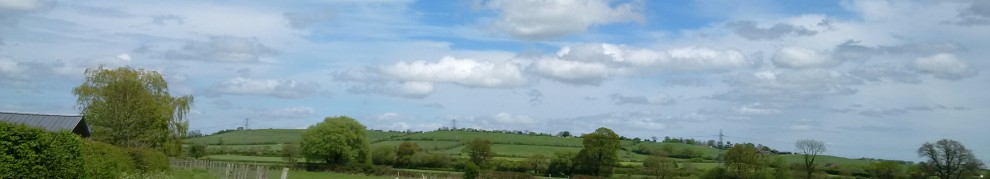
It seemed that the park was a “work in progress” as there was only one new path and this did not seem to lead us very far, so we had to take a much older path, which took us over a lake – actually this was the River Beam.   This river was how the Park was given its name.       The River Beam, is originally known as the “River Rom” as the river rises from the north of Romford,  when it is joined by its tributary “The Ravensbourne” and continues on, it is known as the River Beam – it eventually joins the River Thames.  However, we didn’t see too much of the river at this point.

The walk seemed very short for some reason as we seemed to come out of the park very quickly!  We had to walk down a road, to return into the park at another entrance, just so we could explore another part of the park.  All a bit strange to me.    On immediately entering the park, we were met by a bridge,  which looked newly built.  This bridge took us over the River and it was only then we could really see the park may be a little larger than we first thought.

From 2011 – 23.01.2011 – Beam Country Valley Park Walk

Again we found some empty info boards, and a new path, indicating that the park was very much under renovation! At this point we decided to wander off the beaten track so to speak. We felt it was a good idea to investigate an older path and some entrances to a mound of earth that looked vaguely interesting!

So we climbed to the top of the hill but it was very muddy and very, very tricky – reminding me of an old nursery rhyme!!!! 🙂

“Oh, **Angelfish**
Had a friend;
Marched them up to the top of the hill,
And marched them down again.

And when they were up, they were up,
And when they were down, they were down,
And when they were only half-way up,
They were neither up nor down”

But worth the View

From 2011 – 23.01.2011 – Beam Country Valley Park Walk

But do we know what the mud hill was for? We have no idea!! But I think we were stunned by the amount of land that we saw, it was simply amazing. Once we had managed to get down, we decided to take a wander around the area. It did look like some industrial buildings had been removed/demolished at some time but what I would not know.

As we walked on, I was very intrigued to find metal poles sticking out from the ground. Apart from being dangerous, why would these be interesting!?! They looked like Mooring posts. Why would metal mooring posts be in the middle of the ground no where near water? Well this was evidence of the Old Romford Canal. This canal was built from 1875 onwards and parts of were still in use right up until WW2 for defence – but once the war was over it was filled in. Much work was done on the middle/lower Beam Valley section, including a bridge and one lock complete with gates. At the upper end of the valley nearer Romford, a tunnel and short section of canal was built under the London Tilbury and Southend railway line.

Unfortunately, our walk run out at this point, both with light and with any path!  We ran in to surburbia and into fenced off land – quite rightly so as it looked very marshy to me!  So it was time to end our walk.  We may return to this park at some point to see how the renovations are going!!

All the pictures for the afternoon walk are –

2011 – 23.01.2011 – Beam Country Valley Park Walk

<><

Eastbrookend Country Park – Chase Nature Reserve Walk – 16.01.2011

As promised in my last walk of 2010, we completed our walk at Eastbrookend Country Park (if you look at my previous blog you will see that I have written the history of the area) – and this time the light did not run out on us (although the day was a little cloudy).

We decided to restart our walk from were we left off on our last walk. This particular area of the park I have now discovered is actually known as “Fels Field” – although I cannot seem to find out any logical reason as to why this part of the park was deemed a field or why it was named “Fel” – perhaps it was named after someone?  Anyone with any ideas?  I would be intrigued to know.

The field is not actually that large to walk, but nevertheless very pleasant.  Although their had been no rain, the field was quite muddy to walk on 😦 .  In this instance I was glad that I had dug out my walking boots for the first trip of the year!

From 2011 – 16.01.2011 – Eastbrookend Country Park – Chase Nature Reserve

Sadly this particular Country Park is divided by up roads, which is such a shame as it loses it’s continuity whilst walking 😦 Making it difficult to plan a walk properly…

We navigated our way back down the road, we found our way to Eastbrook pond. Odd name that “pond”, not really that appropriate if you ask me, as it seemed larger than any pond I would normally come across – particularly as it would not fit in the average back garden!

It was good to see an abundance of Wildfowl on the pond and particularly in January. I always like to watch the Swans – they always seem to add a touch of magnificence to the waters! Other wild birds included greylag geese, canada geese and mallard ducks.

From 2011 – 16.01.2011 – Eastbrookend Country Park – Chase Nature Reserve

There was plenty of fisherman around which proved they were not fishing for small goldfish! The “pond” obviously had a population of carp or trout to attract the serious fisherman in early January! So when we took a wrong turning at one point we had to be particularly quiet!

We managed to find our way out again of the park, once again walking down a lane, which looked like we were heading for Eastbrookend Cemetery.   We could see that there was a small path by the cemetery entrance, however it was not very well signposted so we were unsure if this would take us back into the park but it seemed the next best route to take. Especially as the alternative route seemed to be through the cemetery, was not very advisable!

We had arrived at yet another part of the country park – a huge expanse of land.  More like the field I would have expected to see when we were at “Fels Field” which was undulating – this was extremely flat.

At this point we had lost all sense of route, but were enjoying our walk nevertheless and it was good to be out in January! It was then we arrived at “Chase Local Nature reserve”.  This area had a totally different feel about it.  The grass was most definitely greener on the other side!! Although a lot more boggy!

From 2011 – 16.01.2011 – Eastbrookend Country Park – Chase Nature Reserve

We decided to tackle the reserve, and see where this would take us. The terrain was extremely marshy and it was then I was wishing that I had brought my trekking pole, just so that I could test out the ground in front of us… I did not fancy falling into a huge pool in front us which was disguised as a small puddle!

After negotiating a small proportion of the reserve, we noticed that the local wildlife group had helpfully provided small wooden bridges in various places. Obviously the area was in a constant state of marshiness! We found the longest wooden “bridge” which would eventually lead to some steps – but we had no idea where to!

From 2011 – 16.01.2011 – Eastbrookend Country Park – Chase Nature Reserve

The path took us into a totally different environment, which was dark and inhospitable. The muddy path was parallel to the train line meaning it was not particularly nice to walk down, and most of the trees that hung over the path were still very barren – no signs of any life :-(. With the leaves on the ground and an extremely muddy path was a firm reminder that we were well and truly still in winter.

This path seemed to go on and on and on – almost never ending! It eventually came out into suburbia and past some factory buildings. The strangest thing happened, it emerged exactly where we started our walk in the first place, near the station! We had missed this footpath in the first place 😦 we had walked all the way round to Fels Field via the long route when we could have taken this shortcut in the first place!!

These are the photos of the afternoon walk –

2011 – 16.01.2011 – Eastbrookend Country Park – Chase Nature Reserve

<><

Grims Dyke – Bentley Priory Walk – 03.01.2011

The first walk of the year – it was cold but it was sunny and not snowing!   This walk tackled part of the London Loop,  which took us near the “Grim’s Dyke”.  The Anglo-Saxon’s were responsible for the name  “Grim” not as we understand it now – being depressed – as they named the dyke “Masked One” after the God of War – Woden!! But this intriguing earthwork has been in existence for thousands of years – even before the Anglo-Saxon’s and it’s real purpose still remaining a mystery!

Little did we know it but this little section of the Grims Dyke actually forms part of the The Ridgeway National Trail, as it spreads from Hampshire and this little section being the end of the Dyke!    Looks like we have plenty more walking to do!  Although walking along through the woods, I am unsure if we came across the dyke or not,  as  it seemed very elusive to me.  We were slightly distracted by Gilberts lake….

From 2011 – 03.01.2011 – Grims Dyke – Bentley Priory walk

Although from the photo above, it does not seem to be a lake at all!  Some trees and marshy ground.   The loop had taken us around what once had been a “lake”, and we could even see the what looked “fake” rocks which seemed like they had once been where perhaps part of some waterfall.  Once we had completed going around the lake, we even discovered where perhaps there once had been a place to moor boats – unfortunately this was completely in disrepair.   So who was Gilbert?  Sir W S Gilbert of Gilbert & Sullivan fame.

The lake, is part of the Grims Dyke Gardens – Which was once owned by Gilbert who lived there from 1890 to 1911.   We decided to steer off route to take a look at the house and gardens – which by the way are open the public should you wish to look – however the house is now a hotel!    But since this is open the public I am able to put a photo up here as it will should not be open to any copyright issues 🙂 (I hope!!)

From 2011 – 03.01.2011 – Grims Dyke – Bentley Priory walk

Gilbert kept some unusual animals including  a Lynx, Lemurs and even some Monkeys!! Despite not venturing futher into the back of the gardens – apparently his secret monkey house can be seen here!!   The hotel still stages Gilbert & Sullivan Operas to this day! The gardens look like a quite a place to visit during the summer months.   Even now the house is still used in both TV and Film – and at one point it was well used by Hammer Horror movies! oooo Scary!!!!!!!!!

We decided not to walk through the  front gardens as they just looked too lovely to walk through, particularly with our muddy boots!  the lawns just looked too immaculate….  We followed a leafy path through the wooded area – and much too our surprise we discovered the woods had giant redwoods – which we would normally associate with Canada!  (actually they weren’t that giant but they were still very big!)

From 2011 – 03.01.2011 – Grims Dyke – Bentley Priory walk

As we continued through the wood, it was then we felt that perhaps we weren’t on the London Loop any more, particularly as the signs had run out a little while before (but then again that was not unusual in our experience!!).   We hastily made a decision to head towards a sign that was in the distance – this turned out to be part of the Harrow Weald Nature Trail.    We then heard traffic and headed towards the road – but our walk was not over…

We found ourselves abandoning all hopes of rediscovering the London Loop – and joined the “Bentley Priory” circular walk.  Although part of our walk was road walking, we eventually found the entrance to the Priory.  Hidden behind a metal gate – incidentally the London Loop actually went this way!  We only walked part of the Bentley Priory as our morning walk was short and we were still getting in to the swing of walking again!

This nature reserve which is approximately 87 hectares in size and sits behind Bentley Priory house which was built in 1775 as a Stately Home – however, the area was originally  a monastic settlement in 13th Century!  There is lot more to say on this nature reserve but I will save that more another day when I will return!

From 2011 – 03.01.2011 – Grims Dyke – Bentley Priory walk

It was at this point we decided to end our walk for the morning and get some lunch! Please feel free to look at the photos for the whole walk

2011 – 03.01.2011 – Grims Dyke – Bentley Priory walk

<><