Monthly Archives: July 2010

Purfleet – Rainham Walk – 25.07.2010

Purfleet – the name conjured up images of 18th Century Ships, docks and perhaps a song or two by Gilbert & Sullivan!  But Purfleet was nothing at all like that!  In fact I have since discovered that Purfleet area was described as the following in 1836 as  a picturesque place, with its lighthouse on Beacon Hill and dramatic chalk quarries .  When we came out of the station to embark on our excursion however, it was not too picturesque nor did it conjure up 18th Century Maritime images either 😦 The first thing that did strike me when we started out were some beautiful little cottages called the “Botany Cottages” in fact there were quite a few references to “Botany” everywhere.  I thought that perhaps ships from the wharf (which I noted later) embarked to Botany Bay in Australia from here and the sailors lived here!  How exotic!  But I was wrong!  In fact it was reminder to a a mid-Victorian attraction known as the  ‘Botany Garden’ – which was in the disused chalkpit! The walk continued down a lane – we decided against taking the “public footpath” which was signposted, probably a good thing as we discovered a little unusual sign when we approached St Stephen Church.  Purfleet House originally stood here – Or as it was known in Bram Stoker’s “Dracula” novel “Carfax House” at Purfleet on the Bye Road to London!

From 2010 – 25.07.2010 – Purfleet – Rainham Walk

After this little discovery, we saw the signposts to Rainham Marshes!  Hooray!  This was our third attempt at finding the Marshes (see my previous blog rainham walk where we got lost looking for it first time round!!)  The little path took us out onto the side of the Thames and although it was cloudy it was still a lovely view and it was still quite humid. I was also quite surprised to discover a Millennium Beacon!  This is my third one! Firstly in Hainualt and then Largs I think I should start to collect them!  The path then continues past Purfleet Magazine (no not the type you read!) a Gunpowder Magazine – fully restored – we didn’t investigate – but it was open to look around – and if you like Military history (particularly Georgian / Victorian times), looked interesting if you ever pass this way! The path then finally met up with Rainham Marshes!  Not before passing through the most oddest of Artistic Structures celebrating a 1,000 years in Purfleet.  The Marshes themselves very well maintained – in fact the RSPB look after the land – and as we stopped for a break it was obvious that there was plenty of birdlife! We continued on and used the old seawall for the path which gave us a lovely view of the Thames Estuary

From 2010 – 25.07.2010 – Purfleet – Rainham Walk

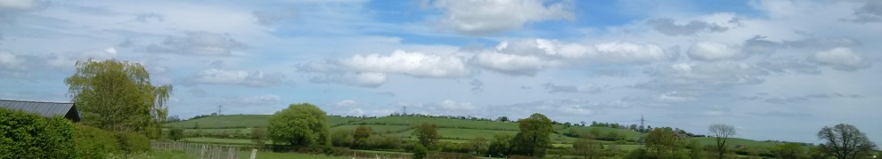
It was interesting to note that although the seawalls we now walked were from the 70’s the seawall we could see in the distance was created by the Victorians and if we had spent enough time there perhaps we could have seen the flood defences of Medieval times!    As the walk progressed we seemed to be sweltering in the heat (despite it being cloudy) and I thought I was having illusions – particularly when I saw the numbers 1-8 sticking out of the ground (perhaps some sort of firing range?) I am yet to still research this! The path that we were taking was the Rainham to Purfleet Path – to my surprise I could not see a “London Loop” sign which I was fully expecting to see!  The route reached a crossroads either to take the path around the Riverside or along the Marshland – which we did.  The path joins a road at this point – it goes straight past a Landfill site!  We Continued along the road, only to think perhaps the path just ran out – and it just ended at the road?  In fact, we had to cross the road to another part of the marsh to continue the walk – it was just a nice!

From 2010 – 25.07.2010 – Purfleet – Rainham Walk

Although we could see a huge road (the A13 to be precise) in front of us) Wildlife obviously thrived in this environment.  Hidden in this lovely little river, Swans had raised a little family of Signets!  We didn’t really want to disturb them, so we carried on with the walk.  The biggest problem with this part of the path was it was locked when we tried to get out!  So we had to improvise this bit! In fact this walk must have been quite new as we had come out at the roadway and the traffic lights still had covers on them!   We rejoined the path the other side of the A13.  Luckily this was not locked up!  This took us right up to Rainham Station!

All the walk photos are –

2010 – 25.07.2010 – Purfleet – Rainham Walk

<><

North Greenwich – Greenwich Park Walk – 18.07.2010

The Millennium Dome… Ah yes ill fated as it was, it still stands today, but not remembered for the year 2000 – but as the 02 – a venue for rock concerts mostly!  Our walk took our right outside the dome – and for a brief while we took a stroll inside – just to take in the atmosphere – and as it was a hot Sunday afternoon – it was not exactly brimming with life!   (Although people looked like they were having fun on the temporary Roller Rink though!)

Leaving the dome behind, we embarked on our walk – our aim was Greenwich park.  At first it was a little tricky to negotiate the building works that are still going on around the site.  Luckily the signposts to “Thames Clippers” were a big clue as to the the way to Thames and hopefully the Thames path where we were headed.

The small and winding path took us exactly to where we thought thank goodness! (for a few moments, I thought it was just to the pier and was panicking!)  and we were able to start our walk.  The view wasn’t so exciting, but with beautiful blue skies, it was certainly lovely to behold.

From 2010 – 18.07.2010 – North Greenwich – Greenwich Park Walk

The Thames may not the best river to walk in places, but I have learnt that it is a river that has changed over the years, it has cleaned up its act in many respects – and now is one of the cleanest in Europe!  (In a city I hasten to add)  with many species of fish (including salmon so I understand)  A far cry from where the river was over 30 years ago!

As we continued on, something caught my eye across the river a lighthouse.  A lighthouse in London?  What an earth would London need a lighthouse for?  Perhaps the peasoupers (Nickname of Smog / Fog that user to London Suffer many years ago) were so bad it needed one in the middle of the Thames?  In fact, I have discovered that this was “experimental” lighthouse was built in 1864 by James Douglass and owned by Trinity house (who maintain the Lighthouses of Britain) to train and test equipment!

As we continued our stroll we came across what we thought was an abandoned Jetty.  In fact this was a purpose built jetty for wildlife – which was nice to see!  In fact two cormorants had taken up roost!  The path unfortunately took a turn for the worst sadly – mostly past building sites – so it was not very well maintained.  We even had to take a temporary diversion off the Thames completely and onto the road, which was a little confusing at points for us but we stuck to the “Thames Path” signs and it worked out!  We did get a sneak preview of a Notting Hill carnival float (we think???) whilst walking the street route however (only the top though)!

From 2010 – 18.07.2010 – North Greenwich – Greenwich Park Walk

We were soon back on the Thames and this part of the path was less industrial.  It was very busy with people though, mostly drinking and relaxing from the Tavern that we walked past or just taking a stroll!  We realised that we were not far from our destination, Greenwich Park.

The route did thin out at this part – as it went in front of the National Maritime Museum, and again it was very, very busy with people!   We managed to reach the Cutty Sark.  Sadly for us this was completely under wraps – as it is being refurbished. The ship was built in 1869 and was known as the fastest tea clipper in the world!

Leaving the ship behind, we continued our stroll to Greenwich Park.  We decided to explore rather than just sit and relax as we had originally planned.   Much to my delight we discovered the Royal Observatory at the top of the hill in the middle of the Park!  How wonderful!  It was nearing 7pm on Sunday and it was free and still open!    It showed me the benchmark for Ordinance Survey maps, Mapping of stars – almost the centre of time!  Such a Doctor Who moment!!!

From 2010 – 18.07.2010 – North Greenwich – Greenwich Park Walk

We spent as much time as we were able too here, so would highly recommend it to all if you are interested into stars or time! It was a wonderful experience (I particularly enjoyed the Camera Obscura – just like Midsomer Murders – although felt a little small and crowded)   It was then we had to leave and finish our day – and our lovely afternoon and walk!

All the photos from this walk are –

2010 – 18.07.2010 – North Greenwich – Greenwich Park Walk

<><

Wemyss Bay – Largs Walk – 16.06.2010

This walk was originally to take us into Skelmorie – just next to Wemyss bay where we were staying, just so we could relax on the beach on such a beautiful day.   Unfortunately, there did not seem to be such a beach 😦 and the walk just seem to last a little bit longer than we anticipated!

As we left the bay behind, we found we had reached Lower Skelmorie very, very quickly! Along the way I did spot a path which may have been worth investigating, but it was such a nice day – may be for another time? We followed the shoreline scouring for a beach to relax on – but to no avail. We just kept going. The road just seem to go on and on – the pavements, however, didnt! It seemed, the pavements ran out as soon as the “civilisation” ran out. We found the road awkward to walk along – luckily the view made up for it though –

From 2010 – 16.06.2010 – Wemyss Bay – Largs Walk

As the pavement disappeared the road narrowed, and our idea of catching a bus to Largs (this was the next village / town) was scuppered too as there were no bus stops – and why would we want to do that?! After all we are used to all this walking?  We were slightly unprepared for the heat and a road walk- particularly after about 3 miles of it!  The view made all the difference… I would, however, urge you not to take this route along the road if you were to walk it particularly as we found it a little very disturbing in places when buses overtook! However,  I did come across the most interesting sign, the “Ayrshire Coast Path“.

I had no idea of this path’s existence – I have since discovered that it is Scotland’s newest long distance walking Path (which is quite nice since it is almost opposite Scotlands very first one on the Isle of Bute!)   It looks like an great path to explore at another time!

Our walk continued on past Knock Castle (a private residence – so no visitors) From what I could just see through the tree – a parapet of a castle – it looked in good shape – but from what I have read it has been mostly rebuilt in the 1900’s for a Greenock Merchant – not much remains of the original castle from 16th Century

From 2010 – 16.06.2010 – Wemyss Bay – Largs Walk

It was not long before we entered Largs itself.  Largs – strange name I thought – but I was soon to find out that it had strong ties with a Viking background! In fact the town stands on an ancient battleground between the Vikings and the Scottish in the early 12th Century. The battle is still remembered today at the Viking Festival Dignitaries from Norway and Scotland now come to the celebration of this battle as a sign of friendship between the two countries! I would be hard pressed to imagine a bloody sea battle on such a glorious day!

We found more Ayrshire Coastal Path signs – a touch confusing for me – with two ways to Skelmorie in two different directions! Following the coastal path into a small park, which seemed to be a little neglected to me – particularly as the paddling pool was empty (perhaps for a reason?), I then spotted something I recognised from a previous walk the millennium Beacon…. Just like the one I had seen at Hainualt Forest! Click here to read if you missed it

From 2010 – 16.06.2010 – Wemyss Bay – Largs Walk

I felt comforted that I had travelled so many miles and the symbol of the beacon, meant that my two walks so far apart something in common! Relaxed we made our way onto Largs town to explore the beach, the ferry and perhaps find some Ice Cream!

For all the photos from this accidentally long walk –

2010 – 16.06.2010 – Wemyss Bay – Largs Walk

Wemyss Bay to Largs Walk Route

<><

Isle Of Bute – Rothesay Walk – 15.06.2010

The Isle of Bute  just “Doon The Wattir” from Glaskey! Well I may not have termed that quite correctly so forgive me readers!  This term came from when hundreds of holiday makers used to flock to the Island from Glasgow during July – mostly using the Paddle Steamers – and when I visited the Island – I can see why!

We came across from Wemyss Bay – no longer a paddle steamer but a pleasant enough journey to Rothesay the main town of Bute.  This walk was not originally intended, but we decided to explore just a very small part of the town and surroundings and I thought it was worth blogging it for future reference!

At first we walked around Rothesay itself, which is a beautiful little town, with its own Castle  – which has a history as far back as Vikings – with that in mind some of the walls are still standing!   However, we then decided to leave the town behind to when we spotted a path that seemed to rise above Rothesay – I could not resist!! I knew it would give us some nice views and perhaps we could find a bench to rest and have our lunch – no such luck though – we were able to enjoy the view-

From 2010 – 15.06.2010 – Isle Of Bute – Rothesay Walk

It was then we found the Woodland Walk to Ardencraig Gardens – so with the West Highland Way walk experience behind us we thought we would give it a try 🙂 !  (and find that elusive bench)   I did have one other thing in mind – though – perhaps this was part of the “West Island Way” ?  The Isle of Bute boasts the first national trail in Scotland (before the West Highland Way!) – but there were no indications it was 😦

The path itself seemed to reasonably looked after, and it was reasonably flat.  The route followed the shoreline, when you could see it through the woodland, and the view was quite impressive when we managed to catch a glimpse of it!  We even managed to find that elusive bench to rest and gaze at the view.

From 2010 – 15.06.2010 – Isle Of Bute – Rothesay Walk

We decided not to complete the woodland walk – perhaps our experiences of the West Highland Way were just too recent!  We will need to complete that another time.  We turned off the route, which took us through Leopold Road (the reason I mention this, is Leopold was Queen Victoria’s son who visited this Island quite regularly!)

Our walk then continued along the shore, which was quite pleasant.  We walked past the stone pier, which had a lovely place for tea (which we did not stop at), only to continue “around the corner….  interestedingly enough there was a very strange building – a victorian one.  When we reached there it all seemed to be part of the Waterworks – and was inaccessible.  I have now since learned it was a municipcial building! So not very exciting really – but it did look nice

From 2010 – 15.06.2010 – Isle Of Bute – Rothesay Walk

Despite walking a bit further on, we realised the time and we had to head back towards town as we had a boat to catch!  So we finished our short walk.  So it seems we will have to go back and explore more and find out about the West Island Way as well!

All the photos for this small walk –

2010 – 15.06.2010 – Isle Of Bute – Rothesay Walk

<><

West Highland Way – Rowarddennan – Balhama Walk – 13.06.2010

Pitter Patter!  Pitter Patter! I could hear rain on the tent!  It was so noisy!  We had double trouble this time taking down the tent – rain and midges!   😦 We therefore wasted no time looking at the view however there was not much to see – the loch was covered in Scotch Mist!  It was really thick and menacing. This was the first time we really got soaked walking!

This was earliest start of the entire walk, mainly driven by it being the last day, weather and finding the Cashel Campsite for breakfast.   We thought that the path would provide us some shelter under the trees as we continued on our way – but the drips of water just seemed larger!     In fact I didn’t take many pictures day as my camera would have just got wet!  But I did manage to capture the greyness of the morning!

From 2010 – 13.06.2010 – West Highland Way – Rowarddennan – Balhama Walk

As we came out of the forest the path met with road, we had to start using pavements – very unusual after all those rough paths we had been walking!!  The Way continues along the lochside and we were quite surprised to see someone doing some waterskiing that early on a Sunday morning!  The waterboat looked very fancy to me – with lights along the top – it seemed like it was ready for some sort of competition and should have been in Miami and not a Scottish Loch 🙂 !

It was not long before we came across Cashel Campsite – breakfast was most welcome, 🙂    Refreshed and just about drying off, we could see the mists were clearing.  We  continued on our way again.    The route took us past “Cashel Farm” – also known as “a forest for a Thousand Years” – which is maintained by the Royal Scottish Forest Society which is over 3,000 acres!!   The path then trundels on over the road and through another wooded area, to when finally we were leaving Ben Lomond National Park behind.

Although the path seemed to be along the road quite a lot at this section due to the Milarrochy Bay Caravan & Campsite,  we did manage to grab a small glimpse of the bay –

From 2010 – 13.06.2010 – West Highland Way – Rowarddennan – Balhama Walk

For some reason we seemed to miss the first entrance to the path from the road, even though we looked for it carefully… But we did manage to found the Way again through the car park even if some of the path had been closed off!   The Way took us through a woodland area and it was not long before we were walking along the lochside again.  From this time onwards the path was very busy with Walkers!

As a rule we had been following the thistle markers for the West Highland Way, so this was no exception….  I had just spotted one which just took us off the shore path, and up some steep steps (Craigie Fort according to the book) but we found no more thistle signs – just the Scottish Forestry Commission ones!  The whole area had just been replanted, and had been taped off by the commission, it looked more like Police crime scenes!!  All a bit scary…  Even worse, Once we were at the top there was no obvious path to get down again! (yes we did look very carefully!)

So we climbed back down, and we went around the hill, over a brand new bridge, and we then started our ascent up the road, into Balhama!  Our Journeys End for this Charity Walk!

Yes we made it!   Happy to achieved our Goal! For Last Day of Walking photos-

2010 – 13.06.2010 – West Highland Way – Rowarddennan – Balhama Walk

<><

P.S.  Yes we may go back and finish the missing sections another time but I am unsure when this will be!!! Just keep watch!

West Highland Way – Inversnaid – Rowarddennan Walk – 12.06.2010

After taking the tent down in yet another record time, (I was beginning to think we could enter the Guiness Book of records for depitching a tent! we headed off to Inversnaid hotel for some of breakfast – I was still unsure if the residents were too happy with all these walkers around the hotel – we did look very out of place!

Climbing the concrete steps behind the hotel – which seemed so odd after so many rocks and wooden steps on previous occasions!  It was then we realised the necessity of so much human intervention at this point, when we reached the top,as there was a a huge drop where a waterfall had gouged out the rocks!

The path did not seem to be as rocky nor as treacherous as the previous day –  we found ourselves walking in a Woodland area – Craigrostan Woods.  Again, an area that had been associated with Rob Roy – it had been at one point his property and again as part of the money he owed – he was forced to sell this part of his estate to the Duke of Montrose (I mentioned Rob Roy and the feud between him and the Duke of Montrose previous blog but to read full history click here) . The trail then descended to the loch shore –

From 2010 – 12.06.2010 – West Highland Way – Inversnaid – Rowarddennan Walk

At this point, we thought we would have to face a tough path again, but apart from a few minor areas to climb across the path then became a lovely wide which was nice!  We had noted that the path had two routes to follow – one along the loch shore (the lower route – we could see it in places when we looked down and but it definetly seemed unkept to me!) and the other the higher route which we took.  Sadly, with the higher route we lost sight of the loch – mostly trees in this section and lots of fellow walkers!  We also found in place the coolness of the trees quite welcome.

Despite this being uphill in places this section was very flat and uninteresting – mainly because of the trees – which blocked the views – but there is nothing you can do about that! I think the nicest surprise was coming across Mr Wheldons bench which had been kindly left for all enjoy with lovely views amazing inscription “Someone like you only happens once in a lifetime”

From 2010 – 12.06.2010 – West Highland Way – Inversnaid – Rowarddennan Walk

In fact rest of this section, was one our our fastest walking times! This was due to us now being on a descent after we reached the bench and the path being such a flat track – this was very pleasant after the rough previous days walking. It was then we approached Ben Lomond National park – Ben Lomond itself I have found out is Scotlands most climbed mountain (surprisingly that was not Ben Nevis!!)  We stopped for food, and sat on the beach for a while. Went to the Youth Hostel for a Bus Timetable for the Sunday buses… and thought shall we pitch tent?… its a bit early (it was also very very crowded!

“Rowarddennan and Beyond!!!” we decided to pick up our rucksacks and continue on!  (Thanks Buzz Lightyear for your inspiration!) Walking past the Inn, duly noting the Red telephone box (I didn’t realise many were still in existence except in peoples garden – my previous blog mentions that!

As we walked further we came across another car park area which was obviously very popular with the locals!  Music was extremely loud and the place was full of tents…  It was very very crowded for a Saturday night (felt like a local festival!!).  We decided to move on.    After crossing a bridge we came across an idyllic cottage the Mill of Ross (No not Mill on the Floss!)

From 2010 – 12.06.2010 – West Highland Way – Inversnaid – Rowarddennan Walk

It was then the path parted from the Loch shore and took a new form.  It became narrow again, and started to climb.  We entered a forest area and we heard some strange noises – something was moving and it wasn’t human!!!  In fact I turned around and a we saw a deer leaping through the forest!  *Phew* I turned around again to see a fellow walker just as perturbed as we were.

At this point leaving the woodland creatures (and walker!) behind we found we were on a very high ascent indeed.  At the top, someone wonderful had put “Write Encouragements to fellow WHW Walkers” (Obviously they had also struggled up this hill!)  At this point we reached the University Field Station (Interestingly enough this was the First British University Freshwater Field Station built in 1964 – all to do with the research of waterlife of Loch Lomond from Plankton to fish and Sediments!!)   We then walked on to find a suitable place to pitch tent for the night.

However, as we pitched tent disaster struck the tent broke!  Midges attacked! Luckily safety pins to help out sort out the disaster we scrambled in and rested up for our last night of our walk!

All the days photos (in fact this is where we pitched tent!)-

2010 – 12.06.2010 – West Highland Way – Inversnaid – Rowarddennan Walk

<><

West Highland Way – Beinglas Campsite – Inversnaid Walk – 11.06.2010

Beat the Midge! Beat the Midge! Sing that to the tune of the Old TV program “Stop The Pigeon” and that was what it was like taking down the tent that morning!  Unlike the other sensible campers with Midge nets around their heads, our only defence was midge repellent which clearly wasnt enough (why am I blogging this? As a warning to any reader out there who is thinking about camping in Scotland in June!)

Doing the sensible thing to continue on our walk,  we went out of the entrance of the campsite we came in to rejoin the way in order to restart our walk to Inversnaid.  However, it suddenly became very apparent we had to go over a stile and back into the very campsite we came out of  – D’OH!  Perhaps we should have consulted the book instead! Or looked at the info board that was that stood in the campsite we stayed in.  We then found the correct entrance to carry on.

The path took us out into slightly different terrain this time.  Again sheep were grazing, but not so much grassland but it seemed to be more fernland.  The path remained relevantly flat and the mountains surrounding us,  as we came around a corner, we realised that we were still quite high, as Loch Lomond came into view –

From 2010 – 11.06.2010 – West Highland Way – Beinglas Campsite – Inversnaid Walk

We could see the little village of Ardlui on the other side of the Loch.  From what I could see the Marina looked full!.  On the way down I spotted my first Scottish Thistle (after 5 days of walking!!)  Passing by an abandoned farm along the loch – which had sadly become a familiar sight in the past few days 😦 we had to pass by the Loch Shore which was quite exciting as we got to see at least one Jet Skiier who was practising on the Loch!

It was then the path took us up into wooded area away from the shoreline.  In fact the path was was very narrow in places and did not feel that safe, particularly as we were carrying such large rucksacks!  (If you read the advice of the book it does say not attempt some of this part of the walk with large rucksacks anyway!) We did get to see some nice views of the Loch through the trees with inviting looking beaches!

From 2010 – 11.06.2010 – West Highland Way – Beinglas Campsite – Inversnaid Walk

This part of the path was very, very busy!  We had to wait in quite a few sections for walkers to pass.  Particularly as in areas the sections were extremely narrow, rocky and tricky to navigate.  This walk was going to take us much longer than we anticipated purely because of the difficulty of the path not because of the distance.  Rocks and caves became more and more apparent!

Talking of caves – a sign came into view – “Rob Roys Cave”.  At this point – the book indcates there are two ways to the cave – so the in fact the path seems a little confusing.  One of us decided to scramble the rocks to see how far the path went – on their return, I found out the Coastguard (not sure if that is what they are known as) saw them and asked if they were in trouble!  Discovering that was a bad route, we decided to use the other path which we had just heard a whole bunch other walkers just descend from!!

Rob Roy  – “The Scottish Robin Hood” –  A cattleman – someone who had defaulted on a loan through loss of his cattle when the chief herder stole both the cattle and money he trusted to them.  Branded outlaw waged  a feud againt the Duke  Montrose who seized his land.  Roy – was eventually pardoned!  It is here that his Cave was meant to be were he hid with his band of men – but sadly we couldn’t find it 😦 (even if the word “Cave” is helpfully painted on it!! – although this could be it??? :-))

From 2010 – 11.06.2010 – West Highland Way – Beinglas Campsite – Inversnaid Walk

As we left Rob Roys cave behind, the path terrain started to change, it flattened out as we approached a little area for where we would camp later (Iversnaid Hotel Wild Campsite).  We passed a little Boat house, and we found ourselves at the Inversnaid Hotel…. ah a nice drink me thinks. (I would tell you though the Walkers entrance is a dodgy entrance near the bins! I didnt know this and proudly walked through the front door first of all!!)

Fully refreshed we headed back to pitch up and on the way back I caught sight of the sunsetting (you can see all my photos if you click on this!)-

2010 – 11.06.2010 – West Highland Way – Beinglas Campsite – Inversnaid Walk

<><

West Highland Way – Crianlarich – Beinglas Campsite Walk – 10.06.2010

4.15 am…. early start??! No, not exactly… that was being woken up by a cuckoo!  Oh the joys of camping! Being close to nature and all that!!    Seriously how wonderful to be able to start out directly on the way from the tent 🙂 – thought it was going to be a dull day – but that was only becuase we pitched tent in the shade 😦 – I have to admit the views made up for the darkness of the trees, noisy cuckoo and lack of early morning tea!

From 2010 – 10.06.2010 – West Highland Way – Crianlarich – Beinglas Campsite Walk

I was able to go into Crainlarich to fetch a few supplies (and breakfast!) whilst the tent was taken down.    Now we were fully prepared we made our way forwards towards Inveranan. At this point the Way was lovely terrain to cross, reasonably flat – it was what I would call more undulating than actual stressful ascents and descents!

Interestingly this actual track was an old 18th Century Military road (hence it was so flat) – but I am still trying to find out more about it – It seems that most of the West Highland Way has been constructed from Old Coaching Routes or Military Routes!   It was then I came across a small sign stating that 929 metres of this particular part of route had been repaired thanks to the Calendonian Challenge – the Challenge crosses 54 miles of the West Highland Way in 24 hours! (Fort William to Ardlui!) That would be amazing!

The Way then left the “road” behind to go underneath the road through a very odd tunnel (book refers to it as a Sheep Creep???) and out the other side where we rested a while.   It was not long before we encountered another River – (River Falloch) which looked very welcoming (despite looking brown again!) as the Sun had become very hot!

From 2010 – 10.06.2010 – West Highland Way – Crianlarich – Beinglas Campsite Walk

The path at this point narrowed out and was quite stony – and was cool in the glades – the only noises we could hear were the leaves rustling in the breeze and some shouts… shouts?!?  They got louder!  As we walked on we could also hear the thunderous roar of water.  We managed to peer through the trees and see two daring walkers who had scrambled to the waterfall to brave a dip in the heat!!!!!

As we continued along we had to cross a few more bridges in this wooded area, and the streams were absolutely amazing – it was easy enough to see why the other walkers had decided to take a tip! the water  was incredibly clear – it was also probably good enough to drink (but I wouldn’t because I wasnt sure what animals may have been around!)

From 2010 – 10.06.2010 – West Highland Way – Crianlarich – Beinglas Campsite Walk

As the trail came out of the wood, we came out at at a crossroads – farm or road? Which way now?  There were no West Highland Way markers – Only one telling us to go back the way we came :-\ !  The book seemed a bit confusing and it seemed logical to carry straight on as the path seemed to look the  same! Mistake – It came to a dead end in what seemed to be in the middle of a Sheep Pen! 😦  We had to turn around and come back again. At the top again we saw the clear sign of walkers – energy bar wrappers etc (naughty them for not clearing them up!) and walking boots imprints on the floor!

We decided to brave it and walk the road, even though there were no markers and it did not feel like the “Way” – but in fact it was correct!!!  It brought us to the Beinglas Woods – exactly where the book said we should be phew!   It was then we were at Beinglas Campsite.  Our shortest walk that week and we decided to camp down for the night in a proper campsite after a night of wild camping!! It felt like a slice of heaven!!  For anyone who likes weapon memoriablia – the Campsite had a great bar with a large display of guns and Swords!

All the photos for the shortest walk of the week are –

2010 – 10.06.2010 – West Highland Way – Crianlarich – Beinglas Campsite Walk

<><

30.6.10 14:12

West Highland Way – Tyndrum – Crianlarich Walk – 09.06.2010

Ready to give up?  Bus back to Glasgow?  Those questions were raised this sorrowful morning.  But that morning it was decided to take a bus to Tyndrum and see what happens…

As we awaited our fate at the bus stop, which seemed like hours, we were able to  reflect slightly on the beauty of Glencoe – I think if we had more time we would have spent some time walking here.  The glen contains tragic history between the Campbells and MacDonalds and the Glencoe massacre of 1692  – it seems these two clans have had some terrible history between them – (see my blog about Battle of Inverlochy!)

Yet in modern history Glencoe has still seen many fights (not so gruesome) – mainly fictious ones from films such as  Harry Potter and the Prisoner of Azkaban, Highlander, Monty Python & The Holy Grail!!

The Bus came and took us to intended destination – Tyndrum.  According to our walking schedule we were not meant to be there for at least another 2 days!  In fact this was a gamble as according to the book, it was the next stop with a proper shop where we could buy a tent ** to carry on the walk… Gladly at the Petrol Station.  Having found the way again, it seemed very different to the path we had been used to – it did not seem to be as rugged at all – it opened up into wide expanse –

From 2010 – 09.06.2010 – West Highland Way – Tyndrum – Crianlarich Walk

This was the Tyndrum Community Woodland, full of history all connected with Robert the Bruce. We noticed “The Legend of the Lost Sword” engraved on a small  seat – it was referring to when the Battle of Dalrigh (1306) raged in this area and Robert the Bruce was being pursued by  the McDougalls … they decided to dispose of their heaviest weapons into the small Lochan for speed but were still captured but they fought their captors and escaped!  (Robert the Bruce’s sword has a legendary size of anything between 5 – 9ft!)

The path continued through this woodland, it continued to follow the River Fillan, which although a nice river with clear water, it always had a strange brown tinge to it. I am not entirely sure why – the river is healthy with Salmon, Perch and Brown Trout (although I don’t think the trout had anything to do with it!)

From 2010 – 09.06.2010 – West Highland Way – Tyndrum – Crianlarich Walk

I must mention before I continue the sound of the cuckoo – from here on in we heard one nearly every day! As we reached Kirkton & Auchentyre Farms – which had  some neat Wigwams to stay in – and seem to be preparing for a Music Festival – not sure of the name of it but it looked like it was going to be a lot of fun!

Going on from the Modern Festival we were thrown back into history as we saw the remains of the Fillan Priory – this Augustinian Priory had been “endowed” by Robert the Bruce himself in 1317.  We even discovered that the Priory was a result of the Fillan the Missionary – he seemed to spoken many wise words about the way a long time ago “All travellers who use wild and beautiful place will do so in peace if they tread their path lightly”

The path then crossed the farmers field – yes full of sheep again!  We did manage to stop a long the way to admire mountains again but this time from a distance  – Ben More, Stob Binnein and Cruach Ardrain

From 2010 – 09.06.2010 – West Highland Way – Tyndrum – Crianlarich Walk

Crossing the River Fillan again, the path suddenly seems to disappear!  We had to follow walkers boots for a while, until the path narrowed by the side of a road!  Once we were over theother side and back on the path, we had to go underneath the stone railway bridge (gladly no trains went across at the time!), and it was then we realised the Way was no longer “flat” – it was uphill from now on!

At this point, the path goes through very dense forest.  The path was very clear so there was never any sense of losing it – it was just tough going.  In places we had too walk over streams that crossed the path making it very muddy –  But the views from the top of hill when we could see over the trees were great –

From 2010 – 09.06.2010 – West Highland Way – Tyndrum – Crianlarich Walk

Once we had crossed the small river (Henive Burn) we were on the descent.    We had reached the crossing point for the West Highland Way – one way to Inversnaid, the other to Craianlarich and the other Bogle Glen.  Our choice was to walk to Craianlarich to be fed and watered 🙂  (only 1/2 mile downhill!) lovely though it was – we had to walk back up hill to pitch up tent for wild camping for the night!

All the photos for the Day 3 of the walking adventures are –

2010 – 09.06.2010 – West Highland Way – Tyndrum – Crianlarich Walk

<><

** If anyone was wondering why we choose the tent?  It was so we could pitch up anywhere safely along the route should we need too no more stressing out about finding places to stay about 10.30pm at night the time we finished on day 1 of the walk!

West Highland Way – Kinlochleven – Kingshouse Walk – 08.06.2010

Having revived ourselves from our first day of walking, we were now ready to set foot on the Way again.    It seemed to us that we were the only ones on the beginning of their journey when everyone else were just ending their after chatting with other walkers that morning!!  Once we had secured our supplies, we found the route pretty easily although we must have confused some people at some point as we did return back into Kinlochleven to purchase a tent only to come back again empty handed!.

Again we found ourselves on the Ascent, which after a nights rest did not seem too bad.  The path was reasonable wide and clearly marked. The Way followed some large pipes  from the back of an old Power / Aluminuim Smelting Works  – so we could once again admire those stunning views.

From 2010 – 08.06.2010 – West Highland Way – Kinlochleven – Kingshouse Walk

From this point on most of the route was under tree cover and streams seem to just tumble down the mountainsides,which was rather refreshing.  It was not long before we were in open countryside again and the Way became a little more difficult to negotiate.   The path became more rocky in places – and despite seem some walkers in little more than trainers – my walking boots were a blessing!  It was not long before we could clearly see “Blackwater Reservoir” in the distance At over 914 m long, the dam is the longest in the Highlands.  This once fed the old smelting works which started our jouney earlier in the day.

As we continued on, we found many walkers had stopped – for a moment I wondered why.  I realised soon that we had reached the highest point of the West Highland Way!   the height is 1797ft (548M if you prefer!) A Cairn marks this prestigious spot – it was easy to see why many people had taken a rest at this point.

From 2010 – 08.06.2010 – West Highland Way – Kinlochleven – Kingshouse Walk

It is then we were on the descent – I could not see the aptly named “Devil’s Staircase” and from my research – if I was doing the West Highland Way the other way around I would think it would be called that for a reason – as it was not good to descend – in fact I was unable to take any photos 😦

However when did manage to eaching the bottom of the “staircase” we reached the road and rested to work out which way was next.  Having thought that we should follow the River Coupall which was across the road, as per the book.   Unfortunately the West Highland way sign (helpfully marked with a thistle) was blocked off and consulting the ever faithful book again (allbeit odd to read backwards!) we decided to follow the path through the nature reserve…  But something didn’t seem quite right.  Particularly when we spotted a walker along the river way over the other side.

So dear readers we foolishly attempted to cross to the river… across solid land – well actually most was boggy & marshy – please do not attempt this if you do this route!!!!  In places we thought we not going to make it.  Eventually getting to river – and to the other side – we decided to stick to the road side. (The A82 runs along the route to Kingshouse) we could now see the Way along the river – very muddy and worn.  We also saw the high route along the road (which we had not noticed the entrance to had we not crossed the road grr!) But we ventually reaching our chosen destination – Kingshouse

From 2010 – 08.06.2010 – West Highland Way – Kinlochleven – Kingshouse Walk

Kingshouse – This an Inn which had stood since 1770’s a traveller rest – built by that Clan Campbell! But that is all that was there! So if you do go this way please bring your tent or book in advance!  Even more disaster struck – I had dropped my blackberry and my companion kindly retraced 1 1/2 miles of the route to retrieve it!  Oh the dangers of pockets.  We both absolutely exhausted and ready to give in – with no tent to stay in – we had to go to Glencoe for the night – 9 miles back in the direction we came from…..

All my photos from day 2 of the walk are as follows –

2010 – 08.06.2010 – West Highland Way – Kinlochleven – Kingshouse Walk

<><

28.6.10 22:59