Denham – Great Missenden Walk

In stark contrast to the cold, snowy and greyness of my previous walk, there was now warmth, sunshine and blue skies. The start of my jaunt was to take my walking feet back down lanes once more, which I felt prepared for and any traffic that may cross my path. Shadows of tall trees dominated most of the way along “Slade Oak Lane”, sadly blocking out the delightful sunny weather. Making my way along the road, I was a little taken aback when I came across a tiny station named “Denham Golf Club”, how lovely a golf club with its very own station! The station has even had its famous 15 minutes when it was used as a location in 1960s TV Series such as “Man in a Suitcase”. The golf club was founded in 1910 and 2 years later the golf club successfully requested for its own station stop. As I made way onwards, there were numerous crossing places for the golfers, which gave me the opportunity to glance across the rather lovely golf course.

From 2016 – 30.04.2016 – Denham – Great Missenden

The road soon passed beneath a bridge carrying a large motorway, it was pleasant change to be walking beneath one rather than walking across as I had done previously. Beyond the bridge I saw a campsite, or rather a scout camp which was hidden away from surburbia, I do hope that they do not hear the roar of traffic from the M40 just down the road! I turned away from the rural lane and followed the roads around into the pretty village of Chalfont St Peter. Chalfont St Peter gained its name after the local Church had been dedicated to Saint Peter in C13th, and was fully recognised in the local Manorial roles as “Chalfund Sancti Petri”. Opposite the church I spotted a sign which for “Best Kept Vilage”, Chalfont St Peter had held this title for quite a number of years, I was so happy I had not encountered mud on this occasion and trampled all the way through the heart of the village and ruined its lovely look on this occasion!

From 2016 – 30.04.2016 – Denham – Great Missenden

Past the village, I came out to a lovely view of the local village common, Gold Hill. The open green was a great sight after the urbaness of the village and the dark overshadowed lane that I had just walked. Commanding views at the top of the hill was a beacon. Only a few days ago this would have been lit along with a large chain of beacons across the entire country to celebrate the Queens 90th Birthday, certainly would have been a lovely sight to behold. Walking onwards past the common my route was to take me back alongside roadway once more. I really do enjoy the lane names that I have started to come across during my walks, this time I had turned into “LongBottom Lane”, which sounded like a name from a Shakespearean play! It took me past Seer Green and Beaconsfield Golf Club. Eventually my route took me through Ledborough lane and on the outskirts of Beaconsfield.

From 2016 – 30.04.2016 – Denham – Great Missenden

I did not walk into Beaconsfield on this occasion, leaving that for another time, I continued onwards. I found myself in “Knotty Green” and passing by the Red Lion pub looking very inviting. Unfortunately I did not get a chance to peer inside, which was a real shame. The Red Lion pub was once the local of the children’s author Enid Blyton, when she a resident in the area. The inn now has the “Enid Blyton Snuggery” with a library of her books to browse through in front of a real fire, how very civilized :-). As I progressed onwards the landscape of my walk changed quite dramatically, with rolling fields and hedgerows surrounding the road. Enjoying the pleasant scenery all around, walking the lanes was very enjoyable for this stretch of my walk. I turned into “Horsemoor Lane”, a very lovely sounding name, I almost expected Horse and Carts to meet me a long the road rather than any cars!

From 2016 – 30.04.2016 – Denham – Great Missenden

The countryside soon met the a small village and pond, sighted on top of “Winchmore Hill”. “Gaude Water” as the small pool is known, has several possible ways the name could have been derived. It particularly intrigued me how the French word for a variety of pumpkins may have been one of the origins! Perhaps it was when locals started to reflect on the shape of this body of water being the same as a pumpkin! In later centuries tales of how the waters were used during Military Exercises by a variety of army personnel from a military training college to the Duke of Cumberland’s troops in the C18th. Whatever the origins of the ponds name it was very peaceful and pretty to look at 🙂 . Walking onwards from the pond, I found myself passing by a cricket match in full swing! I noticed that the local public house overlooked the small pitch, what lovely way to while way time whilst drinking a pint or two in the pub! With the sun shining down on everyone it was certainly a wonderful day for a great match of cricket, how very pleasant indeed!

From 2016 – 30.04.2016 – Denham – Great Missenden

I continued onwards up to the hamlet of Penn Street, which looked very quaint and unassuming, but it probably wasn’t when it was used twice as a filming location for Midsomer Murders! The road took me away from Penn Street and onwards where it came to a junction in the road. I took the turning towards Beamond End, a small collection of houses and farm land. In C16th Beamond was granted to the Royal Nursemaid Sybil Hampden and David of Elizabeth 1 and her Brother Edward in 1553. The entire estate remained in the Penn Family for about 300 years, the land included Beamond, Penn and Mop End. From the Mid C19th the estate fortunes altered, land and houses were sold off. During the early C20th Beamond Farm cottages were empty, run down and derelict. Seeing the potential in them, they were bought by and restored as working diary farm until the 1960s, no longer a farm but at least it is still in good shape and lived in!

From 2016 – 30.04.2016 – Denham – Great Missenden

Past the cottages I turned into “Beamond End Lane”, as I meandered my way along, the lane became narrower and narrower. The lane became a footpath at with hedges overhanging either side and the concrete road gradually being replaced leaves and mud. With no sign of traffic to even bother me at any stage, the lane was extremely enjoyable to walk. It was a nice surprise to discover that the lane crossed with the “South Bucks Way”, so perhaps I will be venturing this way again when I am able to investigate! Leaving the lane behind, I walked up towards the outskirts of “Little Missenden”, where I walked past a beautiful stone Church. The wooden lychgate that stood outside was built during the 1940s as a dedication to the Officers and Men who had been evacuated from Dunkerque during World War II. I decided not to walk into Little Missenden and head towards Great Missenden instead. Unfortunately, I found a bit of a struggle as my route took me down a main road! Eventually reaching Great Missenden I decided to end my walk for the day here.

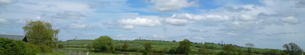
All my photos for the walk are available by clicking on this photo below –

2016 – 30.04.2016 – Denham – Great Missenden

<><

Wendover – Watford Walk

With trees so bare, so bare!
But O so beautiful, so beautiful!
The grey and blue sky
© 1972, Fleetwood Mac, Album – Bare Trees

These words were to ring true for all of my walk, grey skies and very cold weather all day, but very beautiful scenery to be enjoyed throughout… A wander around Wendover small market with a few stalls to look round for a few moments in time before setting out on my walk for the day. Starting off with South Street, which was rather quaint as tudor style buildings were mainly scattered along the road. Turning into “Chapel Lane”, I fully expected to find a church en-route. However as the lane became a footpath, it seemed to follw a number of houses rather than leading me to a chapel. Passing by Wendover Community Orchard, the path was soon to cross over ridgeway national trail. Nevertheless this was a trail for another time, so I continued onwards.

From 2016 – 17.04.2016 – Wendover – Watford Walk

The footpath joined with a small roadway, which I now found myself walking alongside. On reaching the next junction, I started to head down a lane, was beautifully surrounded by fields. Some sections were quite narrow, proving difficult to walk along, particularly when a car tried to pass by! Along the way, I spotted a sign for “Hale Valley Vineyard”. A very odd place grow a vineyard, I would have normally expected one in warmer climes! The vineyard has about 500 vines and produces dry white wines, although there has been some production of sparkling white wines in days gone past. Apparently you are able to book a tour around and view the vines, I wonder if you can manage to have some tasters too?! Marching onwards along the lane, I was soon to pass by “Wendover Woods”. With grey skies and the dark shadows cast by the trees above, it really did look a bit dark and foreboding. I think it will be worth investigating further.

From 2016 – 17.04.2016 – Wendover – Watford Walk

Beyond the woods, the landscaped opened up either side of the road with rolling hills and lovely views across the vale. Eventually the lane started taking past a very small number of houses, I was very surprised to find a large mansion just around the corner. The notable Henry Colet twice Mayor of London in C15th and formally knighted, was born here although it was in an earlier version of the building that stands now. I merrily continued on my way, going past the Ridgeway once more, the grey clouds seemed huddle together and then the rain started to tumble from the skies. For quite sometime I was a quite bemused by the rain as it seem to turn white, at first I confused this with spring blossom falling from surrounding trees. However, the further I walked the trees lining the road disappeared and the white specs coming down from the sky got larger and came down faster! It was then I realised that it was snowing and I was not the only one to battle the weather as I saw a number of cyclists fighting it too as they were on the Chiltern Cycleway which my route now partially followed! Therefore I did not hesitate along this stretch as the snow was extremely cold and the faster I walked the warmer I was! With speed in mind, I found a small chapel belonging to the village of St Leonards.

From 2016 – 17.04.2016 – Wendover – Watford Walk

A church has stood in this very area since C11th when the local Manor was granted to Henry de Crokesley and lands were set aside for a Chapel at ease. During the C17th the Church fell into disrepair, particularly noted after the English Civil War when only the timber construction remained. Restoration and rebuilding of the Church was undertaken at the end of the C17th and is the one that stands today. Heading away from St Leonards, I found myself walking along some very narrow lanes. With overhanging trees, high hedges lining the roadside and a number of turns, quiet but difficult to negotiate in place. The lanes soon brought me out into the small hamlet of “Braziers End”, although it was not much to look at except houses, it really was a great name for the area! The term “Braziers End” is said to be derived from when groups of travellers used to gather together in the area and light Braziers whilst celebrating weddings.

From 2016 – 17.04.2016 – Wendover – Watford Walk

Leaving Braziers End behind, I continued onwards and through the village of Bellingdon. “Bellingdenu” is the Anglo Saxon that the current village name is derived from, meaning “Bellas Valley”. I now have visions of an Anglo Saxon lady ruling and owning the entire valley I had been walking. Walking through the village I spotted a small Corrugated Iron Church, I had seen one previously, in comparison it was well used to the other one, which was unused and unloved. Eventually I started my descent downhill and found I was now approaching “Chesham” Unintentionally I found myself walking further into this town than I originally planned as I misread my route map! However, I did not explore as much as wanted to, so I will be back to find out more about this town! Picking up my route again, I spotted a little plaque showing how a small piece of land had been given to the town of Chesham in the Festival of Britain in 1951! Walking up all I continued onwards through the small areas of Lye Green and Orchard Leigh.

From 2016 – 17.04.2016 – Wendover – Watford Walk

It was not too difficult to navigate on this occasion as there was a footpath alongside the road. I eventually turned into “Jasons Hill”, interesting not only did Bella own a valley, but a chap named Jason had his own hill! Reaching the bottom of the hill, I found I was on the outskirts of the village of Botley. Just outside the village was Ley Hill common, to my nice surprise, I found yet another beacon and this one was being made ready to be lit. The beacon was to be lit by the Scouts in honour the Queen Elizabeth II 90th Birthday 🙂 . The common itself is over 32ha in size and is a “country wildlife site” and very well used. Ley Hulle was first recorded in the C15th but not a grassland to be enjoyed by all, since the name meant “unploughed field”. It was used by settlers to extract chalk and clay to create Pottery, tile and for making bricks. I continued on uphill, walking past Ley hill Golf Club, and onto Shantock lane. Unsurpisingly, like the other lanes I had encountered in my walk, it was narrow and high hedges line the roadside. Nevertheless, I was still able to find my way through onwards through, and eventually reached “Hogpits Bottom”, I am not sure where this name came from, but sounded like something from Harry Potter!

From 2016 – 17.04.2016 – Wendover – Watford Walk

On my way through I found the C18th “Bricklayers Arms” public house. Looking very inviting, I did not quite manage to partake in a tipple, but I could see it was very busy and very much enjoyed. Although the series of Midsomer Murders was not actually filmed here, it is worth knowing that the original cast stopped for a pint a while back! The next stretch of my walk was to take me past the village of Belsize and take me down a number of lanes, both Plough Lane and eventually becoming Bottom Lane. I am still not quite sure what it was bottom of though! I eventually found myself in Chandlers Cross, which looked familiar to me as I had walked in this area before. As this was familiar territory, I found that rather hurried this section of my walk. However, on this occasion I decided walk past Whippendell Woods and onwards.

From 2016 – 17.04.2016 – Wendover – Watford Walk

As I did I found myself negotiating yet more traffic along a very narrow lane, Grove Mill lane to be precise. On the other side of each fence was a Golf course which belonged to “The Grove” Spa & Hotel, still looking as lovely as I had previously seen it. I was pleasantly surprised as a I turned a sharp corner to find Grove Mill, although it looked like residential property now, it still had all the original features of a mill. Going across the humpbacked bridge, I soon found that I had to cross the Grand Union Canal. I had finally reached Watford my destination, so it was here that I finished my walk for the day.

All My photos for the day

2016 – 17.04.2016 – Wendover – Watford Walk

My Route

<

Broughton – Ascott Walk

A good start to the day with the Sun shining and the slightly warmer temperature it was a great day for a walk. Despite this I found myself tacking a cool shady lane, and battling the ever oncoming traffic due to lack of footpaths! Gingerly making my way along the road I found myself walking past a camping and caravanning site, worth noting for future camping and hiking trips! It was not long before a reached a Hump back bridge. This was crossing the Grand Union Canal, a section I had previously walked, “Broughton Lock”. Onwards from the lock, I passed by the Old Mill House, which was part of the Broughton Farm. The name “Broughton” is derived from the Anglo Saxon meaning “Farm By a Brook”, very aptly named if you asked me! Further along I started walking past a number of houses which made up the small hamlet. The area was officially recognised in C13th when it was part of the Manor of Beirton and this was the next village I reached on my route. Beirton was much older in comparison, with the first official record of the village of Bierton, the Domesday Book in the C11th.

From 2016 – 04.03.2016 – Broughton – Ascott

Walking away from the village the landscape started to evolve around me, opening up with waves of large grassy fields. Following the large roadway, my route was not to difficult to follow. Therefore, I was a little confused, when I approached a unkempt lane en-route, looking quite abandoned. Wondering if it was still existed on any maps or indeed led anywhere, I decided against investigating it. Instead I carried on walking along the main road and was treated to the wonderful open countryside views. It was not long before I reached the Anglo Saxon village “Hrothwulf’s home” or rather Rowsham. A name that would be expected in the series “Game Of Thrones”! Despite its history, it did not seem to have very much except a small number of houses lining the roadside, and not many historic buildings to speak of. Once I had passed through the village I continued my way onwards along and the countryside became visible once more. I really enjoyed this section of the walk, as the open countryside was a welcome distraction from the noisy traffic

From 2016 – 04.03.2016 – Broughton – Ascott

An unusual sight on the other side of the road with a flying wooden chair really caught my attention. Thankfully, this was only advert for painted furniture though and not some strange magic trick. Countryside started diminishing and I soon found myself passing by the Houses on each side of me. I found that I had reached the small village of Wing, which I decided to investigate a bit further. This was a historic village which had been standing since the Domesday Book recorded its existence in C11th. I ambled onto the high street, where I duly observed the “The Cock Inn”. As tempted as I was to stop for a swift drink, I didn’t manage to this occasion. If I had, I would have joined the notable people who have enjoyed a drink here, including Henry 8th, Oliver Cromwell and William Shakespeare. As I turned away from the high street, I discovered “All Saints Parish Church”. A Church has been on this very spot since Anglo Saxons times, making this one of the oldest churches in England. It even has its Famous 15 minutes when the programme makers of the “Meet The Ancestors” filmed here and tried to recreate the face of an Anglo Saxon Girl who was buried in the churchyard!

From 2016 – 04.03.2016 – Broughton – Ascott

Leaving the church behind, I found that the road had taken me around in a loop around the village! Rejoining my original route I decided to turn away from the road and cut across the sports field. As I did so I spotted a Millennium Beacon, something I have not spotted for over a year during my walks! Exiting the field and rejoining the large road I spotted Wing Library residing a very grand building on the other side of the road. This was Wing Hall, which was opened by Lord Rothschild the Lord Lieutenant of Buckinghamshire! I continued past the hall onwards up the road.

From 2016 – 04.03.2016 – Broughton – Ascott

I was very curious when I saw quite a number of people heading towards me, I thought that some sort of fair or festival had just finished. I soon discovered that I had reached “Ascott House”, the countryside residence of Lord Rothschild. Going through the entrance it really seems to hide its true potential, with woodland all around, I walked onwards and found the Tudor House, dating back to C16th the house looks magnificent and the outside gardens are amazingly well kept! The whole estate is 4,400 acres in size, comprising of Arable land, grassland, woodland and 40 other properties! The rolling fields that I saw whilst walking the house were all part of the estate! Lord Rothschild, donated the property and Ascott collection to National Trust during the late 1940s. Unfortunately I did not have time to peruse the gardens on this occasion. Therefore, I ended my walk and trip for the day here!

Please feel free to look through the photos I took on the walk by clicking on the photo below –

2016 – 04.03.2016 – Broughton (Aylesbury) – Ascott

My route

<><

Harrow – Chorleywood Walk

Feeling fully prepared, with map and directions, setting out from Harrow on the Hill Station the walk did not feel too daunting. A very urban walk in feel, with mainly pavements and roadways, it really was a good preparation for the London Moonwalk 2016. Starting out, with the landscape full of shops and houses, it was nice to see a wonderful pair of ornate wrought iron gates, stuck between the more modern buildings. These gates hid Harrow Recreation ground just behind them. The ground was established in 1885 and had numerous facilities for local sports club and a Bowls Club amongst them. The gates themselves date from when the ground opened and in the early C19th, making it a very grand entrance to the sports ground!

From 2016 – 12.03.2016 – Harrow – Chorleywood Walk

Passing by the ground, I continued my walk onwards alongside the extremely busy roadway. The route then took me away from the road, to a much quieter area, where houses alone lined the streets. It seemed quite some time before I came across some open space. This was “Yeading Brook” open space, just on the entrance to the space was a number of fruit trees. The trees were quite young and had not grown to their full potential. This was Yeading Brook community Orchard, no long planted I should imagine, surprising to find an Orchard in the middle of a housing estate! As I passed the trees, I was a little shaken when I could not locate any road names, after what seemed like a lengthy decision on my part, I continued onwards hoping I was going in the right direction! As I made my way onwards, I discovered another set of iron gates, but this time not so grand in style. They did not hide such a sports ground behind them, but an area with a much more gentile use, Pinner Village Gardens.

From 2016 – 12.03.2016 – Harrow – Chorleywood Walk

I did not have time to go in and relax in the park, but from the entrance I could see it was well maintained. The roadway eventually took me onto Bridle road, whose name had derived its name in C19th, when it became a 20ft wide bridleway, as part of the surrounding village Ruislip Enclosure Act. As I strolled along the Bridle way, I spotted across the road, the Tudor Lodge Hotel. Surviving Britain’s turbulent history from the C15th when it was built, used as a hospital in the First World War, and being owned by a direct descendent of the Scottish renegade Rob Roy the Lodge is now a beautiful hotel! The route had now taken me to the village of “Eastcote”, such a pretty name, invoking an image of a Dovecote! In reality the village name dates from C13th meaning “Eastern Cottages”, when it was “born” as a mediaeval village just east of the Manor of Ruislip. Seeing “Eastcote Manor Gardens”, on the right of me I progressed around the park, to peer inside.

From 2016 – 12.03.2016 – Harrow – Chorleywood Walk

Although the park looked extremely delightful and very inviting on this spring like day, I decided not to proceed any further into the gardens. I thought I might wander through on another occasion find out more! I crossed over the road and found a small river, this was the “River Pinn”, at almost 12 miles long rising from Harrow Weald to the Thames, would be great to follow on a walk! Crossing the Art Deco bridge, I continued to en-route, taking me uphill. As it did so, I suddenly run out of roadway! The lane turned into a very muddy Public Footpath! According to my original map this should have been Wiltshire lane to take me across “Haste Hill Golf Course”. I struggled my way through the mud which was very thick in places, I was so glad that I had my trusty walking stick to stop me from falling over! Eventually the path opened out onto the top of the golf course where I was treated to a wonderful view. The paths came to a junction either to continue around the course or to rejoin the suburban street. I choose to come away from muddy path and back onto roadway, which ran parallel to the golf course. It would have been more pleasant to view, if there had been less tree coverage.

From 2016 – 12.03.2016 – Harrow – Chorleywood Walk

Finally reaching the end of the golf course, I found a sign for the “Gravel Pits”, an area which was deemed to be a public amenity during Queen Victoria’s Diamond Jubilee! Not bad for a gravel pits which were originally for road repairs! I will need to come back and see these for myself! I carried on along the road, which had taken me towards Batchworth Heath, which hosted 2 local pubs within metres of each other! One of those inns “Ye Olde Green Manne”, caught my attention, not only has it appeared in the dark world of Midsomer Murders, it also found fame in the films of Raiders of the Lost Ark, Genevieve and Withnail & I. Just opposite I spotted a large stone Gateway. Hiding behind the gates was, where a World War II battle the planned, and a large C17th Mansion stands, mostly surrounded by Moor Park Golf Club! I continued on, with Batchworth Heath on the other side of me, my route was to follow the “London Road” although it was quite a long stretch of road the scenery was quite lovely, particularly as if started its descent downhill.

From 2016 – 12.03.2016 – Harrow – Chorleywood Walk

My route had now taken me into Ricksmanworth, where I found that I was crossing a large waterway. This was the Grand Union Canal, I should have recognised it as I had walked this stretch previously. Walking over the canal and onwards, I turned into “Riverside Drive”, aptly named as it runs alongside the River Colne. Between the trees, I could see some lakes which were part of the Ricksmanworth Aquadrome which was particularly occupied with boats and water skiiers! I continued on into Rickmansworth, past the station and turned into the Chorleywood Road. This road was extremely busy and very large, I found it very worrying when I had to cross over the M25 I most definitely did not look down. It was not long before the Road began to shrink in size, at the next junction I took the opportunity to turn down Dog Kennel Lane. This took me onto ChorleyWood Common, which was great to see after my last walk. It was really beautiful, although very muddy, it really was a clearing amongst the trees! Strolling on through people sitting around enjoying the day, locals walking dogs, people flying kites and I finally made my way to the station where I ended my lovely walk for the day.

Route is as follows –

Please feel free to browse through the photos for my walk by clicking on the photo below

2016 – 12.03.2016 – Harrow – Chorleywood Walk

<><

Chorleywood – Great Missenden Walk

“Cerola Leah” sounding like a lively Celtic Dance, but the two saxon words translate to “clearing in a meadow or forest”. This was Chorleywood where I was starting out my walk for the day. Such a clearing survives with Chorleywood Common, but I did not get a chance to investigate, as I my journey led me away from Chorleywood completely. I will endeavour to return, so that I can explore the area more! With blue skies and the sun streaming down, I was not perturbed that my walk was taking me along roadways. Eventually leaving the urban streets of Chorleywood, the landscape either side of the road soon changed. Hidden behind the wall of trees that lined either side road, lay meadows and rolling fields. As I advanced further along the road, the pavement in places gave way to a dusty track which run in parallel to the road. It really did feel like I was walking in the countryside and not along the road!

From 2016 – 28.02.2016 – Chorleywood – Great Missenden walk

The countryside soon began to ebb away as I began to enter into the small village of Little Chalfont. Trees lined the roadside, obscuring most of the buildings behind. However, the distinct shape of a Church Spire could not be hidden that easily. Although it was not as old as the other churches I had seen, the long tall spire of Saint Aidans Church was just as elegant 🙂 . The roadway became more urbanised as the trees dissipated and houses and shops became more prominent. Marching onwards, I was treated to the sight of the very large “White Lion”, I thought it was something to do with the road which I had been walking, “White Lion Road”. The large sign was for “The White Lion” pub. Although it is roughly 150 years old, its actual origins are not very well known, perhaps originating as a pub as part of the thriving Local Wellers Brewery which flourished in Amersham from C17th right up until 1929! If they do serve a delicious drink or two, I was not able to discover that, as I did not get the time to go in!

From 2016 – 28.02.2016 – Chorleywood – Great Missenden walk

Wandering along, I was soon treated to the sight of beautiful Tudor building on the opposite of the road. I could just about make out a sign on it which said “Hyrons Old Barn”. I cannot seem to locate much history surrounding the barn, but assume that it was one of the outbuildings for “Hyrons Farm” that once held the surrounding land. I would not be surprised for this to be the case, particularly when there was a “Hyrons Lane” just next door! I was soon to leave the urban buildings of Amersham behind to start following the open road once more. It was here there was clear evidence of farm land that still surrounds the area, the views of rolling fields into the distance. Views mainly hidden behind gateways, hedgerows and trees.

From 2016 – 28.02.2016 – Chorleywood – Great Missenden walk

The open road, suddenly gave way to the small village green of Little Missenden. I did not get chance to really explore that much, but on my way through, I did spot the local pub, “The Crown”. Although it topped with the beauty of a thatched roof or a Tudor look, it is a past owner of the pub that makes it interesting! The owner of the pub in 1964, Ron How qualified twice for the Speedway Championship during the 1950s and 1960s, in 1965 he was ranked 7th in the World! Leaving Little Missenden behind I followed the road onwards until I reached a very large junction. I following the cycleway underneath the very large roundabout (almost the wrong way!) and it brought me into Great Missenden.

From 2016 – 28.02.2016 – Chorleywood – Great Missenden walk

It was nice to be able to return to Great Missenden after abandoning my previous walk . As I started to make my way into Great Missenden High Street I was greeted by a very unexpected sight, the “Red Pump Garage”. It looked like a garage from perhaps the 1920s or 30s! This particular garage was inspiration for where one of the characters worked in the book “Danny, The Champion of the World” by Roald Dahl. Unsurprisingly, the Roald Dahl museum was directly opposite to the garage. Roald Dahl the author of books such as Willy Wonka and Chocolate Factory, Matilda, James and the Giant Peach and BFG, lived in Great Missenden from the mid 1950s until his death in 1990. I continued to follow the High Street taking me to Great Missenden Station where I ended my walk for the day.

Please feel free to click on the photo below to view all the photos for this walk

2016 – 28.02.2016 – Chorleywood – Great Missenden walk

<><

Aylesbury – Haddenham

With a pathway set in front of us to explore and the sun beaming down, it was definitely a day a great day for a walk! As we set off, the track-way led us parallel to the housing estate, not that picturesque you would imagine, but just opposite rolling fields as far as the eye could see! The further we strolled on we became curious as we spotted as a metal bridge which homed into view. Upon investigation, we discovered we were on the “Round Aylesbury Walk”, but we did not follow it on the extremely muddy field. Instead we decided to follow the path other way which took us behind another part of the housing estate. Just at the end of the muddy track we had to negotiate a very narrow wooden bridge crossing a stream on to the pavement.

From 2016 – 10.02.2016 – Aylesbury – Haddenham walk

It was here the path left the beautiful scenery behind. According to the signs we were “Walking Round Aylesbury”, we therefore decided to continue onwards. The traffic was that bad but, it was nice to have a high wall of green trees line either side of the road to remind us we were still out in the country! As we walked onwards a beautiful stone gate homed into view on the other side of the road. It was only much further along were we to know that this was part of “Hartwell House”. A C17th Stately home which is now hotel and spa hidden behind a large array of trees. If we had been able to glimpse the building via the gateway, we would have seen a home with a very long history notably dating back to the reign of Edward the Confessor over a thousand years ago. It is nice to know that the property itself is looked after by the National Trust, and is being preserved, it would be nice to venture in one day though!

From 2016 – 10.02.2016 – Aylesbury – Haddenham walk

As we continued our wander, we were both puzzled by a sign “Setup”, well at least that is what we thought it said. Upon approaching the sign closer, it actually said “Sedrup”. It was such a bizarre name, we were unsure whether we should investigate or not was it a village or?? We soon that the route had led us to the “Bugle Horn” public House, which looked very inviting indeed. This country inn had been standing here since the C18th when it was built originally as a farmhouse. It has also been used as the wine store for Hartwell House, whilst King Louis XIII of France lived there in exile! We decided not to sample some of the taverns wares, but to save this for a later date, something to look forward too!

From 2016 – 10.02.2016 – Aylesbury – Haddenham walk

Managing to fight the temptation of the “Bugle Horn”, we continued onwards. Again we spotted a sign for “Sedrup”, but this time it was with “Sedup lane”, presumably Sedrup was a small hamlet that was at end of the lane! In this instance we decided not to take the route to investigate but to carry on along the main road. It was to take us past some large riding stables and onwards to the village of “Stone”. Where we passed by it’s recreation ground, village hall and its of course is own pub! We maintained the same route beyond Stone Village for quite some time, eventually we were privileged to a view on the other side of the road as the trees thinned out and we left the urbanity behind us.

From 2016 – 10.02.2016 – Aylesbury – Haddenham walk

However, it was not too long before we were treated to a very unusual sight of a stone ruin. We had to fight our way through the undergrowth to have a good look, but we had found the remains of “Dinton Castle”. Although its official title is a castle, it is actually a Folly, built in C18th by Sir John Vanhattem. He had extensive fossil collection and passion shows clearly in this building as fossils are built into the folly walls! The “Castle” is now privately owned, but still awaiting a full restoration, so it will be nice to find out what happens to it in years to come! We spotted an “Aylesbury Ring” sign, but we through we would leave that walk for another time now! Therefore we left castle behind, and took a change in direction by turning away from the large Roadway. We found ourselves walking along a much narrower thoroughfare and no pavements to walk along, making this part of our walk particularly tricky. Fortunately for us, this was not a very busy road!

From 2016 – 10.02.2016 – Aylesbury – Haddenham walk

The road we had been following had taken us to place known as “Cuddington”. As soon as we could we found a way off the roadside and into a local park. As we followed it round, it was a lot smaller than we bargained for and we were soon back out by the roadside! But we soon stopped to admire a lovely thatched cottage, on the other side of the road, which we soon saw was the pub “The Crown”. The pub may have a history dating back to the C17th, but it is more known today through Midsomer Murders, where it has appeared as a local in quite a number of episodes! We crossed the road to investigate the village further. It really did it seemed like a step back in time with its thatched cottages, stone church and Tudor buildings. It felt like a very sleepy and unassuming little village, which certainly looks like nothing much happens. But the village on a number of occasions has become a place for dark deeds, village gossip and busybodies when Agatha Christies Crime Novel “Why Didn’t they Ask Evans?” and when”Midsomer Murders” have both been filmed here!

From 2016 – 10.02.2016 – Aylesbury – Haddenham walk

Leaving Cuddington behind, we started our walk once again along the road. This time we found ourselves heading in the direction of “Haddenham”. The roadside did not have any pavements once more so it was difficult to walk as it became quite busy at this point. We also found that we walked this part as quickly as we could as we felt we did not want to be on the stay walking along the road for that long. We soon found ourselves in “Haddenham”, however, we did not venture into far, as we felt we would leave this for another time, as we decided to end our walk for the day. To look at all the photo from the walk please feel free to click on the photo below –

2016 – 10.02.2016 – Aylesbury – Haddenham walk

<><

Stoke Mandeville – Wendover Walk

With balmy temperatures, well for January anyway, it really felt spring had sprung. Certainly a nice time for a pleasant Short Sunday stroll. In contrast to the previous week before, when it was cold and snow was all around me. Now the surrounding scenery was much greener and winter felt like a distant memory. We decided to wander on from Stoke Mandeville where I had previously walked, whilst enjoying the spring weather. On this occasion we decided not to walk out in the open countryside, just walk alongside the road. I really didn’t mind as the density of trees around made the walk particularly pleasant and the road was not particularly busy.

From 2016 – 24.01.2016 Wendover Walk

Further along the road, there was a sudden gap in the tree-line, giving us a glimpse of the what lay beyond. In the distance across the field there were houses and then rolling hills. From just this quick glance I certainly thought that it would be nice to see more and maybe walk them! As we walked on the trees finally cleared from the other side of the road and we could see the hills much more clearly, definitely worth investigating. Sadly it had clouded over, so I was unable to capture them in my photos :(. As we continued on, I was quite stunned to observe that a snow and rain had cause some localised flooding. Water had risen so much so it was half way up some of the trees and was spilling onto the paths. It seemed that the Local Ducks really were the only ones that benefited from the rising waters!

From 2016 – 24.01.2016 Wendover Walk

We enjoyed looking at the ever changing landscape as we walked on, but it all seemed a little dull as the clouds had settled in for the rest of the day. We soon reached “Wendover” village, as soon as I was pondering the name or origin of the village, I spotted very odd on the opposite side of the road, but it looked similar to something I had seen Quainton village. The building was an old windmill, was built in 1800 and during 1900 it was converted to a home. It was reportedly it would have been the 2nd largest in England. The Mill It is now a B & B and if you so wish you could stay there!

From 2016 – 24.01.2016 Wendover Walk

We walked onwards onto the small village of Wendover, which was quite charming. At the end of the small high street we crossed the road to look at the small clock tower. The Tower has quite some significance for Wendover, it has served as a Market hall, the local fire station and a prison cell!! I think it is now a the local tourist information office, which is nice as right next door, I spotted a sign for the ridgeway. I found the ridgeway trail, last week on my walk through the snow, it was nice that I was joining up parts of the route!

From 2016 – 24.01.2016 Wendover Walk

Just as we were deciding to end our walk for the day, I spotted a very large tudor looking building, “The Red Lion Hotel”. This was a C16th Coaching Inn, where it has been rumoured that Oliver Cromwell stayed and spoke to his troops from one of the upstairs windows. With much difficulty we decided not go in, and walk on but as we did so, we found another pub! This was the “Shoulder of Mutton”, although this had Tudor features in fact this was an C18th building. If we had decided to end the walk and head home, we would have been spoilt for choice for a warm and cosy place to have a drink! We headed to Wendover station to end our walk for the afternoon, but I think we may return to Wendover to sample its delights!

Please feel free to browse all the photos by clicking on the photo below –

2016 – 24.01.2016 Wendover Walk

<><

Monks Risborough – Great Missenden Walk

Winter snow, had silently fallen early on Sunday morning, not what I had planned for my first walk of the year. As I started out the skies were bright and clear, and the snow was easy to walk through. I just hoped I was prepared enough for the cold temperatures that I was encountering. I made my way through the small village of Monks Risborough, and onwards passing by a small pub or at least it was once…. “The White Cross”. A short walk had taken me on to Askett village, which was full of old English charm. Thatched roofed cottages laden with snow and just for a fleeting moment it felt like I had walked into a Victorian Christmas card scene. As I turned the corner, I spotted an “operational” pub, “The Three Crowns”. It looked extremely inviting but not good enough to temp me in as it was still quite early.

From 2016 – 17.01.2016 – Monks Risborough – Great Missenden walk

Across the way from the tavern was another beautiful thatched cottage, so I crossed over to really savour the sight when I spotted street name “Letterbox Lane”. However, I could not see a letter box or even a post office, just a strange set of fences set up behind the sign. This was the “Askett Pound”, which had fallen out of use, and not been used since at least the 1920’s. The pound was originally set up by the local manor as a service to the workers so they could reclaim there lost livestock, it seems the change in area use means that the pound is just a local oddity!

From 2016 – 17.01.2016 – Monks Risborough – Great Missenden walk

Just passed the village, I passed by “Whiteleaf Golf Club”, “White” was definitely the correct word for the club today as it was covered in snow. I was now walking up “LongDown Hill”. It seemed a bit opposite a name to me I was walking Up the hill, so perhaps “LongUp” hill would have been better LOL. As I walked on, I soon across “The Ridgeway” walk, although it would have liked to take the route, I was unprepared for cross country walking! Something worth attempting at another time! Just further down, I found yet another pub, “The Plough”. It seemed an odd place for it to be particularly as there was no particular village life surrounding it. The pub dates back to C16th when it was an Coaching Inn, on the London run and it is noted to be one of the oldest pubs in the Chilterns. As the road continued uphill, the tree branches hang thickly above road, snow often tumbled down and directly falling on to me!

From 2016 – 17.01.2016 – Monks Risborough – Great Missenden walk

I passed by “Pulpit Wood”, I am still unsure the wood derives it name. Although I can almost imagine that these woods were used for creating wooden church pulpits – who knows? Past the woods, was the “Icknield Way” riders route and sure enough, I spotted a beautiful horse trying to find some green grass amongst all the snow! It was here that I started the descent of “Longdown hill”, where its name was much more appropriate! Once I had reached the bottom of the hill the area became more open. I came across the most interesting name “Cobbershill” – something I am sure I will discover another time, but it was opposite here I saw the “Little Hampden Forge”. This small smithy is one of the oldest working forge in the country, the cottage dates back to the C17th and was another staging post on the “London Run”. Today it houses some beautiful ironwork, but sadly it was not open to look at.

From 2016 – 17.01.2016 – Monks Risborough – Great Missenden walk

Unfortunately as I trekked onwards I had grown much colder, probably due to the snow that had fallen on me. I found that I walked the next section extremely quickly to keep warm! I even found it too difficult to taken any more photos. I finally reached Great Missenden, where I decided to abandon the rest of the walk as it was too cold for me to continue, certainly teach me to buy some adequate walking gear! All the photos from my walk are accessible from the photo below –

2016 – 17.01.2016 – Monks Risborough – Great Missenden walk

<><

Aylesbury – Stoke Mandeville Walk

Warm, blue skies and hardly any breeze to spoil the afternoon, we seized the opportunity to enjoy British weather at its best with a walk 🙂 . We had decided to continue our walk from last year alongside the Grand Union Canal and discover what else that it may have in store… Starting out by the “Hills & Partridges” Lock we found ourselves meandering down the canal along the towpath enjoying the sunshine. The lock name amused me, conjuring up images of large rolling fields and hills, or even a country tavern. Sadly neither exist nearby, just a weeping willow majestically hanging over the canal, and a few trees, all hiding the urban life of Aylesbury behind it.

From 2015 – 06.09.2015 – Aylesbury – Stoke Mandeville Walk

Continuing further along the canal path, we soon reached the next lock, where the rural canalside ran parallel a harsh cold metal fence. Although we were still walking away from town, the canal still flowed alongside Aylesbury housing estates and underneath large roads, it never seemed to reach the countryside! Eventually we spotted from across the way “Circus Field Basin”, the basin simply had a large number of Canal Narrow Boats moored up. Although I was expecting a large amount of clowns and acrobats to be amongst them and possibly a big top behind them LOL. In fact this was a purpose built basin and was built in 2014 and the bicentenary (200 years) of the Aylesbury Canal Arm was held here in September 2015!! (not too long after I had walked past it!)

From 2015 – 06.09.2015 – Aylesbury – Stoke Mandeville Walk

As we continued along the canal the scenery began to change around us, houses began to disappear and large farmers field now surrounded the canal. Gone were the heftier concrete roadbridges, replaced by much smaller brick built bridges. From what some of them looked like they seemed to have been constructed when the original canal was created in the early C19th! We eventually reached the next lock known as “Broughton”. It was from here-onwards we really did fell like we had reached the countryside. Curiosity really did take over when we approached another bridge, as we decided to climb to the top of the bridge to find out where the path may lead us. We were soon to find out the bridge it was full of brambles and grasses, truly abandoned. Were all the other bridges on this stretch like this? Bridges to nowhere? Not used by the farmer? It felt so odd to have a bridge it was not even used!

From 2015 – 06.09.2015 – Aylesbury – Stoke Mandeville Walk

Noting that the bridge would not be able to lead us to anywhere we decided to walk onwards to seek another route away from the canal. We continued on the towpath until we reached the “Redhouse” lock. The lock was well maintained and looked very well preened. One of the local houses were probably home to the lock-keeper and now only a hint of the bygone era of the canal waterways. Now the Canal Trust and volunteers probably maintain the lock instead. We decided here to part our ways from the canal, to see if we could find any paths to take us through those lovely fields. However, to our surprise the path was so well looked after it was tarmacked! We were not walking through any farmers land! It certainly not long before I realised why, when we reached the end of the path we found ourselves near the entrance to a factory!!

From 2015 – 06.09.2015 – Aylesbury – Stoke Mandeville Walk

We hastily had to find a way to walk very quickly, it was not very easy, since most of the routes were along roads at this point. The footpaths we did find did not seem to take us very far as they ran parallel with the very large A41! Even when we did cross the A41, to find yet another public path, our venture did not last long as our route was blocked off by a group of cows!! Although we regretted our actions of leaving the canal to discover other walks, we remained undeterred and we soon found a route which was to take us past fields into the small village of Aston Clinton. We did come across some tiny thatched cottages in the village, very reminiscent of Quainton.

From 2015 – 06.09.2015 – Aylesbury – Stoke Mandeville Walk

The village did not take too long to walk through, but nevertheless I have discovered that it is quite steeped in history. As small as it is now, Aston Clinton, is mentioned in the Domesday book, but with the name “Enstone”. The name “Aston Clinton” derives from the De Clinton family who owned the local Manor house in C13th, no longer stands today. However, by C19th Lord Rothschild, who owned local estates, decided to build “Aston Clinton Park” on the same site as the original manor house. Unfortunately, fortune changed and in the early 1920s the Rothschilds decided to sell of the property for a local private school. It was here that the author Evelyn Waugh who was responsible for writing books such as Brideshead Revisited and Men at Arms. From what I can read he was a very good teacher at the school and enjoyed a drop at the local tavern in Aston Clinton as well 🙂

From 2015 – 06.09.2015 – Aylesbury – Stoke Mandeville Walk

Moving on from Aston Clinton we walked past some beautiful countryside, and on past some dark woodland. The woodland was particularly spooky as it was Ministry of Defence land, therefore I dare not taken any photos just in case I was being watched! We soon found ourselves in Weston Turville, which did not seem any larger than Aston Clinton. However as we did walk through this little village, I did stop to admire the Gold Post Box. The box is Dedicated to Pamela Relph, who grew up in the village, she was the Rowing Gold Medallist in the Mixed Coxed Four in the Paralypmics in London 2012 Paralympics. Just past the post box, I noticed a sign for Weston Turville’s main Street, however it was not Main and not very accessible, as it was a private road and full of cottages – “The Old Thatched Cottage”, “Chantry Cottage”, “Candlewick Cottage” – how enchanting! I would loved to have taken a peek down this road, particularly as some of the buildings are protected 🙂

From 2015 – 06.09.2015 – Aylesbury – Stoke Mandeville Walk

From here we followed the road on through Weston Turville and onwards towards Stoke Mandeville. It was not long before we reached Stoke Mandeville station, two curious concrete statues caught my eye, a very large lion and what a gardener. These sculptures were originally fashioned for the Royal Chelsea Flower Show in 1986 and eventually they made there way to Stoke Mandeville to be permanently sited here. Unsurprisingly the reason the station was chosen was the sculptor, Paul Temple, based the gardener on the railman who used to look after Stoke Mandeville Station for year. What a lovely thought this unsung hero was captured by this artist! It was here we decided to finish our walk for the day 🙂

Please click on the photo below to browse through all the photos taken on our walk –

2015 – 06.09.2015 – Aylesbury – Stoke Mandeville Walk

<><

Stoke Mandeville – High Wycombe Walk

With the blue skies above me and the sun wrapping me in its warm glow, it really was a beautiful day for a Summer Walk. Passing by farmers fields that seemed encrusted with gold, but just merely a mass of flowers waving in the breeze. The fields, however, soon became blocked from my view by hedges and houses, as I had reached a the tiny village of “Stoke Mandeville”. Hidden, amongst what seemed to be overgrown hedgerows, was the Stoke Mandeville Parish Church “St Mary In The Virgin”. From all accounts the whole area was left for wildlife, but otherwise quite well tended! I crossed the road, to continue my way onwards, I could help but notice 2 pubs in close proximity of each other, The Bull and The WoolPack, but as I had only just started out on my stroll I thought I would not be tempted to try any of their wares!

From 2015 – 09.07.2015 – Stoke Mandeville – High Wycombe Walk

I followed the roadway onwards and was to leave Stoke Mandeville behind me. As I did, I passed by a strangely wrapped tree in jumpers, investigating further I found that this about the HS2 railway and how the landscape would change. Walking further along, I found that the pavement soon came to an end and I had to the walk on the edge of the road, which was quite difficult to tackle. Eventually I came across the “Old Risborough Road” and the “Bucks Goats Centre”. I could just see through the fence some cute fluffy animals, sadly I really did not have the quality time to go in and find out more about them 😦 Leaving the Goat centre behind, I continued to follow the “Risborough Road” rather than the old one, for quite some way. With sun beaming down, blue skies and the landscape that the surrounding the roadside being mostly farmland the walk was quite pleasant.

From 2015 – 09.07.2015 – Stoke Mandeville – High Wycombe Walk

I finally reached another small village known as “Little Kimble”, which did not seem to have much other than a station and a few houses! As I strolled on I soon was walking into “Great Kimble”, I am not sure of the difference between the two villages however! I was soon distracted when I spotted a beautiful stone Church, which I thought I would investigate. This was “St Nicholas Church”, which has some quite interesting features, including the “Bruges Madonna”. The Madonna is a replica of one remaining examples of Michelangelo’s Carrara marble statues, which was a subject of the 1945 book “The Monument Men”, more recently made famous in the film starring and directed by George Clooney. I think this is a close as I will get to the original version of the Michelangelo statue When I came out of the church and started onwards, I was struck however, but the very large Iron sign outside the church. I will admit this is the first time I have seen a Church with its very own Pub Sign!!

From 2015 – 09.07.2015 – Stoke Mandeville – High Wycombe Walk

Following the road on, I soon came across the next Village of “Monks Risborough”,a strange sounding name to me. Was this pertaining to an historic Monks rebellion? This could not be further from the truth. The surrounding land at the beginning of the C11th was owned by the Archbishop of Canterbury. It was not until he passed away and a Community of Monks from Christ Church, Canterbury, inherited the estate. From then onwards this piece of “Risborough” obtained the title of “Monks”, hence “Monks Risborough”. As I walked on, I spotted a sign for “St Dunstans XI Church”. I thought that the church would be just off the road, but in fact it was hidden behind some thatched country cottages and along a small pathway. Once I had a negotiated my way along the path, it was enchanting to see a beautiful old church standing in front of me. Unlike the churches with a pub sign or with an overgrown wildlife garden, everything seemed extremely well kept.

From 2015 – 09.07.2015 – Stoke Mandeville – High Wycombe Walk

I wandered out of the church to rejoin the road, but as I did so, I thought that my ears were deceiving me when I heard a steam train whistle… In fact it was a magnificent steam traction engine in the most marvellous condition, it was just trundling down the road! I doubt I would have seen this on one of my more urban walks! I continued on my way walking through Monks Risborough and onwards until I reached “Princes Risborough”. It seemed that I had walked from where Monks had owned land to where a Prince’s Palace had once been. It was in the C14th that Edward, known as the Black Prince, inherited a Manor House or rather what was traditionally to be known as his “Palace”. He would have visited here often to view Stallions, with amazing names as Grisel, Tankarvill, and Morel de Salesbirs – names you would have thought to be found in the book “Lord of the Rings”! However, the Palace does not remain, just a reminder that the Palace once stood where a car park has now been built. Who knows what may lay beneath that car park however…. They found King Richard III under a car park!!

From 2015 – 09.07.2015 – Stoke Mandeville – High Wycombe Walk

As I came out of the high street, I crossed over the road, where I discovered that Princes Risborough was near the National Trail Ridgeway, Icknield Way, The Chiltern Way and the North Bucks Way. As I crossed the road I spotted a large boulder, something I had seen before on my travels, this was a “Sarsen Stone” or a “Pudding Stone”, which has been around since the Ice Age!! I really do like the name pudding stone 🙂 . As I was leaving Princes Risborough, I had the niggling suspicion that I had visited here previously. This was not the case,, but I had seen the buildings when they were used for in the TV Series “Midsomer Murders”! Leaving Princes Risborough behind, I found that my walk briefly joined the ridgeway walk as I sauntered down the Wycombe road and onwards. As I walked along the road I really could see why the national trail came this way, the landscape was really quite amazing as it surrounded the roadside, it was quite tempting to leave my current walk behind. But I am leaving that for a another day!

From 2015 – 09.07.2015 – Stoke Mandeville – High Wycombe Walk

With the sun rays beaming down with intense heat, I found that I walked this stretch quite slow to walk. I was still able to enjoy the ever changing scenery about me, the birds of Prey circling in the sky and the relative quietness of the countryside. It was not long before I reached the tiny village of Saunderton, which only seemed to more than a few houses. Passing on from Saunderton, it was not long before reached “West Wycombe”. As the road turned the corner, I was surprised to see a beautiful building seemingly rise from the top of the hill. It is full of lavishness and style with Archways, columns and stone Urns, but its Grandeur was built as the“Dashwood Family Mausoleum”. It was opulence was built in the C18th to house the family ashes, I cannot see this happening today… With this in mind, there may be Ghostly visitations from family or indeed friends in the West Wycombe village, but I am sure I will come back to find out…..

From 2015 – 09.07.2015 – Stoke Mandeville – High Wycombe Walk

I left the Mausoleum and West Wycombe behind, to find that I had finally reached the town of High Wycombe. I proceeded to walk through the town and on towards the Railway station where I was struck by the large Sheds that stood next door. These buildings were Brunel Railway Sheds, which had been designed and built by Isambard Kingdom Brunel. These sheds were designed as part of Brunels Great Western Railway, where he was famously known for designing bridges, Viaducts and tunnels. These sheds had recently been renovated in Wycombe and had a wonderful mural celebrating Brunel and the Railway. It was here that I decided to end my walk for the day, I am sure I have plenty to revisit over time!

For the route I walked please click here Please feel free to look at my photos from the walk –

2015 – 09.07.2015 – Stoke Mandeville – High Wycombe Walk