Monthly Archives: March 2016

Harrow – Chorleywood Walk

Feeling fully prepared, with map and directions, setting out from Harrow on the Hill Station the walk did not feel too daunting. A very urban walk in feel, with mainly pavements and roadways, it really was a good preparation for the London Moonwalk 2016. Starting out, with the landscape full of shops and houses, it was nice to see a wonderful pair of ornate wrought iron gates, stuck between the more modern buildings. These gates hid Harrow Recreation ground just behind them. The ground was established in 1885 and had numerous facilities for local sports club and a Bowls Club amongst them. The gates themselves date from when the ground opened and in the early C19th, making it a very grand entrance to the sports ground!

From 2016 – 12.03.2016 – Harrow – Chorleywood Walk

Passing by the ground, I continued my walk onwards alongside the extremely busy roadway. The route then took me away from the road, to a much quieter area, where houses alone lined the streets. It seemed quite some time before I came across some open space. This was “Yeading Brook” open space, just on the entrance to the space was a number of fruit trees. The trees were quite young and had not grown to their full potential. This was Yeading Brook community Orchard, no long planted I should imagine, surprising to find an Orchard in the middle of a housing estate! As I passed the trees, I was a little shaken when I could not locate any road names, after what seemed like a lengthy decision on my part, I continued onwards hoping I was going in the right direction! As I made my way onwards, I discovered another set of iron gates, but this time not so grand in style. They did not hide such a sports ground behind them, but an area with a much more gentile use, Pinner Village Gardens.

From 2016 – 12.03.2016 – Harrow – Chorleywood Walk

I did not have time to go in and relax in the park, but from the entrance I could see it was well maintained. The roadway eventually took me onto Bridle road, whose name had derived its name in C19th, when it became a 20ft wide bridleway, as part of the surrounding village Ruislip Enclosure Act. As I strolled along the Bridle way, I spotted across the road, the Tudor Lodge Hotel. Surviving Britain’s turbulent history from the C15th when it was built, used as a hospital in the First World War, and being owned by a direct descendent of the Scottish renegade Rob Roy the Lodge is now a beautiful hotel! The route had now taken me to the village of “Eastcote”, such a pretty name, invoking an image of a Dovecote! In reality the village name dates from C13th meaning “Eastern Cottages”, when it was “born” as a mediaeval village just east of the Manor of Ruislip. Seeing “Eastcote Manor Gardens”, on the right of me I progressed around the park, to peer inside.

From 2016 – 12.03.2016 – Harrow – Chorleywood Walk

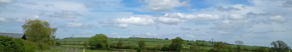
Although the park looked extremely delightful and very inviting on this spring like day, I decided not to proceed any further into the gardens. I thought I might wander through on another occasion find out more! I crossed over the road and found a small river, this was the “River Pinn”, at almost 12 miles long rising from Harrow Weald to the Thames, would be great to follow on a walk! Crossing the Art Deco bridge, I continued to en-route, taking me uphill. As it did so, I suddenly run out of roadway! The lane turned into a very muddy Public Footpath! According to my original map this should have been Wiltshire lane to take me across “Haste Hill Golf Course”. I struggled my way through the mud which was very thick in places, I was so glad that I had my trusty walking stick to stop me from falling over! Eventually the path opened out onto the top of the golf course where I was treated to a wonderful view. The paths came to a junction either to continue around the course or to rejoin the suburban street. I choose to come away from muddy path and back onto roadway, which ran parallel to the golf course. It would have been more pleasant to view, if there had been less tree coverage.

From 2016 – 12.03.2016 – Harrow – Chorleywood Walk

Finally reaching the end of the golf course, I found a sign for the “Gravel Pits”, an area which was deemed to be a public amenity during Queen Victoria’s Diamond Jubilee! Not bad for a gravel pits which were originally for road repairs! I will need to come back and see these for myself! I carried on along the road, which had taken me towards Batchworth Heath, which hosted 2 local pubs within metres of each other! One of those inns “Ye Olde Green Manne”, caught my attention, not only has it appeared in the dark world of Midsomer Murders, it also found fame in the films of Raiders of the Lost Ark, Genevieve and Withnail & I. Just opposite I spotted a large stone Gateway. Hiding behind the gates was, where a World War II battle the planned, and a large C17th Mansion stands, mostly surrounded by Moor Park Golf Club! I continued on, with Batchworth Heath on the other side of me, my route was to follow the “London Road” although it was quite a long stretch of road the scenery was quite lovely, particularly as if started its descent downhill.

From 2016 – 12.03.2016 – Harrow – Chorleywood Walk

My route had now taken me into Ricksmanworth, where I found that I was crossing a large waterway. This was the Grand Union Canal, I should have recognised it as I had walked this stretch previously. Walking over the canal and onwards, I turned into “Riverside Drive”, aptly named as it runs alongside the River Colne. Between the trees, I could see some lakes which were part of the Ricksmanworth Aquadrome which was particularly occupied with boats and water skiiers! I continued on into Rickmansworth, past the station and turned into the Chorleywood Road. This road was extremely busy and very large, I found it very worrying when I had to cross over the M25 I most definitely did not look down. It was not long before the Road began to shrink in size, at the next junction I took the opportunity to turn down Dog Kennel Lane. This took me onto ChorleyWood Common, which was great to see after my last walk. It was really beautiful, although very muddy, it really was a clearing amongst the trees! Strolling on through people sitting around enjoying the day, locals walking dogs, people flying kites and I finally made my way to the station where I ended my lovely walk for the day.

Route is as follows –

Please feel free to browse through the photos for my walk by clicking on the photo below

2016 – 12.03.2016 – Harrow – Chorleywood Walk

<><

Chorleywood – Great Missenden Walk

“Cerola Leah” sounding like a lively Celtic Dance, but the two saxon words translate to “clearing in a meadow or forest”. This was Chorleywood where I was starting out my walk for the day. Such a clearing survives with Chorleywood Common, but I did not get a chance to investigate, as I my journey led me away from Chorleywood completely. I will endeavour to return, so that I can explore the area more! With blue skies and the sun streaming down, I was not perturbed that my walk was taking me along roadways. Eventually leaving the urban streets of Chorleywood, the landscape either side of the road soon changed. Hidden behind the wall of trees that lined either side road, lay meadows and rolling fields. As I advanced further along the road, the pavement in places gave way to a dusty track which run in parallel to the road. It really did feel like I was walking in the countryside and not along the road!

From 2016 – 28.02.2016 – Chorleywood – Great Missenden walk

The countryside soon began to ebb away as I began to enter into the small village of Little Chalfont. Trees lined the roadside, obscuring most of the buildings behind. However, the distinct shape of a Church Spire could not be hidden that easily. Although it was not as old as the other churches I had seen, the long tall spire of Saint Aidans Church was just as elegant 🙂 . The roadway became more urbanised as the trees dissipated and houses and shops became more prominent. Marching onwards, I was treated to the sight of the very large “White Lion”, I thought it was something to do with the road which I had been walking, “White Lion Road”. The large sign was for “The White Lion” pub. Although it is roughly 150 years old, its actual origins are not very well known, perhaps originating as a pub as part of the thriving Local Wellers Brewery which flourished in Amersham from C17th right up until 1929! If they do serve a delicious drink or two, I was not able to discover that, as I did not get the time to go in!

From 2016 – 28.02.2016 – Chorleywood – Great Missenden walk

Wandering along, I was soon treated to the sight of beautiful Tudor building on the opposite of the road. I could just about make out a sign on it which said “Hyrons Old Barn”. I cannot seem to locate much history surrounding the barn, but assume that it was one of the outbuildings for “Hyrons Farm” that once held the surrounding land. I would not be surprised for this to be the case, particularly when there was a “Hyrons Lane” just next door! I was soon to leave the urban buildings of Amersham behind to start following the open road once more. It was here there was clear evidence of farm land that still surrounds the area, the views of rolling fields into the distance. Views mainly hidden behind gateways, hedgerows and trees.

From 2016 – 28.02.2016 – Chorleywood – Great Missenden walk

The open road, suddenly gave way to the small village green of Little Missenden. I did not get chance to really explore that much, but on my way through, I did spot the local pub, “The Crown”. Although it topped with the beauty of a thatched roof or a Tudor look, it is a past owner of the pub that makes it interesting! The owner of the pub in 1964, Ron How qualified twice for the Speedway Championship during the 1950s and 1960s, in 1965 he was ranked 7th in the World! Leaving Little Missenden behind I followed the road onwards until I reached a very large junction. I following the cycleway underneath the very large roundabout (almost the wrong way!) and it brought me into Great Missenden.

From 2016 – 28.02.2016 – Chorleywood – Great Missenden walk

It was nice to be able to return to Great Missenden after abandoning my previous walk . As I started to make my way into Great Missenden High Street I was greeted by a very unexpected sight, the “Red Pump Garage”. It looked like a garage from perhaps the 1920s or 30s! This particular garage was inspiration for where one of the characters worked in the book “Danny, The Champion of the World” by Roald Dahl. Unsurprisingly, the Roald Dahl museum was directly opposite to the garage. Roald Dahl the author of books such as Willy Wonka and Chocolate Factory, Matilda, James and the Giant Peach and BFG, lived in Great Missenden from the mid 1950s until his death in 1990. I continued to follow the High Street taking me to Great Missenden Station where I ended my walk for the day.

Please feel free to click on the photo below to view all the photos for this walk

2016 – 28.02.2016 – Chorleywood – Great Missenden walk

<><

Aylesbury – Haddenham

With a pathway set in front of us to explore and the sun beaming down, it was definitely a day a great day for a walk! As we set off, the track-way led us parallel to the housing estate, not that picturesque you would imagine, but just opposite rolling fields as far as the eye could see! The further we strolled on we became curious as we spotted as a metal bridge which homed into view. Upon investigation, we discovered we were on the “Round Aylesbury Walk”, but we did not follow it on the extremely muddy field. Instead we decided to follow the path other way which took us behind another part of the housing estate. Just at the end of the muddy track we had to negotiate a very narrow wooden bridge crossing a stream on to the pavement.

From 2016 – 10.02.2016 – Aylesbury – Haddenham walk

It was here the path left the beautiful scenery behind. According to the signs we were “Walking Round Aylesbury”, we therefore decided to continue onwards. The traffic was that bad but, it was nice to have a high wall of green trees line either side of the road to remind us we were still out in the country! As we walked onwards a beautiful stone gate homed into view on the other side of the road. It was only much further along were we to know that this was part of “Hartwell House”. A C17th Stately home which is now hotel and spa hidden behind a large array of trees. If we had been able to glimpse the building via the gateway, we would have seen a home with a very long history notably dating back to the reign of Edward the Confessor over a thousand years ago. It is nice to know that the property itself is looked after by the National Trust, and is being preserved, it would be nice to venture in one day though!

From 2016 – 10.02.2016 – Aylesbury – Haddenham walk

As we continued our wander, we were both puzzled by a sign “Setup”, well at least that is what we thought it said. Upon approaching the sign closer, it actually said “Sedrup”. It was such a bizarre name, we were unsure whether we should investigate or not was it a village or?? We soon that the route had led us to the “Bugle Horn” public House, which looked very inviting indeed. This country inn had been standing here since the C18th when it was built originally as a farmhouse. It has also been used as the wine store for Hartwell House, whilst King Louis XIII of France lived there in exile! We decided not to sample some of the taverns wares, but to save this for a later date, something to look forward too!

From 2016 – 10.02.2016 – Aylesbury – Haddenham walk

Managing to fight the temptation of the “Bugle Horn”, we continued onwards. Again we spotted a sign for “Sedrup”, but this time it was with “Sedup lane”, presumably Sedrup was a small hamlet that was at end of the lane! In this instance we decided not to take the route to investigate but to carry on along the main road. It was to take us past some large riding stables and onwards to the village of “Stone”. Where we passed by it’s recreation ground, village hall and its of course is own pub! We maintained the same route beyond Stone Village for quite some time, eventually we were privileged to a view on the other side of the road as the trees thinned out and we left the urbanity behind us.

From 2016 – 10.02.2016 – Aylesbury – Haddenham walk

However, it was not too long before we were treated to a very unusual sight of a stone ruin. We had to fight our way through the undergrowth to have a good look, but we had found the remains of “Dinton Castle”. Although its official title is a castle, it is actually a Folly, built in C18th by Sir John Vanhattem. He had extensive fossil collection and passion shows clearly in this building as fossils are built into the folly walls! The “Castle” is now privately owned, but still awaiting a full restoration, so it will be nice to find out what happens to it in years to come! We spotted an “Aylesbury Ring” sign, but we through we would leave that walk for another time now! Therefore we left castle behind, and took a change in direction by turning away from the large Roadway. We found ourselves walking along a much narrower thoroughfare and no pavements to walk along, making this part of our walk particularly tricky. Fortunately for us, this was not a very busy road!

From 2016 – 10.02.2016 – Aylesbury – Haddenham walk

The road we had been following had taken us to place known as “Cuddington”. As soon as we could we found a way off the roadside and into a local park. As we followed it round, it was a lot smaller than we bargained for and we were soon back out by the roadside! But we soon stopped to admire a lovely thatched cottage, on the other side of the road, which we soon saw was the pub “The Crown”. The pub may have a history dating back to the C17th, but it is more known today through Midsomer Murders, where it has appeared as a local in quite a number of episodes! We crossed the road to investigate the village further. It really did it seemed like a step back in time with its thatched cottages, stone church and Tudor buildings. It felt like a very sleepy and unassuming little village, which certainly looks like nothing much happens. But the village on a number of occasions has become a place for dark deeds, village gossip and busybodies when Agatha Christies Crime Novel “Why Didn’t they Ask Evans?” and when”Midsomer Murders” have both been filmed here!

From 2016 – 10.02.2016 – Aylesbury – Haddenham walk

Leaving Cuddington behind, we started our walk once again along the road. This time we found ourselves heading in the direction of “Haddenham”. The roadside did not have any pavements once more so it was difficult to walk as it became quite busy at this point. We also found that we walked this part as quickly as we could as we felt we did not want to be on the stay walking along the road for that long. We soon found ourselves in “Haddenham”, however, we did not venture into far, as we felt we would leave this for another time, as we decided to end our walk for the day. To look at all the photo from the walk please feel free to click on the photo below –

2016 – 10.02.2016 – Aylesbury – Haddenham walk

<><