Tag Archives: capital ring

Edgware – East Finchley Walk

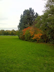
Our walk was quite spontaneous and therefore the route was quite haphazard, finding that the beginning of our trail was mostly trudging alongside roads. Making our way from Edgware, we took the route alongside the A41, which was quite noisy and not that nice to walk. We kept an eye out for a way off the road and onto a green as soon as we could. We soon found a footpath away from the road, which was to take us into Stoneyfields Park. As we made our way through the entrance, we could feel the tranquility of the park. Following the path around, it was to bring us over a small bridge and it was soon to follow a wonderful lake right in the middle of this delightful green oasis. Whilst meandering around the waters, we were blessed by seeing a Swan nesting in the reeds, how beautiful was that!

From 2015 – 06.04.2015 – Edgware – East Finchley Walk

The oak and hazel trees that grow in this park, were once part of an ancient woodland that once stood here before any houses or roadways were built. The babbling brook, the warm sunshine and the wildlife really gave me a warm glow. We soon discovered that the park was not as large as we had hoped as we found ourselves out on the large road we had left earlier! Despite that we trundled our way along and made our way onto past the Apex Corner. As we walked past, Traffic Jams immediately sprung to my mind as this is what it would have famous for to me. However, this roundabout has been made famous when it appeared in the film “The Italian Job” in 1969. We walked on from the corner and onwards along the Watford Way Roadway for quite sometime until we reached Mill Hill. It was here where we decided to cross the road to see if we could find another open space.

From 2015 – 06.04.2015 – Edgware – East Finchley Walk

It was not long before we were once again blessed with more green open land with “Mill Hill Park”. It was very busy for the afternoon, as the sun was really shining now and families were out in force enjoying the green space! The park in comparison to Stoneyfields was more open and not conducive to the wildlife element I felt, it was more for large play areas and for enjoyment than chilling out and watching the world go by. It was a very popular park and certainly one used by families! As we approached the edge of the park, I spotted unusual dome shaped roof of a building on the other side of the road. The semi-spherical roof belongs to the Observatory of the University of London, were telescopes allow student astronomers study the stars and planets.

From 2015 – 06.04.2015 – Edgware – East Finchley Walk

The building was built in during the late 1920’s and when it was completed it was opened by the then Astronomer Royal, Sir Frank Dyson. The observatory survived the hostilities of World War II unscathed, it has now grown in size and houses 3 telescopes! Who knows this observatory could hold the key to some future astronomical discoveries right next to a humble park! We continued our way on through the park which was eventually to take us out into surburbia, where we found ourselves walking roads once more. As always we were on a look out for another footpath, but it quite some time before we did. We had to walk beyond Mill Hill East before we were able to pick up the “Dollis Valley Green Walk”.

From 2015 – 06.04.2015 – Edgware – East Finchley Walk

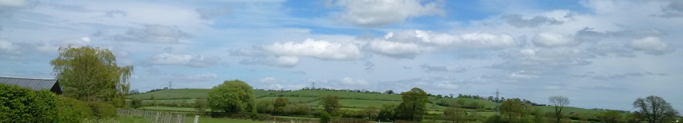
This part of the Valley walk, headed towards Hampstead Heath Extension, and was a section of the walk we still needed to complete, perhaps we would today! Trees lined the majority of this part of the trail, which made it quite dark. Despite this the sun was still able to break through, it was so beautiful to see the sunlight dance upon waters of the Dollis brook :). We followed the Valley walk along the stream, which took on through the Windsor Open Space, until we reached a split in the river. We realised that the brook is extremely well looked after as there was a man made waterfall, which seemed to control the ebb and flow of the river.

From 2015 – 06.04.2015 – Edgware – East Finchley Walk

Although we were officially following the “Dollis Valley GreenWalk” we were now walking alongside the much smaller “Mutton Brook”. I am not sure why it is called Mutton Brook, but perhaps something to do with sheep? Who knows! As we continued along this route, we realised we had inadvertently picked up the Capital Ring. It then dawned on me, allbeit very slowly, that I had walked some of this section last year ! The valley walk follows mostly alongside the North Circular Road, which was quite noisy in the background. A bit of shame in my opinion as walking the brook was quite calming otherwise! The path brought out us onto road, and here we took a wrong turn we missed the signs for the Valley walk. We were meant to go to the Big/Little Wood, but unfortunately we did not see the signs so ended up following the Capital ring instead through to Northway Gardens.

From 2015 – 06.04.2015 – Edgware – East Finchley Walk

It was here then we decided to end our walk as it was late in the afternoon. We continued away from the capital ring, to walk onto towards East Finchley Station. Just before we reached the station, a lovely old inn caught my eye the “Old White Lion”. The tavern dates back from C17th, when it was built as an old coaching inn. It was rumoured that the infamous highwayman Dick Turpin frequented this inn as a rest stop between robberies! However, we did not stop to taste there wares we ended our walk at the station to finish our walk for the day!

All the photos from the walk are available by clicking on the photo below –

2015 – 06.04.2015 – Edgware – East Finchley Walk

<><

Preston Hill – Alperton Walk – 16.11.2013

I thought I would take a short walk in the winter sunshine, without any particular route and let me feet guide me :-). As I started to make my way, I noticed a small stream emerging beneath a small bridge at the side of the road. This was the “Wealdstone brook”, a small waterway mostly hidden from view by tree foliage and the roadway. At one time the brook was not so inconspicuous, it was not beneath the road at all, you had to cross it by a ford no less! Although a footbridge was available for those who needed to cross the waters more politely 🙂 Once I left the brook behind I reached the top “Preston Hill”, and if I looked carefully, on the other side of the road I could just see a little bit of a view :-). During C19th “Preston House” was built near here and one of the owners decided to turn the grounds into the “Preston Tea Gardens”. I can imagine sipping tea and admiring the landscape, unfortunately it was demolished 1962.

I turned away from Preston Hill, to walk along “Shaftesbury Avenue”, no this was not theatre land, it was a road lined with large houses! It was blessed with “Woodcock Park” being towards the end of the road, which I decided to explore. All the leaves on the trees had turned to many hues of golden browns, unsurprisingly most of them had fallen onto the ground. I stuck to the path, as the grass looked quite muddy to me, but it still looked very green and fresh even for November. I once again encountered “Wealdstone Brook” which runs through the entirety of the park. Not only has the stream managed to create an island where horse chestnut trees grow, it sadly divides the park into two areas. As I meandered my way around I spotted that a number of trees had been sadly damaged in the recent storm that we had recently suffered. This is a shame as the park has a number of unusual trees such as copper beech, Oriental plane, conifers, redwood, and even an ancient mulberry!

From 2013 – 16.11.2013 – Preston Hill – Alperton Walk

I was about to leave the park grounds, when I spotted the park information board, and I noticed it was labelled “Kenton Grange” and not “Woodcock Park”. The park was originally part of the grounds of the large “Kenton Grange” and was developed as a public space, as part of “Metro Land” during the beginning of the C20th. Just outside of the park, is a large Tudor style building, this is “Kenton Grange”, which was built as “Kenton Lodge” in 1803. This beautiful home used to have a miniature garden railway steam through its grounds Now that would have been wonderful to have been able see that 🙂 Today the Grange is a hospice, and the residents can’t enjoy the garden railway, as it no longer runs :-(. I left the grange behind to make my way along Kenton Lane, which I hasten to add is a noisy road rather than a quite country lane!

Further on, I came across this huge dominating Church that sits on the side of the Kenton Road. This was the Church of St Marys, built in 1936 to replace the original wooden Church of St Leonard, which originally stood here. The Church holds some artifacts from other churches, a font from St Giles, Cripplegate and fragments of glass from All Saints in York! Walking on from the Church, I decided to leave the noisy road behind and headed towards a residential street, taking me to Northwick Park Station and a shortcut beneath it. Once I was on the other side, I found I my walk had joined up with “Proyer’ s Path”, and the “Capital Ring”, which was to take me through the green space known as “Northwick Park”. It is a very open landscape, quite suitable for lots of games and picnics :-). Sadly, it is not exactly quiet, with the metropolitan line trains on one side, overground trains on the other and the hospital on another! Nevertheless it was still nice to walk 🙂

From 2013 – 16.11.2013 – Preston Hill – Alperton Walk

This park was developed throughout the early C20th, and was originally planned by Captain Spencer-Churchill, a relative of Winston Churchill. The park was meant to leisure park with a tennis and social club, but things changes in the area due to WWI and WWII and plans were abandoned for the leisure park and houses were built instead. Despite the growth of Kenton and the development of the railways, the local council bought some of the Northwick estate for the open space which thankfully is still here today! I followed the Capital Ring through the park and out into “The Fairway” road, I am unsure if this road took its name from a long abandoned golf course that may have been in the area at one time? As I emerged from the road, I spotted some grounds in front of me, this was the “Vale Farm Sports Ground”, it was very muddy and did not have my walking boots on so I was unable to take a shortcut across it 😦 . The Sports centre that I saw includes a large swimming pool, which was originally an open air Lido!

As I was unable to walk along the sports ground, I continued my journey alongside the roadway. Eventually I came across a small bunch of shops opposite a small open space, which was known as “Butler’s Green”. This little green space represents the last remanant of Sudbury Common, which was at one time over 234 acres in size! Over the years the common was gradually built on and this particularly piece of land was preserved when the local council purchased from a group of Trustees and was opened as “Sudbury Recreation Ground”. The grounds were subsequently renamed after Edwin Butler, a local gentlemen who was a very involved in acquiring land for public recreational use and was Wembley’s first Mayor, his Grocers shop. was opposite the land. It was probably one of the shops I was walking past!

From 2013 – 16.11.2013 – Preston Hill – Alperton Walk

As I passed beneath the railway bridge I encountered another green space, Barham Park. I walked on the outskirts of the park and I could see that it looked rather a large space to explore. It was named after “George Barham” who purchased a house and grounds here in the late C19th. Mr Barham was well known in the diary trade, he received a Royal Warrant for delivering milk to the Royal Monarch and his diaries have kept up this tradition right up to the present Queen! Whilst living at the house he saw the area change and grow, sadly as a consequence green common space disappeared. He decided to bequeath his house and lands to the council to ensure that his grounds would remain and open space for all to enjoy. Unfortunately, the house was not maintained and was eventually demolished, but an annual fair take place in the park and I am sure that must be a lot of fun!

My walk took me once again alongside a noisy roadway, I must admit to hurrying along at this point as I was not enamored by my surroundings! Although when I turned the corner to take me along yet another large road I could see a number of trees on the opposite side of the road. In fact this was hiding “Sudbury Golf Course”, the very course I had seen from the Grand Union Canal on another occasion! The road side I was walking along, followed an Underground line, which was not in operation on this particular day, so could imagine it would have been even noiser! I was about to cross over the road to see if could look into the golf course, when I spotted an entrance to “One Tree Hill Open Space”. I walked beneath the railway bridge and it brought me out in this lovely green area, if I had time I would have climbed the hill in front of me, I am sure it would have given me a lovely view of the area, railway and indeed the golf course!

I left the open space behind and followed the road way round and found that I had reached Alperton and found the Grand Union Canal, where I was too leave my walk for the day. I am looking forward to picking up my walk along the Grand Union at Alperton once again! Please feel free to look at the photos for this short winter walk.

2013 – 16.11.2013 – Preston Hill – Alperton Walk

My route for the walk is as follows –

<><

Harrow on the Hill – South Harrow Walk – 03.03.2013

“Up on Harrowdown hill
Where you went to school
That’s where I am
That’s where I’m lying down” © Thom Yorke, 2006, Chrysalis Music

What a great thought to lie down, sit back, relax and enjoy “Harrow On the Hill” where we were heading today. Unfortunately, Thom Yorke, was referring to another Harrow in England, it is just a coincidence that this “Harrow on the Hill” also has a school! The hill is not too steep to walk and provided some charming views whilst we made our way up. As we seemed to near the top, our paths crossed with the “Capital Ring”, a footpath which we have encountered previously. We thought that we would follow some of the “ring” for our walk today, but not as far as some of the sign suggested, particularly as Crystal Palace was just over 30 miles!

As I turned around from the sign I noticed a small wooden emblem engraved “Old Music Schools – Museum of Harrow Life” on the brick building behind us. The school was built in the late 1800’s when the need arose for a separate building for the Music Department. The Architect ensured that the structure had a band room, practice rooms and a concert hall with amazing acoustics. I can just imagine the melodious sounds that would have emanated from this building! I am not surprised that the original name of the lane where the school was built, was known as “Music Lane”. Today the building houses a museum and the rooms are used for lecturing, a far cry from its initial use. As the building no longer makes beautiful music, the name of the lane is now “Football Lane”, probably due to the lane leading to school football fields.

From 2013 – 03.03.2013 – Harrow On The Hill – South Harrow Walk

I looked up to see a statue of Queen Elizabeth 1 which adorns the side of the School. Harrow on the Hill School as it stands to day, was founded in February 1572 under Royal Charter granted by Queen Elizabeth I to a local Farmer John Lyon. However, construction of first school was not started until 1608 after John Lyon’s wife sadly passed away. The School was completed in 1615 and some of the original school still stands today! The School has produced some notable students in its time such as former prime minister Winston Churchill, first prime minster of India Jawaharlal Nehru, Lord Byron, Island Records founder Chris Blackwell and FA Cup founder C.W. Alcock. The school is very active today and I am sure still produces outstanding students in a variety of things. However, I am not sure that “Charms Class” would are on the school curriculum, Professor Flitwick’s, Charms Class, was filmed in one of the form rooms of Harrow Old School.

One student, Anthony Ashley Cooper, Lord Shaftesbury, has the following inscription on the side of the school –

“Blessed is he that considereth the poor”

It was here on the hill he saw with shame and indignation a pauper funeral which was to awaken his lifelong devotion to the service of the poor and oppressed. During his political career he worked tirelessly to have acts passed in parliament to ensure life would be improved for people. These Acts included the Ten Hours Act in 1833 , Mines and Collieries Act in 1842 and Chimney Sweepers Act in 1875. These acts would make changes to people lives for the better ensuring that children would not work long hours or work deep underground.

Finally passing on by the School we had reached the very top of the hill and the church which is perched prominently on of it. A church has been on the hill since the C11th, although the Church has been rebuilt and renewed many times in it’s lifetime. With the spire reaching in to the sky and its wonderful and peaceful location, this church certainly does have some great advantages. Although being so high the church is used as a navigational reference for aircraft approaching RAF Northolt! I was not surprised to learn that one of the Harrows more prestigious students, Lord Bryon used to while away the hours in the church yard gazing at the amazing view that we stumbled across when we walked the other side of the church.

“Again I behold where for hours I have ponder’d,
As reclining, at eve, on yon tombstone I lay;
Or round the steep brow of the churchyard I wander’d,
To catch the last gleam of the sun’s setting ray.”

On a Distant View of The Village And School of Harrow On The Hill, Lord Byron, 1806

As we sat gazing across the view it was very easy to see how Lord Byron would sit for hours. We were strongly thinking the same as we sat there eating our sandwiches. On a clear day, apparently you are able to see Windsor Castle in the distance from here, but I am not quite so sure –

From 2013 – 03.03.2013 – Harrow On The Hill – South Harrow Walk

We did eventually walk on and leave the beloved view behind. We rejoined the path to take us on the other side of the hill. This part of the path was not so inviting to walk as it was a little dark and dingy. Particularly as it walks past what seems like the abandoned Cemetery of St Mary’s Church. I was quite glad when the path came out onto open ground. We were a little disappointed not to be able to find any further signage of the “Capital Ring”, which we had found earlier, which was shame as that seemed like a logical path to follow at this point. Therefore we decided to make our own route for the rest of the walk.

The way were walking now was to take us past the “John Lyon School” Office. As mentioned before, John Lyon was the founder of the Harrow School after Queen Elizabeth issued a Royal Charter in 1572. However, in 1876, a further school was founded when it was deemed that the Harrow School had pupils from outside of the area outnumbering locals. Just past the school I noticed that they were renovating a cricket field, which I presume had been damaged by all the bad weather that we had have had. As we walked around the fields, I noticed that the tiny scoreboard building had a small inscription stating that the Cricket Nets were laid in memory of “Mark Tindall” who was in charge of Harrow XI from 1946 – 1969.

From 2013 – 03.03.2013 – Harrow On The Hill – South Harrow Walk

Mark Tindall MBE studied in Harrow School and while he there he was able to play Cricket. A few weeks after leaving Harrow, he made his debut for Middlesex and he was hit 85 against a Nottinghamshire. He made a century in his Freshmen’s Match at Cambridge, passed 1,000 runs in all in 1936 and was made captain in 1937. Unfortunately, things changed in Cambridge during 1937 and his own form declined. After this time he did not play cricket again until 1946 when he master-in-charge of cricket at Harrow XI, until 1959.

We continued on with the walk, but this time it was mostly along roads. We found that our walk had taken us to South Harrow. We passed by the Tube Station and we carried on down the high Street. We were heading for another destination, Alexandra Park, which is not far from the main road. We discovered a concealed entrance to the park from the main high road, not your usual park gates that you would find. A bit disappointing if you ask me as the park seems to be hidden from the main road and house, which is a shame as it is rather nice.

“Alexandra Park” was opened in 1940 and was named after Queen Alexandra who was wife of Edward VII, and was a frequent visitor to the area. The park is pleasant to walk around and as we walked further into the park we came across some artwork. The sculpture was “Inner View” by Lorraine Benton, it was certainly interesting to look at and if we had time could have provoked some discussion as to what it represented. As we walked a continued around we found the park had a little Millennium garden as well which could have sat down and enjoyed too. However, it really was time to finish our walk as the afternoon was drawing in for us.

For all the afternoon walks photos, please click on the photo below –

2013 – 03.03.2013 – Harrow On The Hill – South Harrow Walk

<><

Silver Jubilee Park – Welsh Harp – Wembley – 08.04.2012

Despite the clouds rolling in, we felt it was time to go back and invesitage Silver Jubilee Park where we had walked past a few months back… It may have been grey, but the view was still quite a sight to behold, particularly as it was quite high. The park had some lovely grass slopes and it was quite tempting to roll down them! It was a shame that we did not have any decorated Easter Eggs or we could have done some “Easter Egg Rolling”, which is a tradition from “pace-egging” from the old English “Pasch” meaning “Passover”. I should have been more prepared!!

From 2012 – 08.04.2012 – Silver Jubilee Park – Welsh Harp – Wembley

Instead of rolling down the slope I decided to run down it instead! From this point on we slowed down our pace so we could take in the sights and sounds of the park. I was beginning to discover that this park was larger than I had a originally envisaged, it seems the entrance we took from the Road near Kingsbury did not give away it’s true size. The reason I say this, is because of the amount of football pitches it seems to have in it! The “Kingsbury London Tigers” have a Football Ground here! I have to admit the football pitches may not be full size like Wembley Stadium but nevertheless it showed the park had lots of room 🙂

Our walk took us out of Silver Jubilee park as we were on the hunt for the “Welsh Harp Nature Reserve”. I had thought the park and the Welsh Harp met up at some point, which I think they do, but we were not fortunate enough to discover that! We found ourselves walking along a very urban road and crossing the River Brent which would have lead us to our destination, but there was no obvious footpaths alongside it. As we were very unsure of our route, we took a diversion through a residential area, as we knew the reserve was located behind it. It was becoming frustrating as we still could not find a way in! Our little diversion was rewarded by seeing a beautiful painting that had been placed on one of the houses, reminding me of the St Ives Branch in Cornwall. If anyone could shed any light on who painted it would be appreciated!

From 2012 – 08.04.2012 – Silver Jubilee Park – Welsh Harp – Wembley

We eventually found our way down through Cool Oak Lane, unfortunately I am unable to discover why it has this name. I have discovered that this was also known as “Wood Lane” and during the 1850’s it seems there was a monastery, known as “the Hyde”, that was located here, and was the London home of the “Passionists”. As we strolled down the lane, we eventually found a public footpath by the Welsh Harp. The footpath took us behind peoples gardens. It was a strange experience to see back gardens on one side and the Welsh Harp reservoir on the other, I was not sure where the path was going to lead us.

As we trudged on through the muddy path, I found a wooden bridge. Well I thought it was a wooden bridge, in fact it was a wooden ramp to a “bird hide”. This hide was donated to the Welsh Harp to enable bird watching on the “Eastern Marsh”. In fact this Hide was opened on 2nd February 1991 by Bill Oddie 🙂 The birdlife is so nice in this reservoir as we spotted a Swan was nesting! We followed the path around the lake, which became increasingly difficult to walk. We had a originally thought that the path would have taken us around the entire reservoir but sadly the path comes to an end. In fact it just ends at a locked gate. We had to turn to back, to Cool Oak Lane.

We had to walk down the lane slightly and over the bridge over the reservoir and found another entrance to the Welsh Harp Open Space. This path was very different to what we had just experienced. In fact this was part of the Capital Ring walk. I had come across the ring before on the other side of London. We were able to stop and look at the Swans that were swimming near the shore a lot more easily on this path 🙂

From 2012 – 08.04.2012 – Silver Jubilee Park – Welsh Harp – Wembley

As we continued on it looked like the harp had been used for Swimming? However due to the growth of dangerous Algae this could not happen anymore :-(. Although I did not capture many in my photos, the lake was very popular with boats. In fact there we walked past a canoeing club that was on the shore! I was not a big surprise to me to find out that this stretch of water was used during the 1948 Olympics to host the rowing events! Very different from the Lee Valley Park which is being used for the 2012 Olympics!

Our walk had come to end at the reservoir, but not before I had been able to find out some of it’s history. It had been built in the early 19th Century and was originally developed to feed the developing Canal System, after the Reservoirs at Ruislip Lido and Aldenham were no longer able maintain the levels required. This reservoir specifically fed the Paddington branch of the Grand Union Canal. There is seems to be conflict in name as the reservoir is really the “Brent Reservoir”, as it is fed from the River Brent, the name “Welsh Harp” came from a nearby famous coaching inn.

The “Old Welsh Harp Inn”, was purchased in 1859 by the enterprising William Perkins Warner. He purchased the fishing rights to the lakes, rebuilt the inn to make it bigger and better than the original. The Inn housed a dining hall for about 300 people, a 500 seater music hall and a museum of birds and beasts! The grounds included a Bowling green and shooting enclosure no less! In 1862 the adjacent farmland was used for a 2 day Steeplechase festival The resort was so popular Victorian Naturalists that used to visit the reservoir, that it had it’s own Station! Sadly this was shut in 1903 when the area became urbanised and day trippers were in the decline. This is so difficult to imagine in 2012!

From 2012 – 08.04.2012 – Silver Jubilee Park – Welsh Harp – Wembley

We left the lake behind to start walking down Old Church Lane. It felt quite spooky as there was a cemetery along this part which was hidden amongst the trees. As I looked carefully there was a Church as I would have expected, but it was very small, I went to investigate. In fact this Church is “old” and it is not in use any more. Although we could not go in as you needed an appointment to visit, I have been assured it would have been worthwhile. Particularly as there are beautiful brasses and a lovely oak lectern, which W.E.Gladstone read at. W.E Gladstone was the Prime Minister of England four times during the late 19th Century. This little Church had been renovated quite a few times in it’s life, but sadly the Church became too small and was declared redundant in 1977.

We continued on our walk along Forty Lane towards Wembley and it was here I spotted a blue plaque to “Arthur Lucan”. No, this is no one related to Lord Lucan! This is Arthur Lucan who was an entertainer, who starred in the “Old Mother Riley” films. He was part of a double act ‘Lucan and McShane’ and 1934 played in a Royal Command Performance!

We left the Lucan residence behind to reach Wembley Park Station and it was here we finished our walk…For all the afternoon walk photos please feel free to click here –

2012 – 08.04.2012 – Silver Jubilee Park – Welsh Harp – Wembley

<

Barking Abbey – Roding Valley Walk – 10.10.2010

We decided at the last minute to see if we could try to complete the Roding Valley Walk after finding the previous week or so in the area near Barking Abbey.

The first place we came to was  “Barking Quay”. This has not long been re-built by the Environment Agency as part of the Flood defences for the area.  Particularly as the river had a history of flooding the surrounding area in the past! This Quay had been created around the 1700’s – and despite being used as Harbour for commercial Shipping to bring such items as Fertilizer (a bit smelly I should imagine!!) local children still took the waters for a swim.

We left the basin behind, to continue our walk, but we  felt it was extremely difficult to walk around the small working estate that was next the quay.  As their were no natural walkways around the river we continued our quest to look for the Roding Valley way (we had assumed this was along the river but this was not the case).  Luckily we were not disappointed.   We found a sign! It took us across a road and onto a “hidden” pathway. Well it felt hidden, although tarmacced, nature had taken over and buddelias were everywhere and despite it being October, Butterflies were still plentiful! Particularly as the sun was shining overhead.

From 2010 – 10.10.2010 – Barking – Roding Valley Walk

But our joy with the walk was shortlived. As soon as we came out from under the bridge we were sadly disappointed when the footpath was closed over a nature reserve due to flood defence works 😦 The alternative route was a road!  Unperturbed by this we decided to continue… We carried on until we discovered the entrance of the path where if would have joined the road naturally.   Sadly this is where the Roding Valley Way signs disappeared so we made our “best guess” as to where to go next!

Continuing doing the road we came to a dead stop – it was barred off by yet more Flood Defence Works.  However some kind Cyclists helped us out by pointing us in the direction of the Roding Valley way which was hidden behind the Cinema! (The signs were not there so we wouldn’t have known!) Otherwise we would need to divert to find the river again.

On finding the entrance to the walkway and then a sign to Roding Valley Way – we were sad to find the entire path was closed!  We needed to take the diversion – and we were unable to walk the river – how disappointing.  The one good thing about this walk, we discovered we linked up with one of our previous walks we had done in the past – totally unintentionally! when crossed the Jubilee Greenway and went into Beckton were we stopped for a late lunch

From 2010 – 10.10.2010 – Barking – Roding Valley Walk

Eventually we gave up on going back to the River Roding and decided to Walk to the Wharf. I am unsure as to the building we found – it looks like an old customs house – which has now been beautifully restored -but I am wrong as I have since discovered this was in fact the Gallions Hotel built in 1881 which served passengers from the P&O Ferry from the Royal Albert Dock! Intriguingly it had an underground stable and an underground passage to the Dock!!

Passing the old hotel we walked along the Dock past the City Airport and again the path ran out! So we joined the Capital Ring to Beckton Park… It was here we decided to end our walk – partly it was giving up our walk for the day and partly due to light starting to change… Oh Well perhaps the Roding Valley Walk will be better once the Flood Defence works are complete – some day!

I have since been informed that if I ever reach the ever elusive Barking Creek that has haunted me on these walks…. that some of the BBC Series “Ashes to Ashes” was filmed here!!


All the photos for the short walk –

2010 – 10.10.2010 – Barking – Roding Valley Walk

<><

Plaistow – Woolwich Arsenal Walk – 15.08.2010

Plaistow,  our starting point for the walk.  This area has a history of having links with the notorious highwayman Dick Turpin (he has cropped up in my blogs before!) as well the football player Bobby Moore!  Although we didn’t stay to explore the area this time.  We were using the “Greenway” walk  towards Beckton.

It was a very strange little route.  For a long time I thought it may be an old railway line to the docks, but I have researched this and can confirm that in fact it was constructed on a old sewer! (At least that would explain the smell!!)  It was still pleasant enough to walk along.  We noted that some of the gates had been replaced recently and the pathways had been renovated.    The path then came to a junction,  and making an educated guess when we crossed the road, we managed to rejoin the “Greenway” which was not quite visible from the path we had just left.  Sadly, this part of the path not been looked after – in fact it is in a bad state of repair.

From 2010 – 15.08.2010 – Plaistow – Woolwich

We noted a sign to “Beckton Alps” – which pointed over a small bridge –  was completely blocked off – such a shame.  We had seen people in the distance on top of the “alps” they must have climbed to the top from the other side!  Why was it called Beckton Alps?  Well from 1989 to 2001 a dry ski slope operated there! Although research indicates that the name may predate this particularly as this is said to be the highest artificial hill in London!

Walking down the path, past Britvic Factory (pity we couldn’t pop in for a  drink we were getting thirsty) the path ended again but with no signs as to left or right!   We made a decision as to which direction to take and we found ourselves looking at a shopping centre and Beckton Gas Works.   So what is so exciting about a Gas Works?  Well did you know that Stanley Kubrick filmed Full Metal Jacket here? Turning an abandoned East London Gas Works into Vietnam?  Did you also know that James Bond For Your Eyes Only opening scene was also filmed here!  I could go on!

Although the looking at the Gas Works was  interesting, we had to return to the path we came off !   It was not long before the path came out on to the roadway,  which had an very odd looking bridge, in fact it reminded me of something that should have been in an old Flash Gordon movie (there was no explanation, however, as to what this bridge was! – all I could find was something about Design for London??)

From 2010 – 15.08.2010 – Plaistow – Woolwich

We had no choice but to go in one direction – as the path was blocked off over the bridge.  It was a little confusing when we reached the roundabout, however, as when we looked at the signs either side of the road, said North Woolwich – pointing both ways! :-O   Logic said to keep going away from the direction we just came from! In fact we ended up rejoining the “Greenway” / Capital Ring by the East London University.  It was here we sat in front of the Royal Albert Dock and ate our sandwiches and watched planes take off from London City Airport.   Despite the noise was rather relaxing!!

Eventually we decided to take up our walk again.  Crossing the “Sir Steve Redgrave Bridge” – Sir Steve Redgrave is Olympic Gold Medalist Rower which the bridge was named after – it was rather a scary bridge to be honest in places – since the wind just whistled through – I was half expecting tumbleweed to blow across the bridge at any minute!

From 2010 – 15.08.2010 – Plaistow – Woolwich

I quite amazed by the lock gates that when then came across – they were bigger than the ones I had seen on the Grand Union Canal or on the River Lea! – I can only imagine the size of ship that could be using these docks!  The path was tad confusing at this point so we had to improvise a little bit – until we reached Royal Victoria Gardens.  Interestingly it had a very strange item on display there.  Which I can only describe to look like a large Microscope.  In fact it was  “Steam Hammer” –  which was taken from blacksmith’s shops from the Royal Albert’s dock – which would have been on the site of the London City Airport.

We had reached the Thames path, and it was nice to find a lovely to find a quote which I can Partly identify with if I have a bad day I go for a walk…” (the full quote is in available on my photos!)    A disused station caught my eye – North Woolwich Station to be precise – now why would that be interesting? In fact this was used to be the Great Eastern Railway Museum – which sadly closed at the beginning 2009 – so I missed it by a year! -but I am aware some of the exhibits have been distributed to the Epping & Ongar Steam Railway which is being restored! I walked over the the railway last year click here if you missed it!.

We had to leave this side of the Thames behind, as the “Greenway” walk continues across the Thames. This means we had to hitch a lift with the Woolwich Ferry. A brief journey but lovely nevertheless

From 2010 – 15.08.2010 – Plaistow – Woolwich

Following the road to our journeys end may not have been the most exciting route that we had planned, but had did have a little surprise in store.  As with many other places we have walked Woolwich is undergoing a lot of revnovation, it was nice to actually see at least one of the place that did not have any boards in front of it – The Royal Arsenal.  Addmittedly most of the area being redeveloped for luxury flats or for businesses – but the Royal Artillery Firepower museum still remains.  I was surprised to learn that an artillery of some sort has been on this site since the 16th Century – by order of Henry VIII ….

Leaving the Arsenal behind, we turned towards the station, and passed the recently restored gates. When we were back at the station, I noted that if we had looked properly last time we came out of the station we may have actually noticed the gates :-)!!

All my photos for this walk can be found if you click on the following –

2010 – 15.08.2010 – Plaistow – Woolwich

<><